

Directions
Access to the site is by float plane or boat only. The flight is typically 15 minutes from Valdez or a 30 minutes from Cordova. To travel by boat is 20 miles from Valdez and 70 miles from Cordova. Tides influence travel to the cabin. Click here for local tide information.
Inclement weather conditions may cause an extension of your trip during any time of the year and winter access can be difficult due to snow and ice conditions. Guests should bring extra supplies to last 2-5 days Please contact the Cordova Ranger District at (907) 424-7661 prior to arrival for more detailed information about safety precautions.
Phone
1 (907) 424-7661
Activities
BOATING, CAMPING, FISHING, HUNTING, WILDLIFE VIEWING
Keywords
JAC3,CHUGACH NF – FS
Related Link(s)
Overview
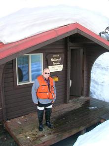
Jack Bay Cabin is located at the east end of Jack Bay in the Chugach National Forest. Visitors to the cabin will find many opportunities for recreation and relaxation in the vicinity.
Access to the site is by float plane or boat only. The flight is typically 15 minutes from Valdez or 30 minutes from Cordova. It is 20 miles from Valdez by boat and 70 miles from Cordova. Tides affect access to this cabin, so it is important to check local tide information. Visitors are responsible for their own travel arrangements and safety, and must bring several of their own amenities.
Recreation
Anglers will find good pink salmon fishing steps away from the cabin’s front door. Coho fishing is good later in the year in nearby creeks.
Razor clams, eel and crabs can be found while beachcombing at low tide.
Boating is the most efficient way to explore Jack Bay. Otherwise, viewing harbor seals and sea otters from the front deck is a fantastic pastime.
Hunters can take advantage of a long hunting season in the surrounding national forest. Bear season occurs during spring and fall, while deer season begins in late summer and lasts through late fall.
Facilities
The cabin is 12-by-14 feet and equipped with wooden bunks that sleep up to six guests. It is furnished with a table, benches, wood and oil stoves, a rainwater catchment barrel and an outdoor pit toilet.
The cabin does not have running water, electricity, cut firewood or heating oil. Visitors must bring their own supply of drinking water, firewood and #1 stove oil for the oil stove.
Visitors must bring food, sleeping bags, sleeping pads, a cook stove, matches, cooking gear, lanterns or flashlights, toilet paper, a first aid kit and garbage bags. All trash and food must be packed out, and visitors are expected to clean the cabin before leaving.
Natural Features
Jack Bay is located southeast of the Valdez Narrows, hemmed in by steep mountains. The cabin sits at the edge of a grassy clearing overlooking the bay. A thick temperate rainforest of spruce and hemlock backs up to the cabin, with an understory of shrubs, fern and moss-covered logs.
From mountains rising from shoreline, waterfalls surge from ice fields and glaciers.
Wildlife in the area abounds, including Sitka black-tailed deer, mountain goat and brown bear (learn more about bear safety).
Nearby Attractions
Jack Bay State Marine Park is located 15 miles from Valdez, southeast of the Valdez Narrows. The uplands of the park consist of alder, muskeg, salt marsh and old-growth forest of spruce and hemlock. The northern arm of Jack Bay within the marine park becomes shallow a quarter-mile out and caution is recommended. Although the bay can be used as a fair weather anchorage, it is not protected. Access to the area is by boat.