

Directions
The cabin is located on the southwest shore of Shelter Bay on Hinchinbrook Island. Access is by floatplane at high tide (20 minutes from Cordova) or wheeled plane at low tide (landing strip located 350 yards north of the cabin). Access by boat is 50 miles from Cordova. Boaters should inquire about local conditions before entering the bay.
Tides affect all access to the cabin. Please consult local tide tables.
Phone
1 (907) 424-7661
Activities
BOATING, HISTORIC & CULTURAL SITE, CAMPING, FISHING, HUNTING, WILDLIFE VIEWING
Keywords
SHE1,CHUGACH NF – FS
Related Link(s)
Overview
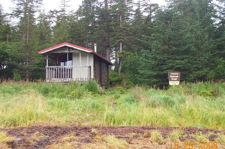
Shelter Bay Cabin is situated on the southwest shore of Shelter Bay on Hinchinbrook Island in the Chugach National Forest. Visitors will find many opportunities for recreation and relaxation in the vicinity, including fishing, hunting, beachcombing and wildlife viewing. Access to the cabin is by floatplane at high tide, wheel plane at low tide or boat. Visitors are responsible for their own travel arrangements and safety, and must bring several of their own amenities.
Recreation
The outlet channel of Shelter Bay is a popular coho salmon fishing site in August and September. Pink and chum salmon start to appear in the outlet in early July. The inlet creek at the far end of the bay is also a good spot to catch pink and chum salmon and Dolly Varden from July to August. Visitors who prefer to stay around the outlet creek can try fly fishing for sea-run cutthroat trout.
Hunters can take advantage of a long hunting season on the island and in the surrounding national forest. Bear season occurs during spring and fall, while deer season begins in late summer and lasts through late fall.
Facilities
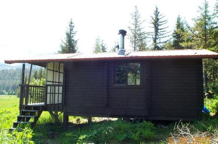
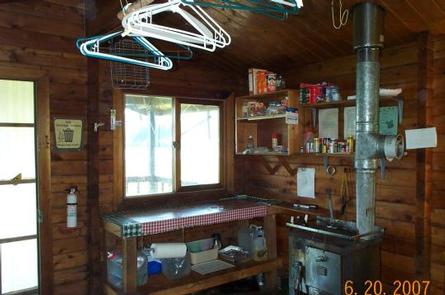
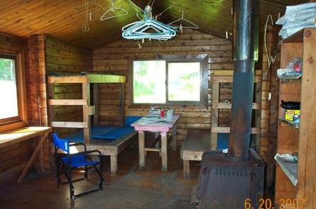
The 20×20-ft rustic cabin can sleep six people on wooden bunkbeds without mattresses. The cabin is equipped with a table, benches, a wood and oil stove for heat and an outhouse.
The cabin has no running water, electricity or cut firewood. Visitors must bring #1 oil, kerosene or wood for the stove, as well as water, food, sleeping bags, pads, cook stoves and cooking gear.
Natural Features
Hinchinbrook Island is in the Gulf of Alaska at the entrance to Prince William Sound. The cabin is located on a tidal bay, surrounded by low, forested hills of spruce, hemlock and muskeg openings.
Wildlife in the area abounds, including waterfowl, Sitka black-tail deer and brown bear. The beaches on the Prince William Sound offer views of the Sound and the surrounding mountains. Occasionally, humpback and orca whales can be seen spouting offshore.
Nearby Attractions
Cape Hinchinbrook Lighthouse is located on the southwest end of Hinchinbrook Island. It is a fantastic historical site that has proved invaluable directing vessels to and from Prince William Sound. Though no longer used as a primary navigational aid, the beacon still serves as a reassuring presence along the rugged Alaskan coast.
Charges & Cancellations
A $10.00 service fee will apply if you change or cancel your reservation. Late cancellations are subject to additional fees. For full details see NRRS Reservation Policy.