

Directions
The cabin is located on the southwest shore of Coghill Lake, on the lagoon just before Coghill River, on the east side of College Fiord in Prince William Sound.
Accessible via float plane (50 minutes from Anchorage or 60 minutes from Cordova). The lagoon has enough water to taxi a plane near the boardwalk by the cabin.
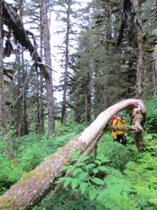
The cabin can also be accessed by trail (three miles) from saltwater to the cabin. The Coghill River Trail is primitive and extremely difficult.
Phone
907-783-3242
Activities
CAMPING, FISHING, HIKING, HUNTING, WILDLIFE VIEWING
Keywords
COG1,CHUGACH NF – FS
Related Link(s)
Overview
Coghill Lake Cabin offers opportunities for year-round rest and recreation near College Fiord in Prince William Sound. The cabin is nestled on a lagoon on the southwest shore of beautiful Coghill Lake, which is known for its excellent salmon fishing.
This remote site can be accessed by floatplane, which is typically a 50-minute flight from Anchorage or an hour from Cordova. Guests are responsible for their own travel arrangements and safety, and must bring several of their own amenities. Hike in options include accessing the Cabin via a very rugged three-mile trail leaving from Coghill Bay (East side of Port Wells).
Recreation
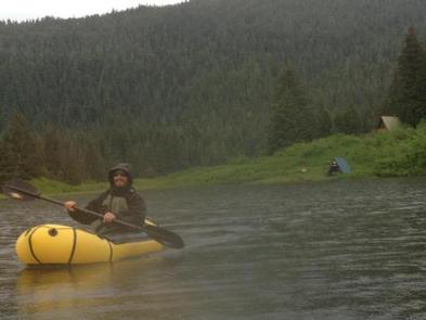
Salmon fishing is excellent from the lakeshore and the lagoon. Anglers can fish for sockeye from mid-June through July, pink and chum in July and August, and Coho salmon in August and September. Dolly Varden trout fishing is also good from May through October. The Coghill River, which connects the lagoon to College Fiord, is also a popular spot for sockeye fishing.
Guests can use the small rowboat and oars provided by the Forest Service; please provide your own personal floatation device. Hunting for black bear and waterfowl is available during designated seasons. Permits are available through the State of Alaska.
Berry pickers will find plentiful salmonberries and blueberries near the cabin in season. Hikers have access to a challenging three-mile trail to Port Wells, but the brush is often thick and some route-finding skills are necessary.
Facilities
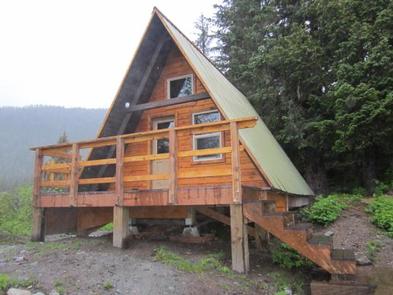
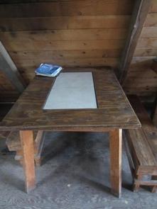
The cabin is a 16×16-foot A-frame with a main floor and a sleeping loft. It accommodates up to six guests and comes equipped with wooden bunks, a kerosene heating stove, a table, benches and an outhouse with a pit toilet.
No water, electricity or fuel for the heater is provided. Guests are responsible for bringing their own drinking water, kerosene for heater (typically ~1 gallon/ day is sufficent), a cook stove, flashlights or lanterns, bedding, mattresses, toilet paper, garbage bags, cookware, dishes and utensils.
Please pack out what you bring in to leave a clean Cabin for the next visitors!
Natural Features
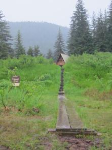
Coghill Lake Cabin is surrounded by rolling hills on the edge of a stand of conifer trees next to a shallow lagoon, which is connected to the lake by a passage. The cabin offers a view of most of the lagoon, with the Chugach Mountains and glaciers in the background.
A large variety of wildlife lives in the area, including Sitka black-tailed deer, bald eagles, waterfowl and river otter. The Coghill Lake area is particularly known for its black bear population, so visitors are urged to practice bear safety (learn about bear safety).