

Directions
From Petersburg, the journey is is 15 miles by float plane or 40 miles by boat. A 14-foot tide is necessary to access this cabin by boat, and the rapids at the entrance to the Salt Chuck are navigable only at high slack tide (up to 45 minutes after high tide). Please check current conditions prior to your trip. Click here for more information. The cabin can be found on USGS topographic map Petersburg D4. Petersburg, C3, C4, D3 and D5 may also be helpful. Maps are available online or by calling the Petersburg Ranger District at (907) 772-3871.
Phone
907-772-3871
Activities
BOATING, CAMPING, FISHING, HIKING, HUNTING, WILDLIFE VIEWING, WILDERNESS
Keywords
SCEA,TONGASS NF – FS
Related Link(s)
Overview
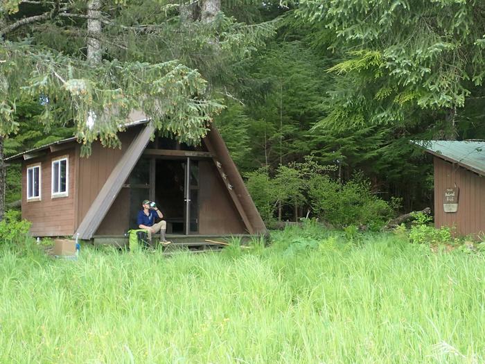
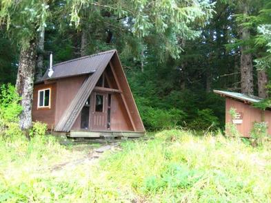
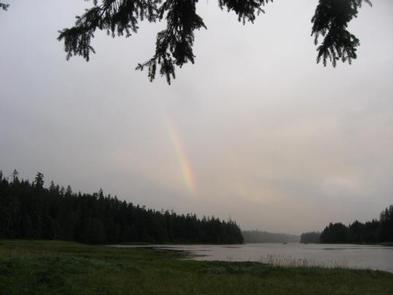
The Salt Chuck East Cabin is located on Kupreanof Island on the east side of the Duncan Salt Chuck. It provides access to a variety of recreational opportunities, including fishing, hunting and wildlife viewing.
The cabin is accessible by boat or float plane only. Guests are responsible for their own travel arrangements and safety, and must bring several of their own amenities.
Recreation
The Portage Mountain Loop Trail is a primitive trail leading from the cabin to Portage Bay (Goose Cove) and Petersburg Lake. The trail is especially primitive and hard to follow between Goose Cove and Petersburg Lake, which is why few people hike that section of the trail.
Fishing opportunities abound and anglers will find abundant steelhead in April and May, coho salmon in August and September and trout from June to September. A rowboat and oars are available at the cabin, however life jackets are not provided and visitors must bring their own. Guests may also choose to bring a small outboard motor.
Hunting is available as per state or federal hunting regulations; click here for more information from the Alaska Department of Fish and Game.
Facilities
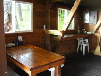
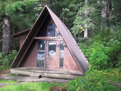
The modified A-frame cabin has two wooden bunks and a sleeping loft that can accommodate up to seven people. It is equipped with a table, benches and a clean-burning oil heater. An outhouse with a pit toilet is provided.
Water for drinking, cooking and cleaning is not provided at the cabin. The nearest water source is a small creek near the cabin. Water taken from any outdoor source should be treated or boiled before consumption. Guests are encouraged to bring drinking water if possible.
Guests will need to bring their own sleeping bags and pads, cook stove and cooking gear, towels, food and clothing, fire starter and garbage bags, among other necessities. Guests are advised to bring enough kerosene or No. 1 heating oil for the oil heater. It burns at a rate of approximately one gallon per day. Oil is not supplied at the cabin.
A broom, dust pan, axe and splitting maul are generally available, but may be missing or damaged. Please report missing or damaged items to the Petersburg Ranger District. The cabin needs to be cleaned prior to leaving and all garbage and food must be carried out.
Click here for more cabin details and maps.
Natural Features
The cabin sits within the Petersburg Creek-Duncan Salt Chuck Wilderness, overlooking a large expanse of saltwater grass flats. The terrain behind the cabin is old growth spruce and hemlock forest. A variety of wildlife can be seen in the area, including waterfowl, grouse, deer and black bears (learn about bear safety).