

Directions
Accessible May through November. Located near the eastern shore of Chichagof Island between the outlets of Tenakee Inlet and Peril Strait, about 45 miles northeast of Sitka. Access is by floatplane, 30 minutes from Sitka or Juneau; or by boating to Corner Bay and hiking 7 miles on logging road and 0.7-miles on Kook Lake Trail to the cabin. For geographic features surrounding the cabin, refer to USGS topographic maps Sitka C-3 and C-4.
Phone
907-747-6671
Activities
BOATING, CAMPING, FISHING, HIKING, HUNTING
Keywords
KOOK,TONGASS NF – FS
Related Link(s)
Overview
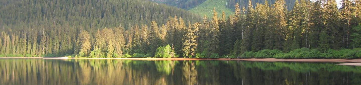
Kook Lake Cabin sits on the west end of Kook Lake, approximately 45 miles northeast of Sitka, Alaska. The cabin is available May through November, weather permitting, and makes an excellent base for experiencing and exploring this corner of Alaska.
The cabin is remote and accessible by floatplane, weather permitting, 30 minutes from either Sitka or Juneau. The cabin can also be reached by a boat and hiking trip. The cabin is about an 8-mile hike from Corner Bay. Visitors are responsible for their own travel arrangements and safety, and must bring their own amenities.
Recreation
Visitors enjoy hiking on a network of old logging roads of the the Corner Bay road system near the cabin. The 0.7-mile Kook Lake Trail begins behind the cabin and ends at Forest Road 7540, part of the Corner Bay road system. The trail is not maintained and crosses through many muskegs. It can be very wet, muddy and hard to follow. On Road 7540, it is a 7-mile hike to Tenakee Inlet and Corner Bay, the site of a former logging camp, now uninhabited. Tenakee Springs is located across Tenakee Inlet.
Cutthroat and Dolly Varden fishing is available year-round in the lake. Good runs of sockeye occur during July and August, and coho salmon during late August and early September. Seasonal deer and bear hunting is also available.
For information about fishing and hunting permits and seasons, visit the Alaska Department of Fish and Game website.
Facilities
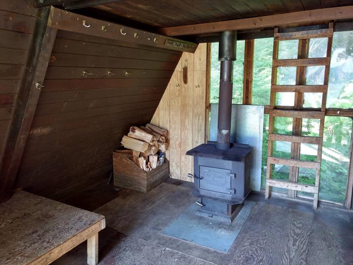
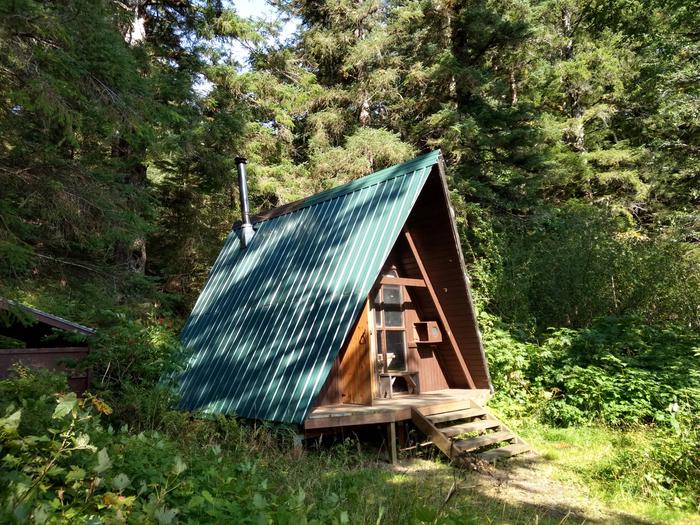
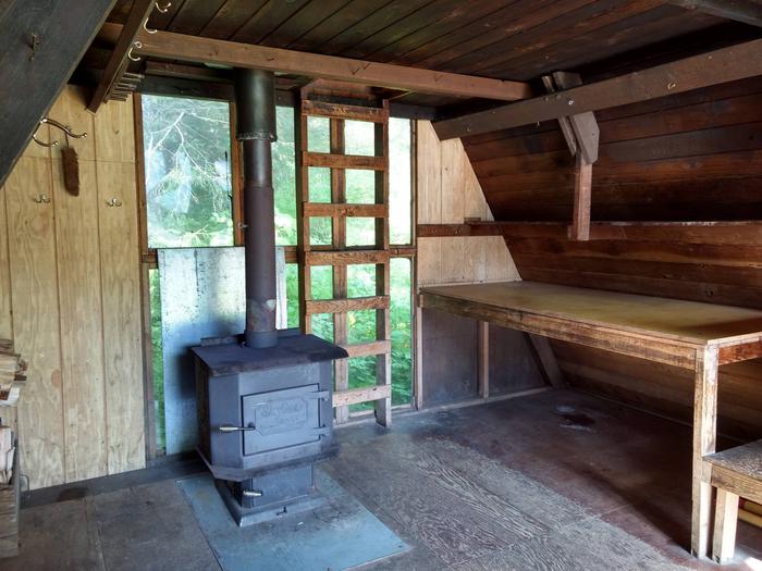
The wood A-frame cabin measures 16 by 16 feet and has one double plywood bunk on the main level, and an upstairs sleeping loft with no bunks reached by climbing a vertical ladder. A wood stove for heat, a table with benches, a cooking counter, a broom, an axe or splitting maul and an outdoor screened cooler box are provided. An outhouse toilet is close to the cabin.
The cabin does not include mattresses or cooking gear. Visitors should bring sleeping bags and pads, a cooking stove, pots, pans, plates, utensils, food, toilet paper, a lantern, garbage bags, fire extinguisher, fire starter and personal flotation devices (PFDs). Rain gear and rubber boots are a necessity.
Water is available from the lake or a nearby stream, but must be treated before using. It’s recommended that visitors bring their own water.
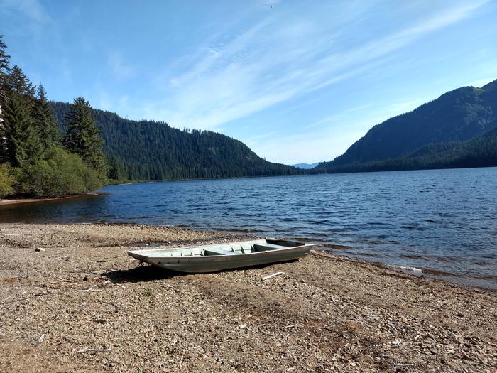
A small but heavy square-bowed skiff (rowboat) is provided. A long-shaft 2-10 horsepower outboard motor enhances the use of the skiff, but is not provided. Each person using the skiff should wear a Coast Guard approved personal flotation device (PFD). Be sure plug is in before launching boat. Tie skiff well up on shore and pull plug before leaving so boat does not fill with rain water.
Click here for more cabin information and maps.
Natural Features
The cabin sits in a beautiful stand of spruce and hemlock, surrounded by flat terrain with a sandy beach in front. North of the lake, the land gradually rises to 1,500 feet (455 meters), then ascends sharply to alpine. On the south, slopes are fairly steep, rising from the lake to 2,500 feet (762 meters). Brown bear frequent the area.