Directions
Open year round, weather permitting. Located 20 miles northwest of Sitka on the western shore of Kruzof Island in the Gulf of Alaska. First-time users of this cabin should contact the Sitka Ranger District office at 907-747-6671 for specific directions to the cabin.
Helicopter or wheel plane can land on the beach at low tide. Access by boat is 45 minutes from Sitka to Mud Bay, then hike 7 miles on the Kruzof Island Road (old logging road) and Shelikof Trail. ATV access is allowed as far as Iris Meadows, approximately 1.4 miles from the cabin.
From Mud Bay, take Kruzof Island Trail about 6 miles to T in road at Iris Meadows. Turn left toward Shelikof Trail, cross footbridge and parallel Shelikof River to right through meadows on south side to large diamond trail marker at the meadow/forest edge. Do not turn left once you cross footbridge. Easier to cross meadows during lower tides of 6 feet or less. Shelikof Trail continues at diamond marker just inside the timber and parallels the forest edge, crossing occasional sloughs before reaching cabin. Be alert, as you can easily lose sight of trail markers at slough crossings.
For geographic features around the cabin, refer to USGS topographic maps Sitka A-5, A-6.
Phone
907-747-6671
Activities
CAMPING, FISHING, HIKING
Keywords
SHEK,TONGASS NF – FS
Related Link(s)
Overview
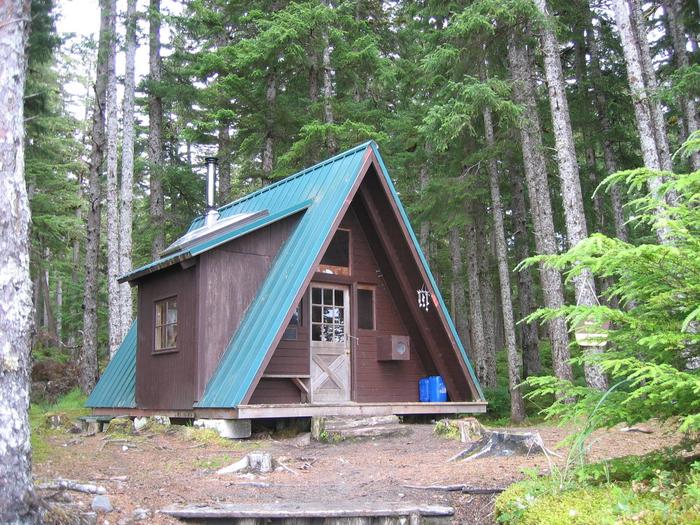
Shelikof Cabin overlooks a sandy beach of Shelikof Bay on the west coast of Kruzof Island, 20 miles from Sitka, Alaska. The cabin is generally available year-round, weather permitting, and was built in 1991 by volunteers from the U.S. Coast Guard Air Station in Sitka.
This is a remote site. The cabin can be accessed by helicopter or wheeled plane on the beach during low tide. Alternatively the cabin can be reached by boat, a 45-minute ride from Sitka to Mud Bay, followed by a 7-mile hike, across the Kruzof Island Trail to Iris Meadows and access to Shelikof Trail, subject to tide conditions. Visitors are responsible for their own travel arrangements and safety, and must bring their own amenities.
Recreation
Scenic viewing, photography, beachcombing and hiking are popular activities here. Fishing is fair for Dolly Varden, coho and pink salmon in a nearby stream.
For information about fishing permits and seasons, visit the Alaska Department of Fish and Game website.
Facilities
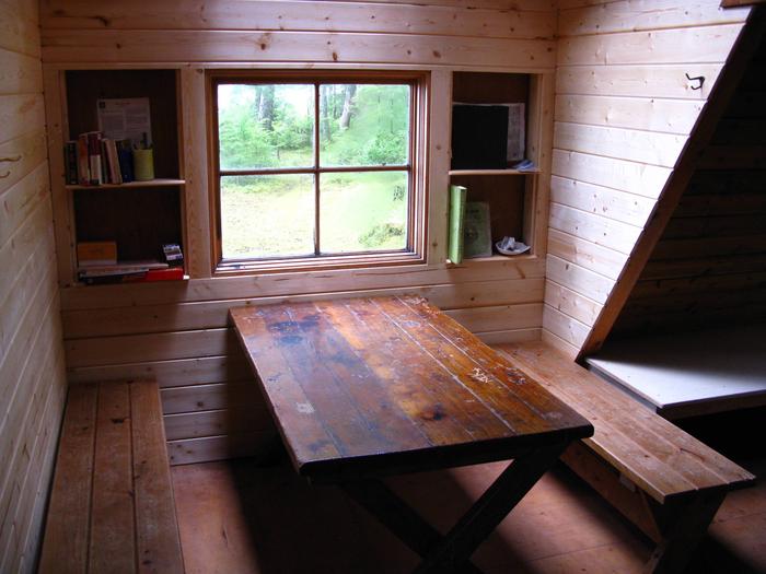
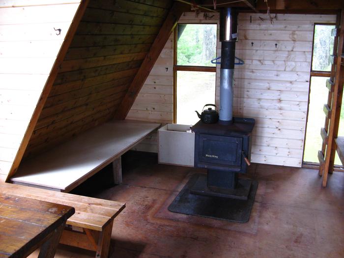
The 16 x 16-foot wood A-frame cabin can accommodate up to eight people, with a double bunk bed on the main level and an upstairs sleeping loft reached by vertical ladder. A wood stove for heat, a table with benches, cooking counter, cupboard, broom and an axe or splitting maul are provided. An outhouse toilet is close to the cabin.
The cabin does not include mattresses or cooking utensils. Visitors should bring sleeping bags and pads, a cooking stove, pots, pans, plates, utensils, food, toilet paper, a lantern, garbage bags, a fire extinguisher and fire starter. Rain gear and boots are recommended.
Water is available from a spring about 1/4-mile from the cabin, but must be treated before using. It’s recommended that visitors bring their own water.
Click here for more cabin details and maps.
Natural Features
The cabin offers spectacular ocean views of Shelikof Bay’s rolling surf from its location at the edge of spruce-hemlock forest. Relatively flat and easy terrain surrounds the cabin and is easy to explore. A expansive sandy beach provides great beachcombing opportunities. North Beach Cabin lies on the northern beaches of Shelikof Bay. Brown bear frequent the area.


