
Directions
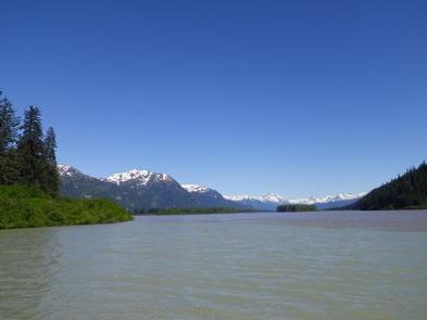
The Shakes Slough Cabins are located in the Stikine-LeConte Wilderness on the north shore of the Stikine River at the Shakes Slough entrance. From Wrangell, the cabins are 20 miles by float plane or 25 miles by shallow draft boat. Low river levels and tides affect access to the cabin ( Stikine River level at Shakes Gage ). A minimum depth of 14 feet is required for navigating through the Stikine River tide flats. The river is normally ice-free May to October.
Phone
907-874-2323
Activities
BOATING, CAMPING, FISHING, HUNTING, WILDLIFE VIEWING
Keywords
SHAL,TONGASS NF – FS
Related Link(s)
Overview
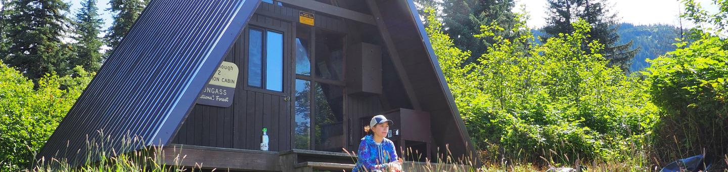
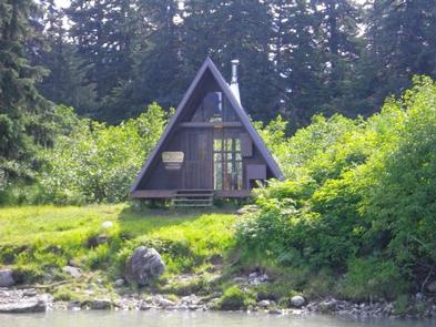
Shakes Slough 2 Cabin makes an excellent basecamp for exploring the Stikine River. It is located at the confluence of the Stikine River and Shakes Slough and within a few hundred feet of neighboring Shakes Slough 1 Cabin. These cabins offer spectacular views of the surrounding Stikine-LeConte Wilderness. The site can be accessed by float plane or shallow draft boat, depending on conditions. A tide of at least 14 feet is required to navigate the Stikine River tide flats. Guests are responsible for their own travel arrangements and safety, and must bring several of their own amenities.
Recreation
This area of the Stikine River offers plenty of places to explore by boat. Shakes Lake and Glacier are three miles north of the cabin and offer excellent opportunities to view wildlife and scenery. The Chief Shakes Hot Springs are approximately four miles upstream, and can be accessed by boat from Hot Springs Slough, which is off the Ketili Slough. A 0.3-mile trail leads from Hot Springs Slough to the Chief Shakes Hot Springs. Cutthroat trout and Dolly Varden are in the river from June to October, but a boat is needed to reach the trout streams. River levels and tide charts should be checked before any boating activity. Hunting is also available in the area during designated seasons.
Facilities
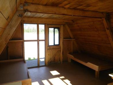
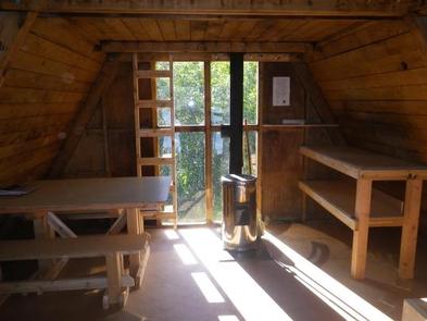
The 16-by-16 cabin (A-frame style) was built in 1963 and has two single bunks (one with a trundle bed) and a sleeping loft, to accommodate up to seven people. It is also equipped with a table with benches, an oil space heater (No.1 oil only), broom and an outhouse. The partially covered front porch has a bear-proof locker for food storage. Water and electricity are not provided, and there are no natural drinking water sources near the cabin. Guests must bring their own drinking water. Heating oil is not supplied by the Forest Service. In addition to bringing a supply of No.1 stove oil, guests should pack sleeping bags, sleeping pads, a cooking stove, lanterns or flashlights, cookware, plates, utensils, food, toilet paper, garbage bags, a fire extinguisher and matches, among other necessities. Guests are expected to pack out trash and clean the cabin before leaving ( click here for more cabin details).
Natural Features
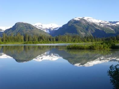
The cabin is tucked into a stand of spruce trees, set back from the bank of the Stikine River. It overlooks Shakes Slough and offers spectacular views of Popof Glacier, Mount Basargin and other nearby peaks. The vegetation in front of the cabin is primarily ferns and salmonberry, with willow and alder along the slough. The surrounding rainforest consists of Sitka spruce and western hemlock, with cottonwood on the valley bottom. Brown and black bears roam the area, and moose are sometimes seen among the willow thickets ( bear safety information ). Mountain goats can occasionally be spotted in the surrounding mountains. The Stikine River tide flats are a major stopover point in the spring and fall for migratory shorebirds and waterfowl.
Charges & Cancellations
A $10.00 service fee will apply if you change or cancel your reservation. Late cancellations are subject to additional fees. For full details see NRRS Reservation Policy.