COLUMBINE CAMPGROUND (NM), NM Campground Reservation, Info, Images, Map, Directions

COLUMBINE CAMPGROUND (NM), New Mexico Campground Images, Info & Reservations

Directions

Five miles east of Questa, New Mexico via NM highway 38.

Phone

435-245-6521

Activities

CAMPING, FISHING, HIKING, VISITOR CENTER, WILDLIFE VIEWING

Keywords

Related Link(s)

Rec Area Info & Images

New Mexico State Road Conditions

New Mexico State Tourism

Overview

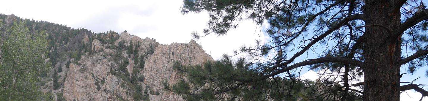
Columbine Campground is located between Questa and Red River, New Mexico. The Red River flows past the campground and a trailhead leads into the Columbine-Hondo Wilderness area. Columbine Campground sits at 7,900 feet in elevation.

Recreation

The Columbine Twining hiking trail can be found at the south end of the campground and gives access to 14 miles of hiking trails, and leads into the Columbin-Hondo Wilderness area. The Red River runs near the campground and can be accessed near the first loop.

Facilities

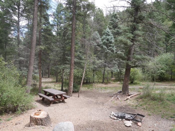
This campground offers 26 single sites, potable water, and vault toilets. Each site is has a fire ring, picnic table, and tent pad. Please note that no water can be filled directly into a trailer, rv, or motorhome anywhere in this campground – the potable water is only for filling containers you bring back to your site.

Natural Features

The campground is composed of two loops. One small loop at the campground entrance, has all open sites and views of the towering mountains. The other is a long loop up the canyon along the fast-flowing Columbine Creek. The campsites in this loop are tucked in among pine, spruce and some aspen providing ample shade and good privacy between campsites.

Nearby Attractions

Be sure to explore Red River, Questa, and the Enchanted Circle while in the area.

Reservation

More from CampingHiking.net:

PAYSON LAKES GUARD STATION, Utah Campground Images, Info & Reservations

Directions From I-15, take exit 250 toward north Payson/Salem and proceed south on Main Street to 100 North/Highway 198. Travel east to 600 East. Turn south onto 600 East, which becomes the Nebo Loop Scenic Byway/Payson Canyon Road. Travel south along the Nebo Loop Road 015 until you see the

JUDITH GUARD STATION, Montana Campground Images, Info & Reservations

Directions From Great Falls, travel east on U.S. Highway 87 for about 63 miles to Windham, Montana, from Windham turn right off HWY 200/87 and head south for approximately 10 miles until the town of Utica. Turn right at Utica, continue south for approximately 13 miles on the county road.

DRY GULCH, California Campground Images, Info & Reservations

Directions From Highway 140, turn on to Foresta Road. Landmarks include Red Bud Picnic Area and a National Park Service warehouse. After bridge, turn left onto the spur road. Immediately turn left onto Incline Road. Continue 1.3 miles to the facility. Phone 559-642-3212 Activities CAMPING Keywords DRYG,EL PORTAL,MERCED RIVER,SIERRA NF

CAMP CREEK, Oregon Campground Images, Info & Reservations

Directions From Portland, travel east on Highway 26 for approximately 32 miles. Camp Creek Campground is located on the south side of the highway, about 3 miles past the community of Rhododendron. Phone 503-630-5721 Activities BIKING, CAMPING, FISHING, HIKING, VISITOR CENTER Keywords CACR,MT. HOOD NF – FS Related Link(s) Rec

OBEY RIVER PARK, Tennessee Campground Images, Info & Reservations

Directions From Byrdstown, Tennessee, take Highway 111 south for 3 miles. After crossing the bridge turn right and follow the signs into the campground and day-use area, located to the left of Sunset Marina (2040 Sunset Dock Road, Monroe, TN 38573). From Livingston, Tennessee, take Highway 111 north for 15