ROBINSON CREEK SOUTH, CA Campground Reservation, Info, Images, Map, Directions

ROBINSON CREEK SOUTH, California Campground Images, Info & Reservations

Directions

Take U.S. Highway 395 through Bridgeport. Turn south on Twin Lakes Road at the Shell gas station. Travel 9.3 miles on Twin Lakes Road. Turn left into the campground.

Phone

760-932-7092

Activities

CAMPING, FISHING, HIKING, WILDLIFE VIEWING, DAY USE AREA

Keywords

ROBS,HUMBOLDT-TOIYABE NF-FS

Related Link(s)

Rec Area Info & Images

California State Tourism

Forest Service Concessionaire

California State Road Conditions

Overview

Robinson Creek South Campground is located just 9 miles from Bridgeport, California, next to Robinson Creek at an elevation of 7,000 feet. The Twin Lakes area is close by, offering boating, fishing, hiking and horseback riding opportunities.

Recreation

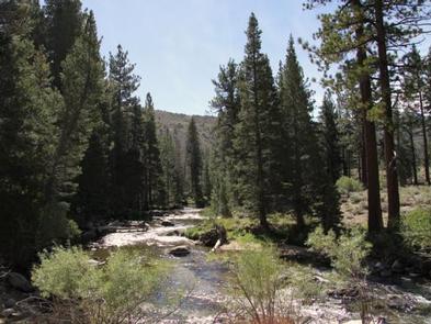
Robinson Creek offers good rainbow trout fishing and can be easily accessed from within the campground. Numerous hiking trails are in the vicinity, including the popular Robinson Creek Trail.

Facilities

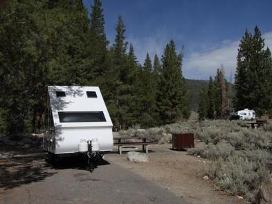
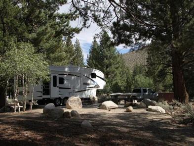
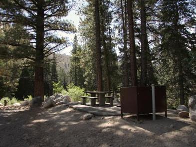
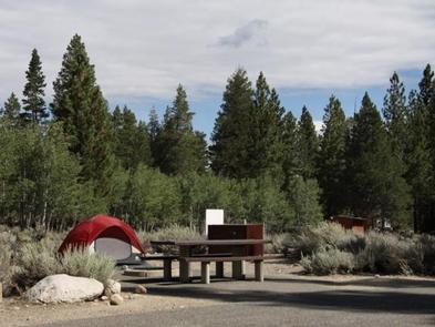
The campground contains single sites with picnic tables, food storage lockers and campfire rings with grills. Vault toilets, drinking water and trash collection are provided. Firewood is available for purchase from the host.

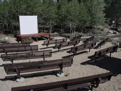
Educational programs are held at the campground’s amphitheater on weekends from July 4 through Labor Day. Robinson Creek North Campground is adjacent.

Natural Features

The campground is situated alongside its namesake creek, where a forest of massive Jeffrey pines towers over the site, offering partial shade. Lodgepole pines, sagebrush and summer wildflowers dot the landscape.

Nearby Attractions

Upper and Lower Twin Lakes are nearby, offering beautiful mountain scenery, boating, canoeing and fishing for Kokanee salmon and rainbow and brown trout. The rugged and scenic Hoover Wilderness Area can be accessed from the Twin Lakes area and offers additional hiking and horseback riding trails.

Reservation

More from CampingHiking.net:

LINK CREEK, Oregon Campground Images, Info & Reservations

Directions Travel approximately 13 miles northwest of Sisters on Highway 20/126. Turn left onto Forest Road 2070/Suttle Lake Campgrounds. Travel less than 1/2 mile to Blue Bay entrance on the right to Link Creek. Phone 541-323-1746 Activities BOATING, CAMPING, FISHING Keywords LINK,SUTTLE LAKE CAMPGROUND,DESCHUTES NF – FS Related Link(s) Rec

Chief Paulina Horse Camp, Oregon Campground Images, Info & Reservations

Directions From Bend go south 23.5 miles on Hwy 97, then 13.9 miles east on Rd. 21 From La Pine go north 5 miles on Hwy 97, then 13.9 miles east on Rd. 21 Phone 541-383-5300 Activities HIKING, HORSEBACK RIDING, HORSE CAMPING Keywords CHIF,Chief Paulina,Paulina Horse,Chief,Newberry Horse,Chief Paulina Horse Campground,Chief

WOODED HILL GROUP, California Campground Images, Info & Reservations

Directions Located 50 miles east of San Diego, California. Take I-8 to the Sunrise Highway exit. Go approximately 8.1 miles and turn west onto Wooded Hill Road. Phone 619-445-6235 Activities BIKING, CAMPING, HIKING, PICNICKING Keywords WOOH,CLEVELAND NF – FS Related Link(s) Rec Area Info & Images California State Tourism California

METHODIST COVE, Nebraska Campground Images, Info & Reservations

Directions From U.S. Highway 80, take Highway 183 south to Alma, Nebraska. Turn left on South Street and travel 2.5 miles. The park entrance is on south side of the road. Phone 308-799-2105 Activities BOATING, CAMPING, FISHING, HUNTING Keywords METH,HARLAN COUNTY LAKE,METHODIST,HARLAN COUNTY LAKE Related Link(s) Rec Area Info &

AMITY RECREATION AREA, Georgia Campground Images, Info & Reservations

Directions From Thomson, Georgia, take U.S. Highway 78 west for 6 miles. Turn right on State Route 43 and continue for about 7.5 miles. The park is on the right (look for signs). The park is located on the McDuffie/Lincoln County line. Phone 800-533-3478 Activities BOATING, FISHING, PICNICKING, WILDLIFE VIEWING,