
Directions
From Kooskia, ID, take Highway 12 East to Kamiah. Turn left onto Woodland Road for half a mile, then take the second right onto Glenwood Road (Road 100). Stay on this paved road until you reach the junction with Yakus Creek Road (Road 519). Park here (be sure to park out of the way of traffic as there may be active logging operations throughout the winter).
Travel by snowmobile along Road 519 about 1 mile where it turns into Road 514. Travel this road for approx. 9 miles where it intersects Road 101 at Fan Saddle. Continue on Road 101 for another 5 miles to Mystery Saddle and turn right on Road 486A. At the junction of Road 486D, stay to the right and follow Road 486A for another 2 miles to Walde Cabin.
Phone
208-926-4274
Activities
CAMPING, WINTER SPORTS, WILDLIFE VIEWING
Keywords
WDLC,Walde Lookout Tower,Walde
Related Link(s)
Overview
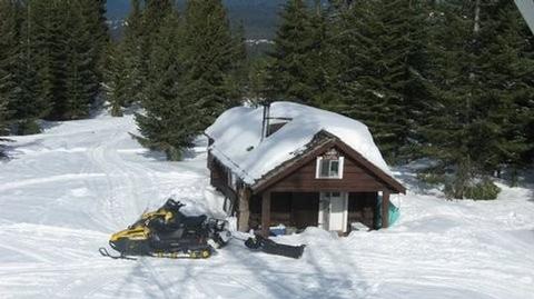
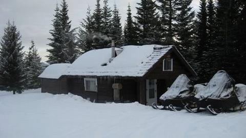
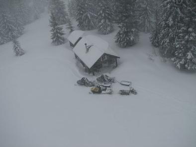
Walde Lookout Cabin was built in 1941 to house the employees who worked in the adjacent fire lookout, which was built in 1939. The fire lookout is still in use during the summer and fall, so the cabin is only available for rent from approximately mid-December through late March. This charming, rustic cabin has been restored to its original character.
Guests must reach the cabin by snowmobile, skis or snowshoes. This is a trip of around 17 miles, and guests are responsible for their own travel arrangements and safety. The cabin provides a few conveniences, but guests will need to bring some supplies and gear to make a cozy and comfortable retreat for enjoying winter recreation.
Recreation
Several trails crisscross the vicinity, ideal for snowmobiling, snowshoeing or cross-country skiing. There are good places to sled nearby.
Facilities
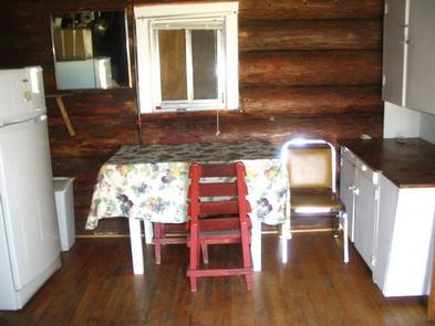
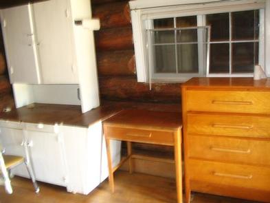
This 14×16-ft. log cabin accommodates four people with two mattresses located in a loft area and two cots. A wood stove heats the cabin, which is also equipped with a table and four chairs, a propane cook stove, propane lights, basic cooking and eating utensils, smoke alarm, mop and bucket, fire extinguisher and a snow shovel. Click here for additional cabin details.
Firewood is available in a shed just outside. Toilet facilities consist of an outhouse with a pit toilet. Guests should be prepared to shovel a path to the cabin, shed and outhouse, as well as remove snow from the propane tank to turn it on.
There is no electricity or running water. Guests should bring their own drinking water. Natural sources can also provide water, although it should be boiled for culinary use. Garbage bags are also needed to pack out trash.
Bedding, flashlights or lanterns, extra batteries, matches, first aid supplies and toilet paper are not provided. Guests should remember to bring their rental permit with them to the cabin.
Natural Features
The cabin sits at an elevation of 5,220 feet on the watershed divide between the Lochsa and Clearwater Rivers. This vantage point shows off the western slopes of the vast Selway-Bitterroot Wilderness and the jagged peaks of the Selway Crags. The cabin is surrounded by a dense evergreen forest.
The winter landscape is blanketed in deep, pristine snow. Wildlife sightings may include mule and white-tailed deer, elk, moose, gray wolf and cougar. A variety of birds also inhabit the area.