Eagleview Group Campground (Reservation), OR Campground Reservation, Info, Images, Map, Directions

Eagleview Group Campground (Reservation), Oregon Campground Images, Info & Reservations

Directions

From Sutherlin, travel west on Highway 138 for 12 miles. Turn left at the Bullock Bridge, cross over the bridge and immediately turn right onto County Road 57 (Bullock Road). Travel one mile to Eagleview. Campground is on the right.

Phone

541-440-4930

Activities

BOATING, CAMPING, FISHING, HIKING, SWIMMING SITE

Keywords

EGCA,Eagle View Campground,Eagle View Group Campground

Related Link(s)

Rec Area Info & Images

Oregon State Road Conditions

Oregon State Tourism

Overview

Eagleview Group Campground is situated between the Pacific Coast and the city of Roseburg, Oregon. Its location on the Umpqua River caters to avid anglers and water sport enthusiasts while the grassy field and horseshoe pits offered onsite, provide more casual recreation options closer to the campground.

Recreation

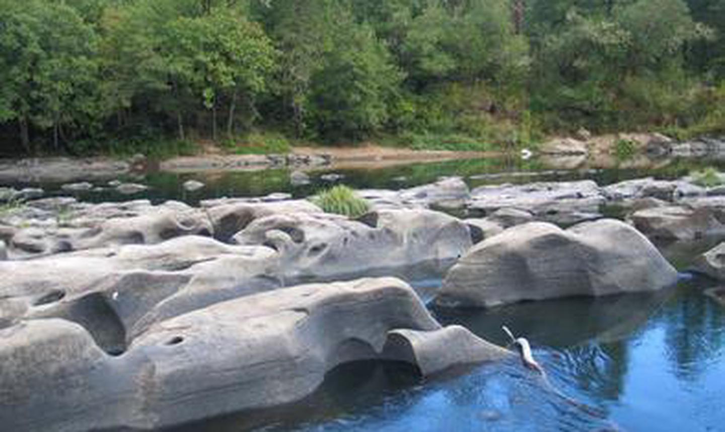
Fishing enthusiasts will enjoy the chance to catch chinook salmon, coho, steelhead or smallmouth bass depending on the season. Float the river on a kayak or canoe or just swim in the cool Umpqua waters on a hot summer’s day. These are just a few of the many things to do at Eagleview.

Facilities

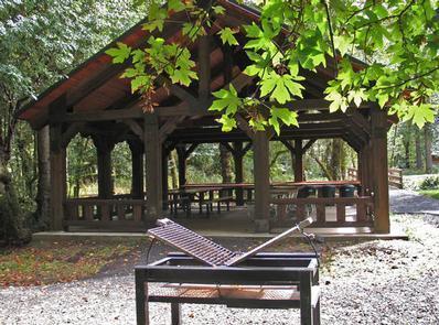
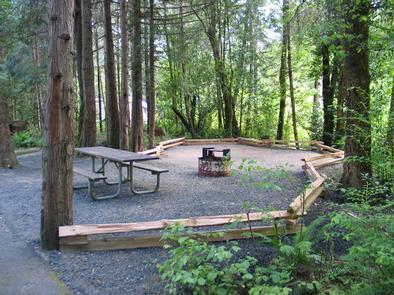
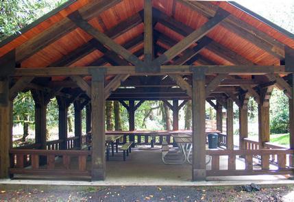
The campground has 10 campsites that will accommodate up to 100 campers. There is also a group picnic area, covered pavilion and a large fire pit for group gatherings. The grassy field is ideal for bocce ball, croquet or throwing around a Frisbee and a small frisbee golf course. Horseshoe pits are also on-site.

Natural Features

Eagleview is situated along the Umpqua River in southwestern Oregon. It is only one of two rivers in Oregon with headwaters that begin high up in the Cascade Mountains and meander on down to the Pacific Ocean. The campground lies in a broad river canyon surrounded by deeply forested mountainsides.

The name, Umpqua, is a surviving term of the Native American Umpqua language, and translates to “thundering waters,” “satisfied,” or “across the waters.”

Nearby Attractions

The Umpqua River Scenic Byway offers travelers the opportunity to drive along the Umpqua River from Interstate 5 to the coastal communities of Reedsport and Winchester Bay. Along the byway lies the town of Elkton, well-known for its wineries. West of Elkton is the Dean Creek Elk Viewing Area, where spotting majestic Roosevelt Elk near the roadway is almost guaranteed. The Pacific Ocean is roughly 45 miles from Eagleview via Highway 138.

Reservation

More from CampingHiking.net:

WILLOW LAKE, Utah Campground Images, Info & Reservations

Directions From Ferron Utah Willow Lake is located approximately 25 miles up Ferron Canyon, on Forest Road 022. From Mayfield Utah Willow Lake is located approximately 27 miles from Mayfield. Head East from up Forest Road 022, turn left on Skyline Drive at 12 Mile Campground then following signage towards

WHITE SULPHUR SPRINGS CABIN, Alaska Campground Images, Info & Reservations

Directions Accessible year round, weather permitting. Located 65 miles northwest of Sitka on Chichagof Island within the West Chichagof-Yakobi Wilderness Area. Boat access is possible with anchorage in Mirror Harbor, where 0.9-mile White Sulphur Springs Trail leads to the cabin; however, local knowledge is recommended before attempting anchorage there. White

STILLHOUSE, Texas Campground Images, Info & Reservations

Directions From Interstate 35 in Belton, Texas take State Highway 190 west to the Simmons Road exit. Exit and turn left under 190 onto Simmons Road. Proceed about three miles to the park. Phone 254-939-6741 Activities BOATING, CAMPING, FISHING, SWIMMING SITE Keywords STIL,STILLHOUSE HOLLOW PARK,STILLHOUSE HOLLOW Related Link(s) Rec Area

DIMOND O, California Campground Images, Info & Reservations

Directions From the Groveland District Office, head east 15 miles on Highway 120, then turn left on Evergreen Road and travel 4 miles. The campground is located on the left. Phone 209-379-2258 Activities BIKING, BOATING, CLIMBING, CAMPING, FISHING, HIKING, CANOEING, ROCK CLIMBING Keywords DIMO,DIAMOND O,DIMOND O,STANISLAUS NF -FS,Diamond (CA) Related

CHILHOWEE GROUP CAMP, Tennessee Campground Images, Info & Reservations

Directions From Highway 64/411 intersection, travel east 7 miles, turn onto Forest Road 77, drive 7.5 miles to campground/recreation area. Phone 423-338-3300 Activities BIKING, CAMPING, FISHING, HIKING, WILDLIFE VIEWING, MOUNTAIN BIKING, KAYAKING, CANOEING, WATER ACCESS, SCENIC DRIVE, RAFTING, RIVER TRIPS, WHITEWATER RAFTING, AMPHITHEATER, ACCESSIBLE SWIMMING Keywords CHILHOWEE GROUP CAMP,CHILHOWEE Related