WESTLAKE DAY USE, TX Campground Reservation, Info, Images, Map, Directions

WESTLAKE DAY USE, Texas Campground Images, Info & Reservations

Directions

From Dallas, go north on I-35E and take the Swisher Exit (exit 458). Cross over I-35 onto North Denton Drive. Stay on Denton Drive until the Main Street stop sign. Turn left and stay on Main St. until it enters into the park. (2000 Main St., Hickory Creek TX)

Phone

(469)645-9100

Activities

CAMPING, FISHING, SWIMMING SITE

Keywords

west lake,westlake shelters

Related Link(s)

Rec Area Info & Images

Texas State Tourism

Texas State Road Conditions

Overview

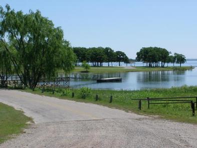
Westlake features four group shelters on Lewisville Lake, where visitors can spend a day picnicking or boating on the almost 30,000-acre reservoir, just outside the Dallas/Fort Worth area.

The lake rests above an archeological site where prehistoric remains have been found. It is believed these early humans inhabited the area as far back as 12,000 B.C., making this one of the oldest human-inhabited sites in the Southwest United States and Mexico.

Recreation

The lake hosts a number of fishing tournaments each year, drawing anglers from all over to try for trophy-sized bass.

Warm water temperatures offer ideal conditions for water sports including boating and jet skiing.

Facilities

Each of the open-sided pavilions come with a large grill and water, and are all within walking distance to a restroom. Blackjack Oak is lakeside with large shade trees. This pavilion seats 50-75 people and has electric hookups.(CLOSED) Bur Oak seats 100-150 people and has its own parking lot. Cottonwood is close to the shoreline, has electric hookups and seats 100-150 people. Green Ash sits in a large, open field and offers electric hookups. It seats 75-100 people.

Natural Features

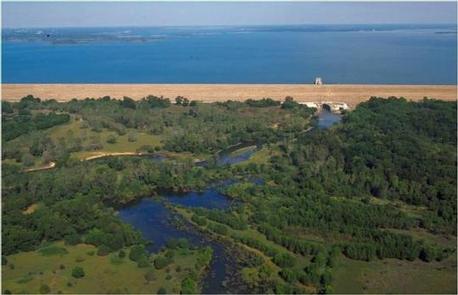
The day-use area sits on the western banks of Lewisville Lake. The lake stems from the Elm Fork of the Trinity River in northern Texas and generally has low visibility, but plenty of surface acres for boating and fishing.

Nearby Attractions

Horseback riding and golfing can be found nearby. The active city of Dallas is about 40 minutes away.

Reservation

More from CampingHiking.net:

ELKMONT GROUP CAMP, Tennessee Campground Images, Info & Reservations

Directions From Cherokee, NC: Take Newfound Gap Road (aka U.S. 441) North through the park into Tennessee. Turn left at Sugarlands Visitor Center. Follow Little River Road approx. 4.5 miles. Turn left at the Elkmont Campground sign and proceed 1.5 miles to the campground office. From Gatlinburg, TN: Take Newfound

DAVIDSON RIVER, North Carolina Campground Images, Info & Reservations

Directions From Asheville, North Carolina, take I-40 West to I-26 East to Exit 40 (Airport Road/Asheville Regional Airport), onto State Highway 280. Continue south 15.5 miles on 280 to Pisgah National Forest. Turn right at the intersection of Highway 280/64/276. Go north on 276 for 1 mile. Follow signs to

Laurel River Lake Picnic Area, Kentucky Campground Images, Info & Reservations

Directions From London, Kentucky, head west on HWY 192 for approximately 15 miles. Turn slight left onto KY-1193. Continue on KY-1193 until arrive at destination on left. Area is marked by "Laurel Dam Picnic Area" signs. Phone 606-864-6412 Activities HIKING, SWIMMING SITE Keywords Laurel River Lake Picnic Area,Laurel Picnic Area

OAK FLAT LOOKOUT, California Campground Images, Info & Reservations

Directions From Bakersfield, California, take Highway 99 to Highway 178 and travel east towards the Kern River Canyon. After passing through the last traffic light (Miramonte Drive) east of town, you will travel downhill. Rancheria Road will be the next left turn off the highway. Proceed 15 miles north along

BIG CREEK CAMPGROUND, Montana Campground Images, Info & Reservations

Directions From Columbia Falls, Montana, follow State Route 486 north for approximately 20 miles to the campground entrance on the right. The road is pavement for 10 miles and gravel for approximately 9 miles. An alternate route through Glacier National Park would be to enter the park through West Glacier.