COUNCIL LAKE DISPERSED CAMPSITE, MI Campground Reservation, Info, Images, Map, Directions

COUNCIL LAKE DISPERSED CAMPSITE, Michigan Campground Images, Info & Reservations

Directions

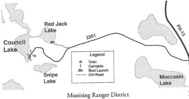
From Munising, Michigan, take Highway 28 east towards Shingleton. Turn south on Highway 13 at Wetmore. After 10 miles turn right onto Forest Service Road 2261. Continue until the road ends at Council Lake.

Phone

906-387-2512

Activities

BIKING, CAMPING, SWIMMING SITE

Keywords

CLDC,COUNCIL LAKE DISPERSED CAMPSITE (MI),Council Lake,Council Lake Dispersed Camp Site

Related Link(s)

Rec Area Info & Images

Michigan State Tourism

Michigan State Road Conditions

Overview

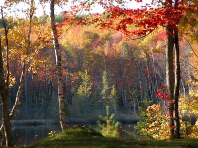
Council Lake Campsite sits on the shores of Council Lake in the center of the Hiawatha National Forest. Its location amid a series of forested lakes provides ample opportunity for visitors to enjoy nature in the scenic surroundings.

Recreation

Council Lake is a 14-acre lake with yellow perch, rock and largemouth bass, bluegill, black crappie, bullhead and northern pike. Licenses are required to fish in Michigan waters. Non-motorized boats can be used on the lake, however access at the campground is by land only. A boat ramp can be found at adjoining Red Jack Lake. Canoeing and kayaking are also popular among visitors to the tranquil campsite.

Facilities

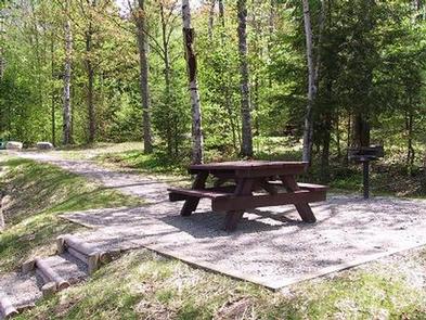
There are four primitive campsites at Council Lake for tent and small RV camping. Each campsite is equipped with a table and a campfire ring. A pit toilet is located near one of the sites, but toilet paper is not provided.

The day-use area is equipped with tables and a campfire ring with a grill. The area is near a beach that is perfect for lounging and swimming. No drinking water is provided at the campsite; water must be brought in and garbage must be carried out.

Natural Features

The small campground is nestled in a mixed stand of hardwood trees and pines. It is on the southern shores of Council Lake, close to adjoining Red Jack and Scout lakes.

Reservation

More from CampingHiking.net:

SARGE CREEK, Oklahoma Campground Images, Info & Reservations

Directions From Kaw City, Oklahoma, travel nearly 3 miles east on Highway 11, then follow signs to the campground. Phone 580-762-5611 Activities BOATING, CAMPING, FISHING, HIKING, WILDLIFE VIEWING, DAY USE AREA Keywords SARG,KAW LAKE,KAW LAKE Related Link(s) Rec Area Info & Images Oklahoma State Tourism Oklahoma State Road Conditions Overview

ALTURAS LAKE PICNIC AREA (ID), Idaho Campground Images, Info & Reservations

Directions From Stanley, Idaho, take State Highway 75 south for about 22 miles. Turn right on Alturas Creek Road/Forest Road 205 and continue west for about 2.6 miles to the campground. Phone 928-537-8888 Activities BOATING, CAMPING, FISHING, HIKING, WATER SPORTS, SWIMMING SITE Keywords ALTU,SAWTOOTH NF – FS Related Link(s) Rec

BLUE CREEK, Oklahoma Campground Images, Info & Reservations

Directions From Tulsa, OK, take U.S. Highway 169 north for 23 miles to Highway 88. Turn right and continue for nearly 6 miles. Turn right onto Edgewater Road, then left on Spencer Creek Road. After about a mile turn left onto Blue Creek Road and continue into the campground. Phone

KIASUTHA, Pennsylvania Campground Images, Info & Reservations

Directions From Kane, Pennsylvania, take State Highway 321 north for 10 miles, then turn onto Longhouse Scenic Drive and continue for a mile to the campground. From Warren, Pennsylvania, take State Highway 59 east for 13 miles, then turn south on Longhouse Scenic Drive and continue for 10 miles. Phone

EMERY BAY CAMPGROUND, Montana Campground Images, Info & Reservations

Directions From Martin City, Montana, turn off Highway 2 and continue on the main road through the town heading south. This road becomes East Side Reservoir Road. Continue for about 6 miles into the campground. Phone 406-752-7924 FOR RESERVATIONS CALL: 1-877-444-6777 Activities BIKING, BOATING, CAMPING, FISHING, HIKING, SWIMMING SITE Keywords

SPRINGY POINT, Idaho Campground Images, Info & Reservations

Directions From Sandpoint, Idaho, take US 95 south across the Long Bridge, then turn west onto Lakeshore Drive. After three miles turn right into the campground. Phone 208-437-3133 Activities BOATING, CAMPING, FISHING, PICNICKING, DAY USE AREA, SWIMMING Keywords SPRP,ALBENI FALLS DAM Related Link(s) Rec Area Info & Images Idaho State