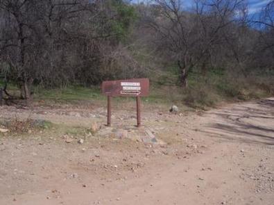
PEPPERSAUCE, AZ Campground Reservation, Info, Images, Map, Directions

PEPPERSAUCE, Arizona Campground Images, Info & Reservations

Directions

From Tucson, drive north on Oracle Road (U.S. Highway 89). Continue for 27 miles to State Highway 77. Turn right (east) and drive 10 miles to the town of Oracle. Take the first Oracle exit and travel 4 miles through the town to Forest Road 38. Follow 38 to Peppersauce Canyon.

Please note: the speed limit is 5 mph inside the campground and 35 mph outside the campground on Forest Road 38.

Phone

520-749-8700

Activities

CAMPING, HIKING, HUNTING, PICNICKING, VISITOR CENTER, WILDLIFE VIEWING

Keywords

Peppersauce Group,Peppersauce Group Site,Peppersauce Group Reservation Site,PEPPERSAUCE (AZ),Peppersauce

Related Link(s)

Rec Area Info & Images

Arizona State Tourism

Arizona State Road Conditions

Overview

With its picturesque vegetation and dramatic setting at the foot of 9,157′ Mt. Lemmon in southeastern Arizona, Peppersauce Campground is an outstanding area for enjoying an afternoon picnic or a weekend campout. This year-round facility is a popular stop among off-road vehicle enthusiasts and families. Hunting, hiking and scenic driving opportunities are nearby. It is located 8 miles from the town of Oracle.

Recreation

The Santa Catalina Mountains are known for their exceptional hiking. Hikers can find access to the Arizona Trail, which runs from Mexico to Utah, about 5 miles from the campground along Forest Road 38. Off-road vehicle trails are also available in the area.

A few nearby caves afford visitors the opportunity for caving and spelunking.

Facilities

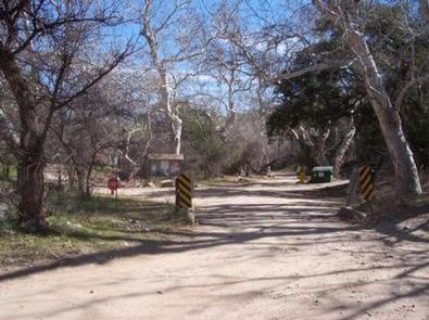
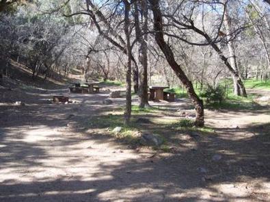
Peppersauce Campground has one reservable group camping area for up to 35 people at a time. The facility is equipped with vault toilets, several tables and benches, a grill, campfire rings and lantern posts. The parking area can hold up to 10 vehicles. First-come, first-served individual campsites are also available.

A campground host is available on-site for visitor assistance.

Natural Features

Campsites at Peppersauce are spread throughout a creekside oasis of enormous Arizona sycamore and walnut trees that provide shade in summer and color in autumn. The campground sits at an elevation of 4,700 feet alongside Peppersauce Creek. The creek is normally dry except during heavy rains or the area’s summer monsoon season. Campers should be aware that the creek is prone to flash flooding during rain events.

Nearby Attractions

Visitors can explore several historic, cultural and natural attractions within a day trip, including the University of Arizona’s Biosphere 2, the city of Tucson, Saguaro National Park, Sabino Canyon and Colossal Cave.

Reservation

More from CampingHiking.net:

SHORELINE, Idaho Campground Images, Info & Reservations

Directions From Boise, Idaho, travel 85 miles north on Highway 55 to Cascade. Turn east on Warm Lake Highway and go 25 miles to Forest Road 489. Turn south and continue a half-mile to the campground. Phone 208-382-7400 Activities BIKING, BOATING, CAMPING, FISHING, HIKING, HUNTING, WILDLIFE VIEWING, SWIMMING SITE Keywords

ARROYO SECO, California Campground Images, Info & Reservations

Directions Coming from the south on Highway 101 to Greenfield, take the first exit (Arroyo Seco) into town. Turn left on Elm Street and go west to Arroyo Seco Road and turn left. Arroyo Seco Road dead-ends at the campground. Coming from the north on Highway 101, just past Soledad,

The Dalles Campground, Washington Campground Images, Info & Reservations

Directions From Enumclaw, Washington, go southeast on Highway 410 towards Mt. Rainier park for approximately 26 miles to campground. Phone 360-804-1103 Activities CAMPING Keywords DALS,MT. BAKER-SNOQU NF – FS Related Link(s) Rec Area Info & Images Washington State Road Conditions Washington State Tourism Forest Service Concessionaire Overview Situated on the

PANTHER FLAT CAMPGROUND, California Campground Images, Info & Reservations

Directions From Highway 101 north of Crescent City, California, take highway 199 east for 16 miles to the campground. Phone 707-457-3131 Activities CAMPING, FISHING, SWIMMING SITE Keywords PANF,SIX RIVERS NF -FS Related Link(s) Rec Area Info & Images California State Tourism California State Road Conditions Overview Panther Flat Campground sits

BOYKIN SPRINGS RECREATION AREA, Texas Campground Images, Info & Reservations

Directions From Zavalla, Texas, travel east on Highway 63 for approximately 10.5 miles. Turn right on Forest Road 313 and proceed 2.5 miles to the campground. Phone 936-897-1068 Activities BIKING, CAMPING, FISHING, HIKING, WILDLIFE VIEWING, NON-MOTORIZED BOATING Keywords None Related Link(s) Rec Area Info & Images Texas State Road Conditions

AXTEL, Kentucky Campground Images, Info & Reservations

Directions Begin at ramp onto I-64 West toward New Albany/St. Louis, traveling 22.3 miles. Take the IN-135, Exit Number 105, toward Palmyra/Corydon, onto IN-135 South toward Corydon, traveling 16.7 miles. Continue on Bypass Road KY-79 for 2.1 miles. Turn right onto KY-79, traveling 10.1 miles. Continue on 1st Avenue, KY-79S