
Directions
From Saguache, take Colorado Hwy 114, 34 miles northwest from Saguache, over North Pass. Take FR#804 south 4 miles to junction, east 1 mile to FR #787, then 21 miles south to the cabin.
Phone
719-655-2547
Activities
CAMPING, INTERPRETIVE PROGRAMS, FISHING, HIKING, HORSEBACK RIDING, HUNTING, WINTER SPORTS, WILDLIFE VIEWING
Keywords
Saguache Park Cabin,Stone Cellar CG,RIO GRANDE NF,SCGS
Related Link(s)
Colorado State Road Conditions
Overview
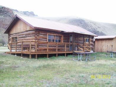
Stone Cellar Guard Station is a remote cabin located at an elevation of 9,500 feet, just outside the boundary of La Garita Wilderness in Saguache Park in the Rio Grande National Forest.
The cabin is a secluded getaway for guests seeking relaxation and recreation in south-central Colorado.
Recreation
The area offers many opportunities for hiking in summer, hunting in the fall and cross country skiing and snowmobiling in the winter.
The cabin is located in a meadow with Saguache Creek flowing through it, affording visitors excellent fishing for rainbow, cutthroat, brown and brook trout right out the back door.
The cabin is adjacent to a working cow camp, where guests can witness real cowboys at work during the summer months. In the fall, this cabin makes an excellent big game hunting camp.
Facilities
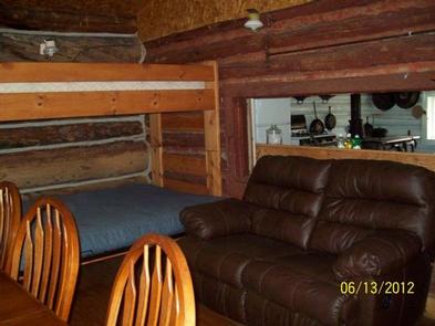
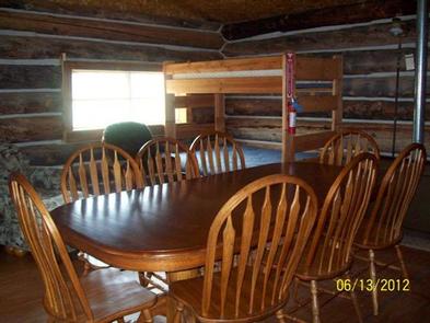
Stone Cellar Guard Station is a log structure furnished with four bunk beds, with twin beds on the top and fold-out full beds on the bottom, accommodating up to 12 people. The cabin has stove, refrigerator and heater, all powered with propane. The living area has a table and chairs, couch and other furniture. The kitchen is equipped with some cooking utensils and some pots and pans. A picnic table, a fire pit and a outdoor vault toilet are also on-site.
There is no electricity at the guard station, however water is available by an outside hand pump. Water is also available at the Saguache Ranger District Office during business hours from May through November.
Although the cabin has some amenities, guests do need to provide their own food, sleeping bags, linens, towels, dish soap, matches, cooking gear, first aid kit, toilet paper and garbage bags.It is recommended that guests bring an additional light source in case of emergencies.
Stone Cellar Campground is located approximately about a half-mile from the guard station.
Natural Features
Situated in an expansive inter-mountain grassland and located close to the Continental Divide, this cabin offers guests seeking solitude and seclusion an opportunity to experience wilderness at its best.
About 35 miles of the Continental Divide lie well above timberline in the La Garita Wilderness, adjacent to the guard station. This area provides ideal habitats for large herds of elk and mule deer, and on the southern slopes lies an ancient forest of towering spruce and fir. It is a landscape of rushing streams, broad and gentle alpine meadows, beaver ponds, long talus slopes and mountain beauty.
Nearby Attractions
Visitors may want to take a day to visit Bonanza, a historical silver mining town that was booming in the 1880s. Today visitors to Bonanza can see old mines, historical buildings and old time mining equipment as they follow the Bonanza Mines Off-Highway Vehicle Tour. Maps for the tour are available at the Saguache Ranger Station.