Rooks Park (WA) Bennington Lake, WA Campground Reservation, Info, Images, Map, Directions

Rooks Park (WA) Bennington Lake, Washington Campground Images, Info & Reservations

Directions

From Walla Walla, take Highway 12 East. Exit at Airport Way and turn right onto Airport Way. Drive .25 miles then turn left onto East Isaacs Ave. Continue onto Mill Creek Rd in .75 miles. Drive .5 miles then turn right onto Rooks Park Rd. Continue .25 miles to park.

Phone

509-527-7160

Activities

BIKING, HIKING, PICNICKING, DAY USE AREA, PLAYGROUND PARK SPECIALIZED SPORT SITE, PHOTOGRAPHY, SWIMMING, MOUNTAIN BIKING, MUSHROOM PICKING

Keywords

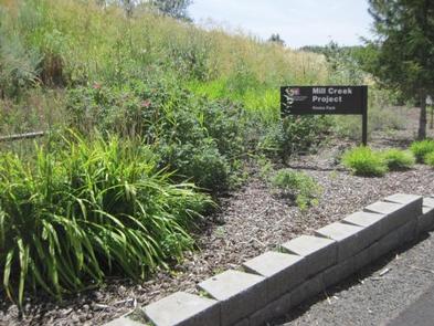
Bennington Lake,Mill Creek Project,Rooks Park,Mill Creek Lake,Mill Creek Trails,Walla Walla,Mill Creek,Mill Creek Dam,. Rook,Rooks

Related Link(s)

Rec Area Info & Images

Washington State Road Conditions

Washington State Tourism

Overview

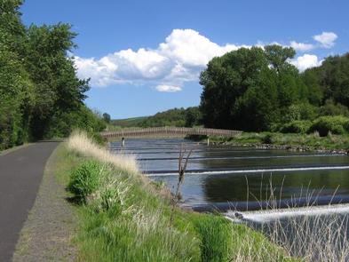
Rooks Park is located 10 minutes east of Walla Walla, Washington. This 18-acre developed park offers visitors a wide variety of recreational opportunities.

Recreation

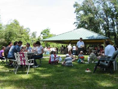
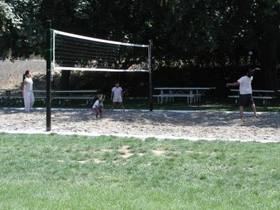
Rooks Park’s grassy spaces provide the ideal place for family picnics and games of volleyball, football or Frisbee. Visitors also enjoy cooling their feet in the creek.

Facilities

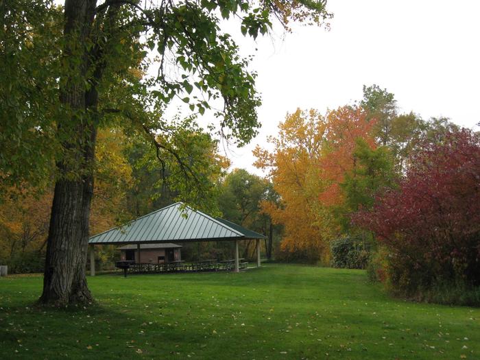
This day-use area is open year-round to foot traffic, and April to mid-October to vehicles. A group picnic shelter is available for reservations and can accommodate up to 75 people.

Amenities include flush toilets, drinking water, a playground, sand volleyball court and horseshoe pit.

Natural Features

The park consists of large open spaces and smaller secluded areas for groups and families alike. Large trees and irrigated lawns offer shade and relief from Walla Walla’s hot summer days.

Nearby Attractions

Bennington Lake is less than 10 minutes from Rooks Park. It is the only public lake in the Walla Walla Valley, covering approximately 52 surface acres. Throughout the spring, the lake is stocked with rainbow trout to enhance angling opportunities.

Reservation

More from CampingHiking.net:

BOCA SPRING, California Campground Images, Info & Reservations

Directions From Reno, take I-80 west to Hirschdale Exit. Go north approximately 3 miles then turn right and go 1 mile to the campground. From Truckee, take I-80 east to Hirschdale exit. Turn left and travel approximately 3 miles then turn right and go 1 mile to the campground. Phone

WYETH CAMPGROUND, Oregon Campground Images, Info & Reservations

Directions From east or west on Oregon Interstate 84, take Wyeth exit #51. Turn west on Herman Creek Road. Wyeth Campground is 1/4 mile west of the interchange. Phone 541-308-1700 Activities BIKING, HIKING, BIRDING Keywords Related Link(s) Rec Area Info & Images Overview Wyeth Campground is just off of Interstate

POTATO PATCH CAMPGROUND, Arizona Campground Images, Info & Reservations

Directions From Prescott, take U.S. Highway 89 north past Granite Dells, turn right on Hwy 89A and travel approximately 20 miles to the top of Mingus Mountain on steep, mountainous grade. Potato Patch Campground entrance will be to your left (across from the Summit Picnic Area) on Forest Road 106.

White Earth Campground, Montana Campground Images, Info & Reservations

Directions Heading north along MT highway 12/287 from Townsend. Drive north to the town of Winston, MT, and turn right onto Beaver Creek Road and follow the road 5.5 miles to the campground. Phone 406-475-3921 Activities BOATING, CAMPING, FISHING, WATER SPORTS, WILDLIFE VIEWING, MOTOR BOAT, KAYAKING Keywords White Earth Shelter,WHITE

STILL CREEK, Oregon Campground Images, Info & Reservations

Directions From Portland, travel east on Highway 26 to Government Camp. Continue 1 mile east of Government Camp. The campground is on the south side of the highway. Phone 503-630-5721 Activities BIKING, HISTORIC & CULTURAL SITE, CAMPING, FISHING, HIKING, WINTER SPORTS, WATER SPORTS Keywords STIC,MT. HOOD NF – FS Related

IRON SPRINGS GROUP ASHLEY, Utah Campground Images, Info & Reservations

Directions From Vernal, Utah: Travel north on U.S. Highway 191 for 20 miles. Turn northwest onto Forest Road 018/Red Cloud Loop and travel approximately 5 miles to the campground. Phone 435-789-1181 Activities BIKING, CAMPING, HIKING Keywords IROG,ASHLEY NF – FS Related Link(s) Rec Area Info & Images Utah State Tourism