WILSON POINT (Day Use), OK Campground Reservation, Info, Images, Map, Directions

WILSON POINT (Day Use), Oklahoma Campground Images, Info & Reservations

Directions

From Sawyer, OK, take Highway 147 north for a mile, then turn left into the day use area.

Phone

580-326-0173

Activities

BOATING, CAMPING, FISHING, HIKING, HUNTING, WILDLIFE VIEWING, SWIMMING SITE

Keywords

None

Related Link(s)

Rec Area Info & Images

Oklahoma State Tourism

Oklahoma State Road Conditions

Overview

Wilson Point Day Use is a large recreational area in a forested expanse of southeast Oklahoma. The park is perched along the banks of Hugo Lake, providing guests with plenty of outdoor activities.

Recreation

There are always fish to be caught at Hugo Lake. From early sand bass and slab crappie to late season fall bass, anglers will always find opportunities. Hugo Lake also provides excellent catfishing during the summer. The lake area offers plenty of hunting opportunities, with over 25,000 acres of land available. Bow hunting is permitted in and around most of the park areas. Kiamichi Park features an archery practice range and a 3,000-acre Quality Deer Management Area. Wildlife around the lake includes waterfowl, bobwhite quail, dove, whitetail deer, mink, fox and beaver.

Facilities

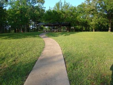
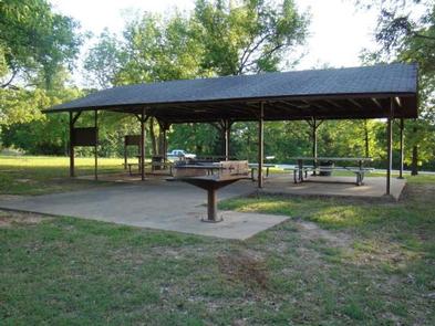
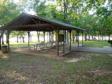
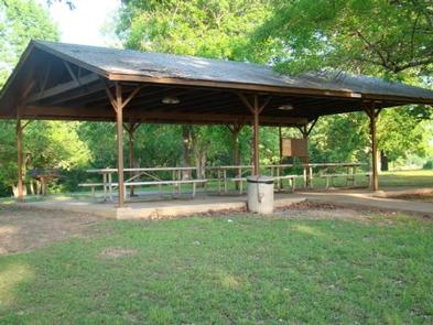
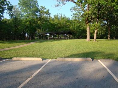
Wilson Point offers a large group picnic shelter, playground, swimming beach, kids fishing pond, and boat ramp. This park is perfect for large parties, youth trips, or family functions.

Natural Features

Hugo Lake Dam is located on the Kiamichi River, 18 river miles upstream from its confluence with the Red River. The dam, completed in 1974, provides flood control, water supply and fish and wildlife management for nearby communities. It also provides a recreational oasis for outdoor enthusiasts of all types.

Nearby Attractions

A number of historical attractions are located near Hugo Lake, including Native American cultural centers, Civil War headquarters, historic churches and schools. Visit the lake website for more information.

Charges & Cancellations

A $10.00 service fee will apply if you change or cancel your reservation. Late cancellations are subject to additional fees. For full details see Recreation1Stops Reservation Policy.

Reservation

More from CampingHiking.net:

TOLLGATE, Oregon Campground Images, Info & Reservations

Directions From Portland, travel southeast on Highway 26 for about 32 miles. Phone 503-630-5721 Activities BIKING, HISTORIC & CULTURAL SITE, CAMPING, FISHING, HIKING Keywords TOLL,MT. HOOD NF – FS Related Link(s) Rec Area Info & Images Forest Service Concessionaire Oregon State Road Conditions Oregon State Tourism Overview Tollgate Campground is

SPRING, Oregon Campground Images, Info & Reservations

Directions From Crescent, Oregon, travel 12.2 miles west on Road 61, then 3.5 miles north on Highway 58, then 8.1 miles west on Road 60 to the campground. Phone 541-323-1746 Activities BIKING, BOATING, CAMPING, FISHING, HIKING, VISITOR CENTER, WATER SPORTS, SWIMMING SITE Keywords None Related Link(s) Rec Area Info &

RACETRACK CABIN, Montana Campground Images, Info & Reservations

Directions Attention: The road to Racetrack Cabin is impassable to 2 wheel drive vehicles, you must have a high cleareance 4×4 vehicle. This is an extremely rough and rutted road. Do not even attempt this drive unless you’re experienced with primitive forest roads. Allow yourself at least 30 minutes to

FUCHS HOUSE, Missouri Campground Images, Info & Reservations

Directions From Poplar Bluff, take Highway 67 north for 14 miles, then drive west on Highway 49 for 9 miles (about 3 miles past the town of Williamsville). Take the first right after crossing the Black River to enter Markham Springs Recreation Area. The drive way to the Fuchs House

JUNIPER SPRINGS REC AREA, Florida Campground Images, Info & Reservations

Directions From I-75, take Highway 40 east through Ocala and Silver Springs for approximately 36 miles to the Juniper Springs Recreation Area. From I-95, take the Ocala/Silver Springs Exit (Highway 40) west for approximately 37 miles to the Juniper Springs Recreation Area. From the intersection of Highway 40 and Highway