
Directions
Take VFW Road off NC 58 approximately 1.25 miles north of the junction of NC 24 and NC 58. Follow signs to the campground on VFW Road.
Phone
252-638-5628
Activities
BOATING, HISTORIC & CULTURAL SITE, CAMPING, FISHING, HIKING, WATER SPORTS, SWIMMING SITE
Keywords
Croatan National Forest
Related Link(s)
North Carolina State Road Conditions
Overview
Cedar Point Campground and Recreation Area is located in eastern North Carolina at the junction of the White Oak River and the Bogue Sound, immediately adjacent to the Swansboro Inlet. It is within 1 mile of full service shopping, and within 2 miles of NC’s Crystal Coast and the barrier island beach community of Bogue Banks.
Recreation
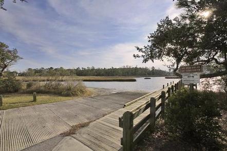
Canoeing and fishing are popular options. Power boating is allowed on the White Oak River.
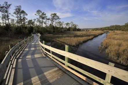
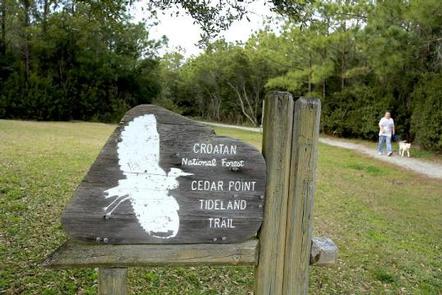
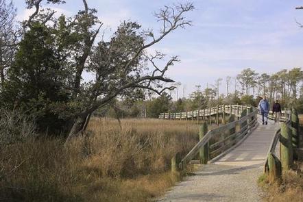
Visitors can hike the Tidelands National Trail, a 1.9-mile path divided in two loops that lend themselves to wildlife viewing. Ospreys and the occasional dolphin can be viewed along the loops.
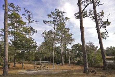
The recreation area is also home to a picnic area and shallow draft boat launch.
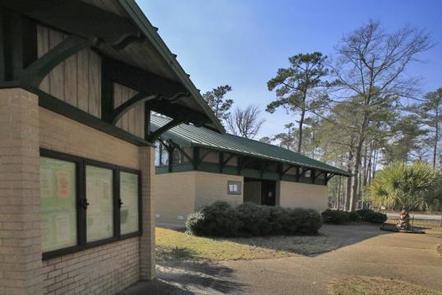
Facilities
The campground has 40 sites with full electrical service. A modern, state-of-the-art bath house is available, with private, hot showers. Accessible flush toilets, drinking water and a dump station are also provided.
Natural Features
Cedar Point, at the mouth of the White Oak River, is bordered by a salt marsh and a coastal forest. The salt marsh, where fresh water meets salt water, stretches out like a sea of grass. This nutrient-rich wetland is a valuable habitat for commercial seafood, including fish, shrimp, crabs and oysters.
The recreation area is part of the Croatan National Forest, a 160,000-acre tract on North Carolina’s coast, bordered on three sides by tidal rivers and Bogue Sound.
Nearby Attractions
The campground is a short drive from the developed barrier island town of Bogue Banks.