HOPEWELL LAKE CAMPGROUND, NM Campground Reservation, Info, Images, Map, Directions

HOPEWELL LAKE CAMPGROUND, New Mexico Campground Images, Info & Reservations

Listen

Directions

From Taos, New Mexico, take U.S. 64 about 40 miles west. The campground is on the south side of the road.

Phone

435-245-6521

Activities

CAMPING, FISHING, HUNTING

Keywords

CARSON NF-FS,Carson National Forest

Related Link(s)

Rec Area Info & Images

New Mexico State Road Conditions

New Mexico State Tourism

Forest Service Concessionaire

Overview

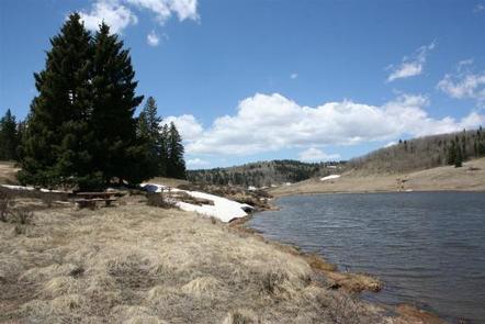
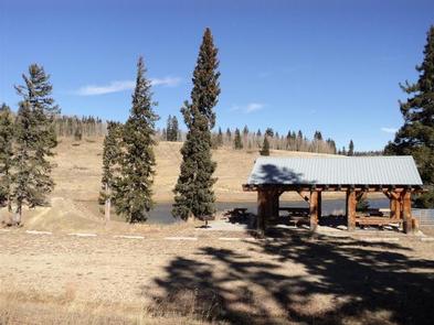
Hopewell Lake Campground sits next to its scenic namesake lake between Tres Piedras and Tierra Amarilla in northern New Mexico. Visitors enjoy horseback riding, hiking, fishing and canoeing.

Recreation

The 14-acre lake is perfect for canoeing and is regularly stocked with rainbow and brook trout. The Contiental Divide National Scenic Trail goes through the campgound, and is popular with horseback riders and hikers.

Facilities

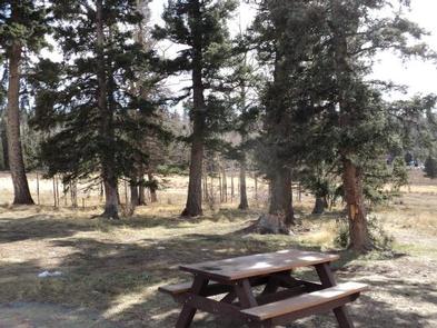
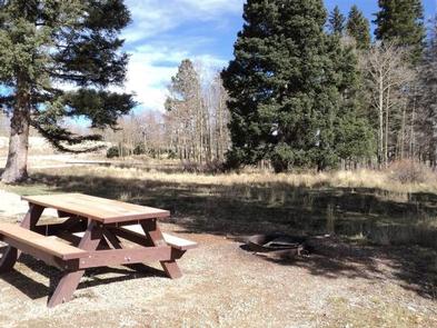
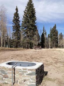
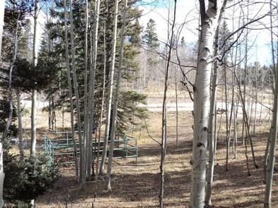
The campground has 31 camping sites. There is also a group day-use shelter and group overnight campsite, both available by reservation. Horse corrals and water troughs are available at two campsites. Vault toilets and drinking water are provided. First-come, first-served sites are available.

Natural Features

Hopewell Lake is a small, man-made lake, set high in the Carson National Forest at an elevation of 9,500 feet. A forest of conifer and aspen trees covers the area and offers partial shade in the campground.

Reservation

More from CampingHiking.net:

COLUMBINE CAMPGROUND, Colorado Campground Images, Info & Reservations

Listen Directions From I25 in Denver, take 6th Ave West to state Highway 6, through clear Creek Canyon. Proceed north on State Highway 119, turn left on Gilpin County Road 279 (Gregory St. next to Bullwackers Casino) in Black Hawk, follow signs to Central City. Gregory St. changes to Lawrence

WAR EAGLE CAMPGROUND, Arkansas Campground Images, Info & Reservations

Listen Directions Take Highway 412 East from Springdale and for about 8 miles. Turn left on Nob Hill Loop, then continue onto County Rd 95/War Eagle Blacktop Rd and travel about 3 miles. Turn left onto War Eagle Park Road, which is the entrance of the Park. Phone 479-750-4722 Activities

SILVER LAKE EAST- ELDORADO, California Campground Images, Info & Reservations

Listen Directions From Pioneer, CA, take State Route 88 east 36.6 miles to campground on right. Phone 209-258-2287 Activities CAMPING, FISHING, HIKING, SWIMMING SITE Keywords SILE,SILVER LAKE EAST ELDORADO,ELDORADO NF – FS Related Link(s) Rec Area Info & Images California State Tourism California State Road Conditions Forest Service Concessionaire Overview