

Directions
From Morehead City, NC, take Highway 70 east approximately 22 miles, and you will arrive in Davis. Cape Lookout Cabin Camps and Ferry Service is located at 125 Grady Davis Lane and Davis Shore Ferry is located at 148 Willis Road.
Phone
252-728-2250 HARKERS ISLAND VISITOR CENTER OR (252)725-0256 GREAT ISLAND CABIN CAMP OFFICE
Activities
BOATING, HISTORIC & CULTURAL SITE, CAMPING, FISHING, HIKING, HUNTING, WATER SPORTS, FIRE LOOKOUTS/CABINS OVERNIGHT, PADDLING, SWIMMING, KAYAKING, BEACH CAMPING, BEACHCOMBING, CLAM DIGGING, CRABBING, SEA KAYAKING, STAR GAZING, SURFING
Keywords
Willis Fish Camps,Davis Island,Cape Lookout National Seashore
Related Link(s)
North Carolina State Road Conditions
Overview
Great Island Cabin Camp is located on South Core Banks within beautiful Cape Lookout National Seashore just off the mainland of North Carolina. The historic camp has been a favorite of fisherman and beach goers for many years. The camp can only be reached by boat, adding an element of both privacy and adventure. Visitors can travel by personal boats or reserve a spot on the vehicle ferry, which cruises across scenic Core Sound to South Core Banks and the Great Island Cabin Camp.
Recreation
The park’s sandy beaches are a prime location for fishing, exploring, beachcombing/shelling, swimming, birding or simply relaxing. Spring and fall at Cape Lookout offer what many consider to be some of the best fishing on the Atlantic Coast. Kayaking is a popular activity at the park. With 112 miles of uninhabited shoreline ranging from docile sound to pounding surf, Cape Lookout National Seashore has become one of the premier paddling destinations on the Mid-Atlantic Coast.
Facilities
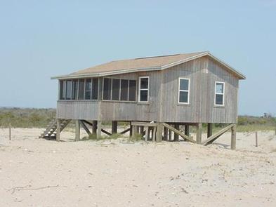
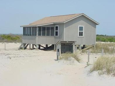
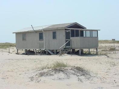
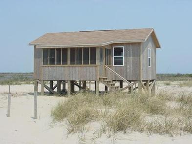
Great Island Cabin Camp offers 23 rustic, wooden beachfront cabins with porches for individuals and families or small groups of up to 12 people. Cabins range in size from 288 to 960 sq ft., and Cabin 2 is accessible. All cabins are wired for generator use, needed to power electricity. Guests must provide their own generators, no larger than 5,500 watts or equipped with a GFI.
Each cabin contains bunk beds and mattresses, a private bath with sink and shower stall, a hot water heater, a table and chairs. Small kitchens are equipped with cabinets and a propane oven/stove. There are no refrigerators. A grill is just outside each cabin. Bathroom facilities with showers are also centrally located within the camp.
Campers must provide their own linens, bedding, cookware, food and food storage, coolers, first-aid supplies and anything else needed during their stay. Most campers also bring flashlights or lanterns. Ice and fuel are available at the camp office.
Natural Features
Cape Lookout National Seashore is a low, narrow ribbon of sand running from Ocracoke Inlet to Beaufort Inlet. At 56 miles long, these barrier islands consist mainly of bare beaches with low dunes covered by scattered grasses, flat grasslands bordered by dense vegetation and large expanses of salt marsh along the sound.
Nearby Attractions
Cape Lookout Lighthouse, historic Cape Village
Charges & Cancellations
Please note: Customers who cancel a cabin reservation less than 14 days prior to the arrival date will pay a $10.00 service fee AND forfeit the first night’s use fee. Refunds resulting from storm closures will be handled on a case-by-case basis.