CHERRY HILL CAMPGROUND, SC Campground Reservation, Info, Images, Map, Directions

CHERRY HILL CAMPGROUND, South Carolina Campground Images, Info & Reservations

Directions

From Walhalla, go north 8 miles on State Highway 28. Turn right on Highway 107. Continue on Highway 107 for 9 miles. A sign for Cherry Hill Campground is on the right.
From Cashiers, NC, go south on Highway 107 for 9 miles. The sign for Cherry Hil will be on the left.

Phone

864-638-9568

Activities

CAMPING, FISHING, WILDLIFE VIEWING, FISH HATCHERY

Keywords

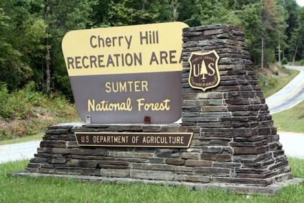
FRANCIS MARION-SUMTER NF – FS

Related Link(s)

Rec Area Info & Images

South Carolina State Road Conditions

South Carolina State Tourism

Overview

Open April 1 – October 31.

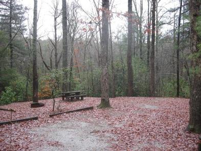
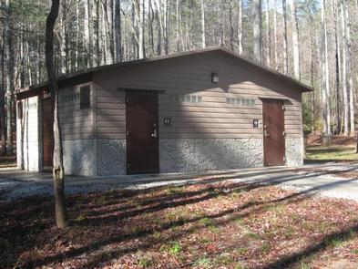
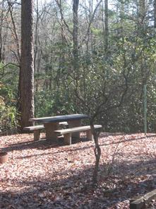
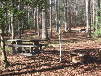
Cherry Hill is near the Chattooga Wild and Scenic River, and many miles of hiking trails. Site amenities include centrally-located drinking water, cooking grills, tables and lantern posts as well as a restroom with flush toilets and hot showers.

When you make a reservation, post one of the following on the clip provided at your site: a) Your confirmation letter. b) Your reservation number. c) The name of the person that the site is reserved for.

Reservation

More from CampingHiking.net:

BROOKEN COVE, Oklahoma Campground Images, Info & Reservations

Directions From Enterprise, Oklahoma, take Highway 71 north for 5 miles and follow signs to the campground. Phone 918-799-5843 Activities BOATING, CAMPING, FISHING, HIKING, SWIMMING SITE Keywords BRCO,EUFAULA LAKE,EUFAULA LAKE Related Link(s) Rec Area Info & Images Oklahoma State Tourism Oklahoma State Road Conditions Overview Brooken Cove Campground sits along

CURRIER GUARD STATION, Oregon Campground Images, Info & Reservations

Directions From Paisley Ranger District, drive 12 miles north on Highway 31 and turn left on Forest Road 29, also referred to as Government Harvey Pass. Drive 10 miles on Forest Road 29. Drive carefully on this road as it has narrow curves and washboard conditions. At the junction with

SALTHOUSE BRANCH, Virginia Campground Images, Info & Reservations

Directions From US 220, turn onto Henry Road (SR-605), go 6 miles; turn left onto Knob Church Road and go 2 miles. Turn left onto Salthouse Branch Road and follow signs to the entrance. GPS Users: Do not use SR-727 (Stoney Brook Lane) or SR-894 (Johnson Hill Road). Phone (540)

TAYLOR, Texas Campground Images, Info & Reservations

Directions From Interstate Highway 35 take Hwy 79 east to Hwy 95. Go north on Hwy 95 to FM 1331; go east on FM 1331 for approximately 5 miles to the entrance on the left. Phone 512-859-2668 Activities BIKING, CAMPING, FISHING, HIKING, WATER SPORTS, WILDLIFE VIEWING, SWIMMING SITE Keywords TAYL,GRANGER