
Directions
From Red Bluff I-5, drive east on State Highway 36 approximately 70 miles to Chester. Turn left at the fire station immediately after crossing Feather River Bridge (watch for National Park Service sign on right) and continue approximately 13 miles following signs to Juniper Lake. The Juniper Lake Stock Corral is located directly behind the Juniper Lake Ranger Station. Turn left towards the Juniper Lake Campground, after passing the ranger station, and make an immediate left into the stock corral area and campsite.
Phone
530-595-6121
Activities
BOATING, CAMPING, HIKING, VISITOR CENTER, FIRE LOOKOUTS/CABINS OVERNIGHT, SWIMMING SITE
Keywords
Lassen Volcanic National Park
Related Link(s)
California State Road Conditions
Overview
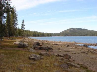
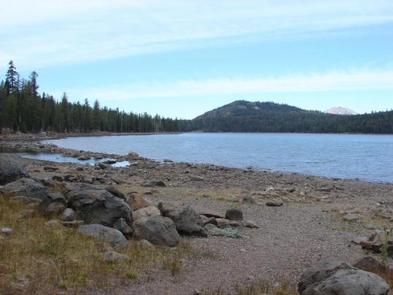
Juniper Lake Stock Corral (elevation 6,800 ft.) is a remote and rustic facility in the southeastern part of Lassen Volcanic National Park in northern California. It is located within walking distance of Juniper Lake, which is popular for fishing, canoeing, kayaking and swimming. Several trails are located nearby. The facility is over one hour from the main park road.
Recreation
The main trailheads for Horseshoe Lake, Snag Lake, and access to the interior of the park are within the facility. The Mount Harkness Trail ascends to a historic fire tower that is still in use. Longer trails will take you to Butte Lake and Summit Lake. The Pacific Crest Trail can also be accessed from Juniper Lake and runs through the park.
Facilities
The stock corral area has two adjacent metal corrals with water troughs. A vault toilet is located next to the facility for the use of those reserving the corral. This facility is remote and accessed on seven miles of a rough gravel road and six miles of roughly paved road. Drinking water is not available.
Natural Features
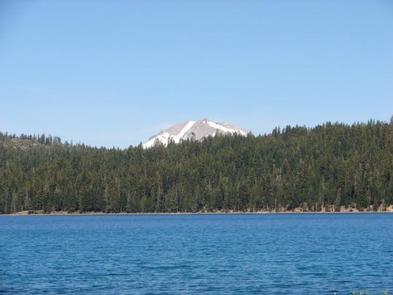
The national park is known for its volcanic history, as well as its diversity of plants and animals. It contains 300 active volcanic domes and many hydrothermal features, such as mud pots and steam vents. Lassen Peak is the southernmost active volcano in the Cascades, and the second most recent volcano to erupt in the lower 48 of the United States before Mount Saint Helens.
Lassen Volcanic National Park boasts over 700 species of flowering plants and 250 species of vertebrates, including birds, mammals, reptiles and fish. The park is at the junction of the Cascade Mountains, the Sierra Nevada Mountains and the Great Basin, thus providing many unique habitats.
Nearby Attractions
The Caribou Wilderness area is managed by the Forest Service and has numerous trails that are suitable for stock use and can be accessed directly from the park via the Widow Lake trail.