

Directions
From I- 81 North, take Exit 175 just south of Natural Bridge. Go north on U.S. Highway 11. Turn right at the Natural Bridge parking lot onto Route 130 East. Continue for approximately 4 miles to Natural Bridge Station. Turn right onto State Route 759 and continue for about 3 miles, then turn right again onto State Route 781. Turn left into the recreation area, then bear left at the Y intersection and continue into the campground. From I-81 South, take exit 180 (left exit) and continue south to Natural Bridge. Turn left onto Route 130 East and continue following the above directions.
Phone
540-291-2188
Activities
CAMPING, FISHING, HIKING, WILDLIFE VIEWING, DAY USE AREA, SWIMMING SITE
Keywords
Cave Mountain Lake,CAVE MOUNTAIN LAKE FAMILY CAMP (VA)
Related Link(s)
Virginia State Road Conditions
Overview
Cave Mountain Lake Family Camp is nestled in the Blue Ridge Mountains of Virginia, and welcomes visitors to enjoy the rustic and peaceful getaway. Easy access from the interstate and close proximity to historic Lexington and the Natural Bridge State Park make Cave Mountain Lake an ideal destination.
Recreation
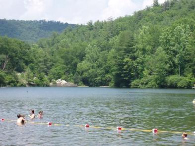
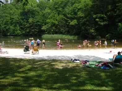
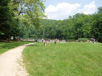
The 7 acre lake offers opportunities for swimming in a designated area which includes a sand beach. Fishing for youth only (ages 15 and under) is open from April 1st through June 15th, then fishing is open to anglers of all ages with a valid Virginia fishing license, trout stamp and National Forest stamp for the remainder of the season. There are several piers around the lake for better fishing access. A number of opportunities for photography, birding, and wildlife viewing are available along the trails and water’s edge. Hiking trails surround the area, offering everything from a short walk around the lake to an all-day hike along the nearby ridges. The Panther Knob Trail starts beside the group picnic shelter and skirts the edge of the lake to the dam. The Wildcat Trail starts above campsites #41-42, climbs the mountain, then loops back to the campground above the volunteer host site in the upper camping loop. Visitors may also enjoy a day hike or backpacking trip on the Appalachian National Scenic Trail, in the James River Face Wilderness, or in the Thunder Ridge Wilderness.
Facilities
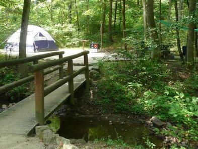
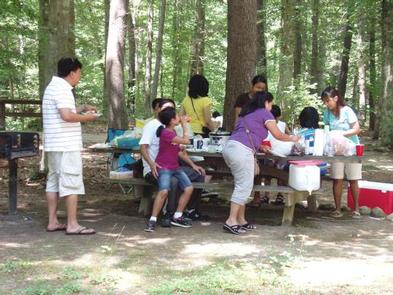
Cave Mountain Lake offers 28 reservable campsites and 13 campsites remain first-come, first-serve only. Amenities at each campsite include a picnic table, lantern post and campfire ring with grill. Flush toilets and water spigots are located throughout the campground. There is a bathhouse with warm water showers located across the road from Campsite #20. Each campsite can accommodate up to 8 people per site. Campsite #41-42 is considered a double campsite with space to accommodate up to 12 people.
Natural Features
Cave Mountain Lake covers seven acres and was built in the late 1930’s by the Civilian Conservation Corps, using existing buttresses of natural rock to form a 35-foot dam. A grassy field extends from the lake’s sandy beach to forested hills that paint a scenic backdrop.
Nearby Attractions
Lexington, Virginia, just 20 minutes away, is home to several historic sites including the Stonewall Jackson House, George C. Marshall Museum and the Virginia Military Institute Museum. It’s a charming town with horse drawn carriage rides through the streets. Ice and other sundries can be found at small stores along State Route 759 as you drive to Cave Mountain Lake Recreation Area. Natural Bridge State Park is a short 8 mile drive away and offers visitors views of the 215 foot tall Natural Bridge and limestone gorge, 6 miles of hiking trails, a Monacan Indian Village, and the 30 foot cascade of Lace Falls.