
Directions
Eastman Lake is 30 miles northeast of Madera, 25 miles east of Chowchilla, and 50 miles north of Fresno. From Highway 99, travel east on Avenue 26 then north on Rd 29. Follow signs into the campground.
Phone
559-689-3255
Activities
BIKING, BOATING, CAMPING, INTERPRETIVE PROGRAMS, FISHING, HIKING, HUNTING, DAY USE AREA, SWIMMING SITE
Keywords
CODO,BUCHANAN DAM,EASTMAN LAKE,EASTMAN LAKE,Codorniz Campground,Wildcat Campground,Equestrian Campground,Lake Veiw Trail,Chowchilla Recreation Area,Chowchilla Day Use Area,Chowchilla Boat Ramp,Codorniz Boat Ramp,campground
Related Link(s)
California State Road Conditions
Overview
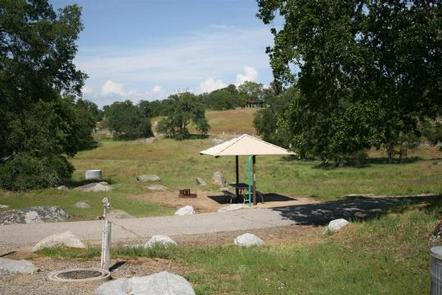
Codorniz Campground on Eastman Lake is a perfect launchpad for activities like canoeing, birding and hiking. Tucked in the Sierra Nevada foothills, the area attracts abundant wildlife like bobcats, golden eagles, mountain lions, hawks and wood ducks.
Recreation
Eastman Lake is the first designated Trophy Bass Fishery, by the California Department of Fish and Wildlife. Both young and old anglers will find fishing on Eastman lake a satisfying challenge. At the campground, visitors can try their hand at disc golf or challenge a group of friends to a game of volleyball. Horseshoe pits are also available for a little friendly competition.
Facilities
A mix of electric and non-electric campsites are available. Fish cleaning stations are near each boat ramp, and showers are on hand as well. Wireless internet is provided from the campground office and horse camping corrals are available.
Natural Features
The rolling hills around Eastman Lake are surrounded by tall grasses and scattered oak trees, giving way to stunning mountain views.
The lake features 1,780 surface acres, fed by the cool waters of the Chowchilla River.
Nearby Attractions
The Sierra National Forest is a short drive to the east of the campground.