BOAT-IN SITES (LAKE SONOMA), CA Campground Reservation, Info, Images, Map, Directions

BOAT-IN SITES (LAKE SONOMA), California Campground Images, Info & Reservations

Directions

Take Highway 101 north of San Francisco to the town of Healdsburg and exit on Dry Creek Road. Travel west 11 miles to reach the visitor center on the right. The public boat ramp is 1.5 miles further up the road.

Phone

707-431-4533

Activities

BOATING, CAMPING, FISHING, HIKING, WATER SPORTS, SWIMMING SITE

Keywords

BOIS,LAKE SONOMA,BOAT IN,BOAT,BOAT IN SITES,Lake Sonoma,LAKE SONOMA,Sonoma Lake,Warm Springs,Dry Creek,Quick,Quick Silver,quicksilver

Related Link(s)

Rec Area Info & Images

California State Tourism

California State Road Conditions

Overview

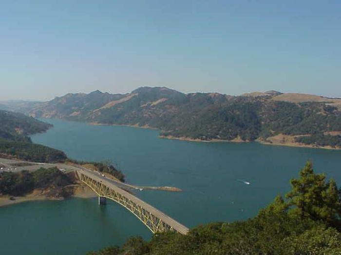
Lake Sonoma’s Boat-In Sites are scattered around beautiful Lake Sonoma, only a 45-minute drive north of Santa Rosa and a two-hour drive from San Francisco.

World famous vineyards and a land rich in history surround the lake, where visitors enjoy boating, fishing and exploring the area’s extensive trail network.

Recreation

The lake provides great boating and swimming opportunities. Anglers fish for large and smallmouth bass, catfish and sunfish. A small native population of rainbow trout exists in the waters as well.

Hikers, mountain bikers and horseback riders enjoy exploring several miles of trails that meander along the shoreline.

Facilities

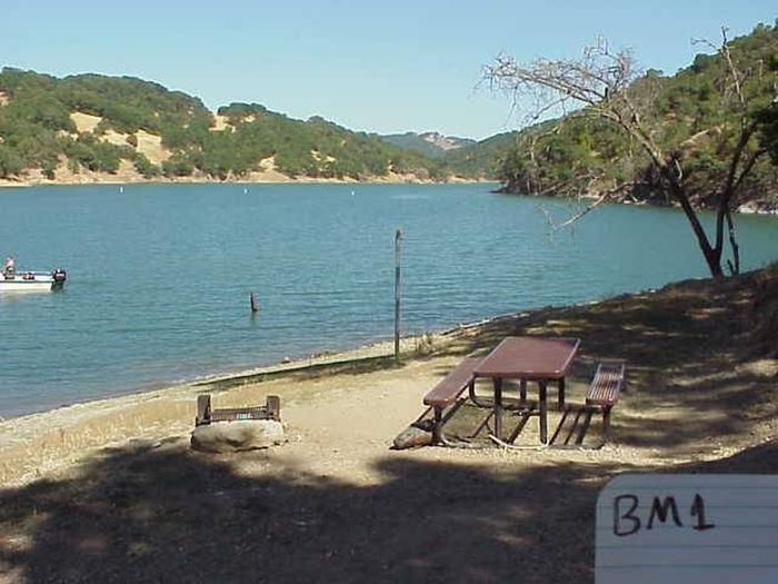
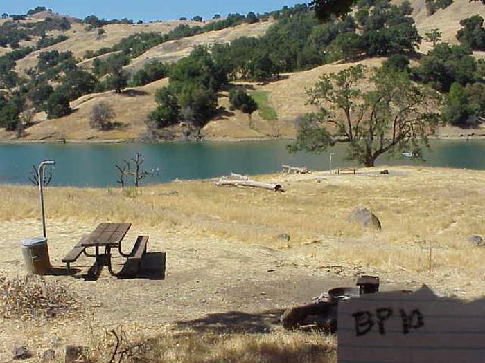
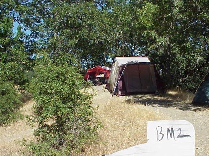
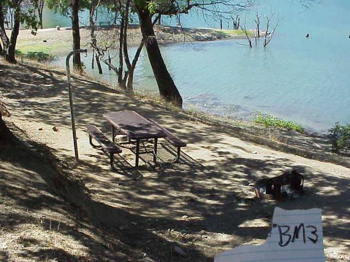
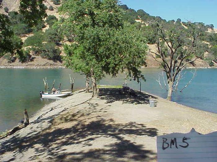
The lake boasts nearly 100 boat-in campsites. Some sites lie close to the lake’s ski zones while others are in more secluded regions perfect for fishing or swimming.

Boaters who wish to camp/sleep on their boats may anchor anywhere within the park, but boats must be equipped with anchor lights. If boaters wish to tie up to the shore, they must be at one of the designated campgrounds.

Natural Features

Lake Sonoma is nestled in the beautiful coastal foothills of Sonoma County, California. The area typically has cool, foggy, wet winters and hot, dry summers. Temperatures average in the upper 90s during the summer with short periods of higher heat.

Reservation

More from CampingHiking.net:

FORT SPOKANE, Washington Campground Images, Info & Reservations

Directions Take State Highway 2 west of Spokane for 32 miles. Turn north on State Highway 25 at the town of Davenport and travel 24 miles. Follow the signs to the campground. Phone 509-754-7889 Activities BIKING, BOATING, HISTORIC & CULTURAL SITE, CAMPING, INTERPRETIVE PROGRAMS, FISHING, HIKING, PICNICKING, VISITOR CENTER, WATER

SWAN LAKE CAMPGROUND, Montana Campground Images, Info & Reservations

Directions From Bigfork, Montana, take State Route 209 east for 4.9 miles to Swan Lake/State Route 83. Turn right and go 10.9 miles to the campground sign. Turn left at the sign into the campground. Phone 406-752-7924 FOR RESERVATIONS CALL: 1-877-444-6777 Activities BIKING, BOATING, CAMPING, FISHING, HIKING, WATER SPORTS, WILDLIFE

NORTH OVERLOOK PARK (KS), Kansas Campground Images, Info & Reservations

Directions Take I-70 to exit 295, then 4.5 miles north to Hwy. 57, then east approximately 3.2 miles to park entrance. Phone 785-238-5714 Activities CAMPING, WILDLIFE VIEWING, SWIMMING SITE Keywords Related Link(s) Rec Area Info & Images Kansas State Tourism Kansas State Road Conditions Overview North Overlook Park is a

COLD SPRINGS, Colorado Campground Images, Info & Reservations

Directions From Interstate 25 in Denver, go west on 6th Avenue to State Highway 6, through Clear Creek Canyon. Turn onto State Highway 119, heading toward Black Hawk and Central City. Follow the highway approx. 5 miles north of Black Hawk, to the campground. Phone 801-226-3564 Activities BIKING, CAMPING, FISHING,

COTTONSHED PARK (AR), Arkansas Campground Images, Info & Reservations

Directions Approximately 5 miles south of Mineral Springs on Highway 355, turn right / west onto Bright Star Road travel approximately 3 miles, turn left / south onto Cottonshed Lane. OR North on Hwy 355 approximately 5 miles, turn left / west onto Bright Star Road travel approximately 3 miles,