CHARBONNEAU PK, WA Campground Reservation, Info, Images, Map, Directions

CHARBONNEAU PK, Washington Campground Images, Info & Reservations

Directions

From Pasco, Washington, take Highway 12 east. After crossing the Snake River Bridge, take the first exit and proceed to Highway 124. Continue east through Burbank, Washington. Turn north on Sun Harbor Drive and follow for 1.5 miles, then take a left on Charbonneau Road. Campground is on the right.

Phone

509-547-2048

Activities

BOATING, CAMPING, FISHING, DAY USE AREA, SWIMMING SITE

Keywords

CHARB,ICE HARBOR,LAKE SACAJAWEA,ICE HARBOR LOCK & DAM

Related Link(s)

Rec Area Info & Images

Washington State Road Conditions

Washington State Tourism

Overview

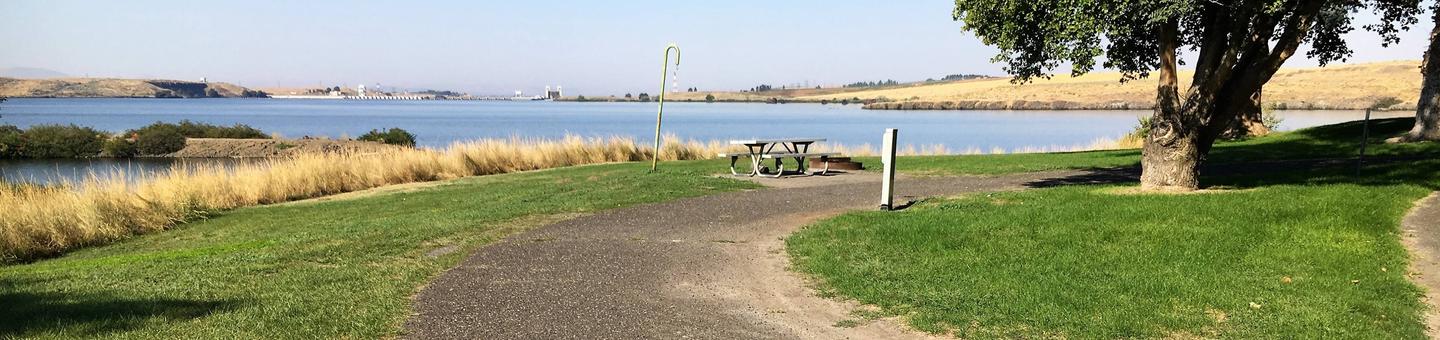
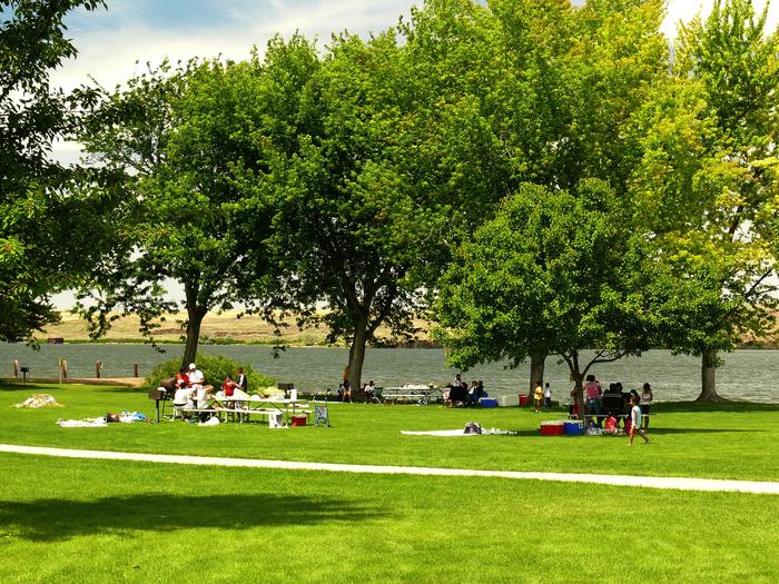
Charbonneau Park in Eastern Washington was named one of America’s Top 100 Family Campgrounds. It is located on Lake Sacajawea, formed by Ice Harbor Lock and Dam on the Lower Snake River. The park was named for Toussaint Charbonneau, an interpreter for Lewis and Clark and husband of Sacajawea, the famous Shoshone interpreter on the Corps of Discovery. The park provides excellent recreational opportunities for boaters, campers, upland and waterfowl hunters and anglers.

Recreation

The lake provides great boating and swimming opportunities, and a boat ramp is provided for guests. Fishing is also a popular pastime, and anglers will find excellent salmon and steelhead fishing on the lake.

Facilities

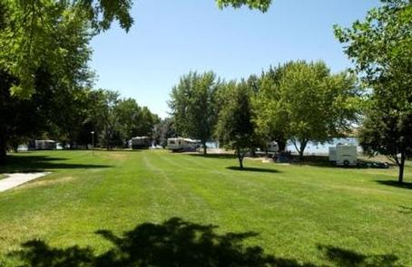
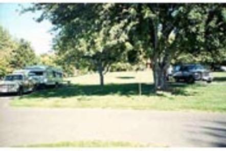
The park offers 52 family sites and two day-use group picnic shelters, all with electric hookups.

Natural Features

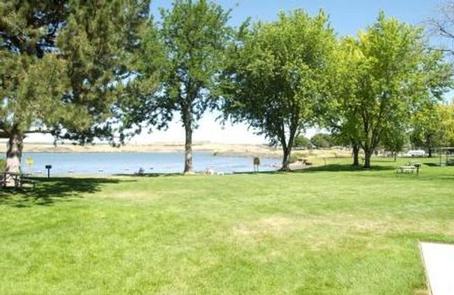
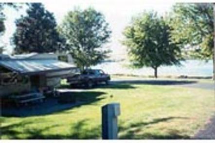
The campground is situated on the banks of Lake Sacajawea, and several of its waterfront sites have scenic views of the lake. The park is characterized by its open grassy areas dotted with a few large shade trees.

Reservation

More from CampingHiking.net:

MOUNTAIN PARK, Colorado Campground Images, Info & Reservations

Directions From Fort Collins, travel west on Colorado Highway 14, to Ted’s Place, and continue up the Poudre Canyon to mile marker 98.8. Phone 970-295-6700 Activities BIKING, BOATING, CAMPING, FISHING, HIKING, WATER SPORTS, WILDLIFE VIEWING, BIRDING, RAFTING, WHITEWATER RAFTING Keywords MOUT,POUDRE RIVER,CACHE LA POUDRE RIVER,ARAPAHO AND ROOSEVELT NF – FS

NORTH MILLS RIVER, North Carolina Campground Images, Info & Reservations

Directions From Asheville, take U.S. Highway 280 west to North Mills River Road. Follow North Mills River Road to the campground. Phone (828) 552-8040 Activities CAMPING, INTERPRETIVE PROGRAMS, FISHING, HIKING, WATER SPORTS, SWIMMING SITE Keywords NOMR,NFs IN NORTH CAROLINA – FS Related Link(s) Rec Area Info & Images North Carolina

ROSE CANYON, Arizona Campground Images, Info & Reservations

Directions From Tucson, Arizona, take Catalina Highway/Arizona Route 39 northeast. The campground is located between mile markers 17 and 18 on the Catalina Highway. Phone 520-576-1477 Activities CAMPING, FISHING, DAY USE AREA Keywords ROSE,ROSE CANYON REC AREA,ROSE CANYON LAKE,ROSE PARK,ROSE CANYON PARK,CORONADO NF – FS Related Link(s) Rec Area Info

COSBY PICNIC PAVILION, Tennessee Campground Images, Info & Reservations

Directions Seasonal phone is 423-487-2683 From Cosby, TN, proceed south on TN 32 about 1.5 miles from junction with US 321. Turn right at Cosby sign. Group camp is another 2.2 miles. Phone 423-487-2683 Activities HISTORIC & CULTURAL SITE, CAMPING, FISHING, HIKING, HORSEBACK RIDING, VISITOR CENTER, WILDLIFE VIEWING, DAY USE

HORSE CREEK, California Campground Images, Info & Reservations

Directions From Visalia, CA, take HWY 198 for 20 miles east. Follow signs to Horse Creek Campground. Phone 559-597-2301 Activities BIKING, BOATING, CAMPING, FISHING, HIKING, HORSEBACK RIDING, VISITOR CENTER, DAY USE AREA, INFORMATION SITE, PHOTOGRAPHY, SWIMMING, BIRDING Keywords HCRE,LAKE KAWEAH CAMPGROUND,KAWEAH LAKE CAMPGROUND,KAWEAH CAMPGROUND,HORSE CREEK Lake Kaweah,LAKE KAWEAH Related Link(s)