CLARKS FERRY, IA Campground Reservation, Info, Images, Map, Directions

CLARKS FERRY, Iowa Campground Images, Info & Reservations

Directions

From Davenport, Iowa, drive west on Hwy 22 about 15 miles and turn at Clark’s Ferry Sign (in Montpelier)

Phone

563-419-7594

Activities

BOATING, CAMPING, FISHING, DAY USE AREA, BIRDING

Keywords

CLAR,MISSISSIPPI RV. RI

Related Link(s)

Rec Area Info & Images

Iowa State Road Conditions

Iowa State Tourism

Overview

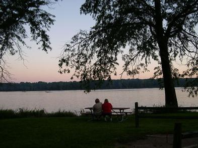
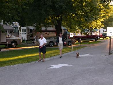
Clarks Ferry is a outdoor lovers delight, with fantastic bird watching and lots of shore fishing opportunities with our new accessible fishing dock! The park has plenty of trees to lounge under while taking in the spectacular views of the mighty Mississippi River.

Recreation

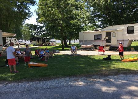
Take the kids to one of the two playgrounds, play a game of horseshoes, volleyball, or go boating. The Mississippi River draws crowds of anglers for channel catfish, bluegill, walleye, crappie and northern pike.

Facilities

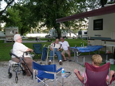
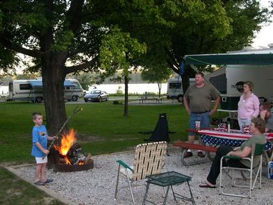
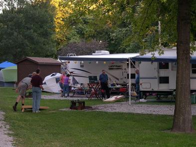
Picnic tables, campfire rings, and 50-amp electric hookups are provided at every campsite. A boat ramp, dump station, and picnic shelter are also onsite.

Natural Features

The park is surrounded by large mature trees along the Iowa side of the Upper Mississippi River. The Upper Mississippi is the section of the river that starts in the headwaters of Lake Itasca, Minnesota and flows 1,250 miles to Cairo, Illinois, where it joins with the Ohio River.

Nearby Attractions

Clarks Ferry is near the Shady Creek Recreation Area and the Wildcat Den State Park.

Reservation

More from CampingHiking.net:

BURNS RUN WEST, Oklahoma Campground Images, Info & Reservations

Directions From Highway 75 in Denison, Texas, take Exit 72 to Highway 91, travel north on 91 across Denison Dam, 5 miles. Take the second left, follow signs for about 1.5 miles. Physical address: 825 West Burns Run Road, Cartwright, OK 74731 Phone 580-965-4922 Activities CAMPING, SWIMMING SITE Keywords BURW,TEXOMA

McGillivray Campground (Group Site), Montana Campground Images, Info & Reservations

Directions From Libby, travel 15 miles northeast on State Highway 37. Turn west on Forest Development Road 228 and continue for about 10 miles to the site. Phone 406-293-7773 Activities BIKING, BOATING, CAMPING, FISHING, WATER SPORTS, WILDLIFE VIEWING, SWIMMING SITE Keywords MCGL,MCGILLIVRAY,McGillivray Campground (Group Site),KOOTENAI NF – FS Related Link(s)

BOULDER GULCH, California Campground Images, Info & Reservations

Directions From Highway 99 in Bakersfield, California, take Highway 178 east to the town of Lake Isabella. Take Highway 155 around the west side of Lake Isabella for 4 miles to the campground entrance. Phone 760-376-1815 Activities CAMPING, HIKING Keywords BOGU,LAKE ISSABELLA,KERN VALLEY,SEQUOIA NF – FS Related Link(s) Rec Area

ANTELOPE FLAT, Utah Campground Images, Info & Reservations

Directions From Vernal, Utah, take U.S. 191 north for 54 miles to Dutch John. Continue north for 8 miles, then turn west onto Forest Road 145 and travel 4 miles to the campground. From Manila, Utah, take Highway 44 for 28 miles. Turn left on U.S. 191 and go north

ARROYO SECO, California Campground Images, Info & Reservations

Directions Coming from the south on Highway 101 to Greenfield, take the first exit (Arroyo Seco) into town. Turn left on Elm Street and go west to Arroyo Seco Road and turn left. Arroyo Seco Road dead-ends at the campground. Coming from the north on Highway 101, just past Soledad,

PICNIC POINT (ID), Idaho Campground Images, Info & Reservations

Directions From Cascade, turn east on Warm Lake Highway. Travel approximately 26 miles along the paved road to Forest Road 489 and turn south. Continue about a half-mile past the Shoreline Campground and North Shore Lodge. The campground will be located just past the lodge, on the left side of