KYEN CAMPGROUND AND OAK GROVE DAY USE AREA, CA Campground Reservation, Info, Images, Map, Directions

KYEN CAMPGROUND AND OAK GROVE DAY USE AREA, California Campground Images, Info & Reservations

Listen

Directions

From San Francisco, travel north on Highway 101 for 5 miles past Ukiah. Turn east onto Highway 20, then turn right on Marina Drive. Continue past the north boat ramp to the campground entrance.

Phone

707-467-4200

Activities

BIKING, BOATING, CAMPING, FISHING, HIKING, HUNTING, DAY USE AREA, SWIMMING SITE

Keywords

KYEN,LAKE MENDOCINO,WATER FRONT SITES,KYEN CAMPGROUND DAY USE AREA,LAKE MENDOCINO

Related Link(s)

Rec Area Info & Images

California State Road Conditions

California State Tourism

Overview

Kyen Campground is currently outgranted to FEMA for a housing mission and closed to the public. Kyen Campground and Day-Use Area is situated on Lake Mendocino in California’s Mendocino Range, where redwood forests meet wine country. The lake is formed by the Coyote Dam on the Russian River. A wide variety of recreational opportunities is available, including boating, swimming, water skiing, fishing, hiking and horseback riding.

Recreation

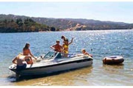
The 1,822-acre lake provides abundant boating, swimming and water skiing opportunities. Anglers will find sunfish, smallmouth bass, striped bass, crappie, white and channel catfish, bluegill and perch.

Several miles of trails wind around Lake Mendocino, including the 3-mile Shakota Trail, which begins at the Pomo Cultural Center within the campground and offers beautiful views of the lake.

Facilities

Kyen Campground offers 93 family sites within walking distance of the lake. The day-use area has four group picnic shelters, two of which have electric hookups. Several family picnic shelters with tables and grills are available on a first come, first served basis.

Amenities include flush and vault toilets, showers, drinking water, a dump station and boat ramp.

The Pomo Cultural Center is operated by the Coyote Valley Band of Pomo and the U.S. Army Corps of Engineers. The center is modeled after a traditional Pomo roundhouse and offers displays about Pomo hunting, dancing and basketry, as well as local fish, wildlife and plants.

Natural Features

Lake Mendocino lies in the scenic rolling hills of Coyote Valley. Groves of oak mixed with manzanita and pines forest the area, offering limited shade and an excellent bird and wildlife habitat.

Nearby Attractions

The charming city of Ukiah, less than 15 minutes away, offers a variety of shopping and dining opportunities, museums and golf courses. The Ukiah Farmer’s Market runs Saturday mornings and Tuesday evenings throughout the summer, offering fresh produce, local wines, arts and crafts and live music.

Reservation

More from CampingHiking.net:

WAPITI CABIN, Montana Campground Images, Info & Reservations

Listen Directions Summer access (May 16 to December 1): For summer access from West Yellowstone, proceed north on Highway 191 for approximately 33.5 miles. Turn left on Taylor Fork Road/Forest Service Road 134 and proceed approximately 3.5 miles. Turn left on Forest Service Road 2522 and proceed approximately 1.5 miles.

BOYKIN SPRINGS RECREATION AREA, Texas Campground Images, Info & Reservations

Listen Directions From Zavalla, Texas, travel east on Highway 63 for approximately 10.5 miles. Turn right on Forest Road 313 and proceed 2.5 miles to the campground. Phone 936-897-1068 Activities BIKING, CAMPING, FISHING, HIKING, WILDLIFE VIEWING, NON-MOTORIZED BOATING Keywords None Related Link(s) Rec Area Info & Images Texas State Road

LINDER POINT CAMPGROUND, Iowa Campground Images, Info & Reservations

Listen Directions From Interstate 80 (Iowa City, Iowa), take Exit 244 towards Dubuque St./North Liberty. Travel north on Dubuque St. for 3 miles and turn right onto West Overlook Rd. NE. Travel on West Overlook Rd. NE for 0.7 miles. The entrance to the Linder Point Campground will be located

FRENCH CREEK, Idaho Campground Images, Info & Reservations

Listen Directions From Boise, Idaho, travel north on Highway 55 for 85 miles to Cascade. Turn west on Old State Highway and go a half-mile to Lakeshore Drive. Turn south and travel 3 miles to West Mountain Road. Turn west and follow the road 5 miles to the campground. Phone

SULPHUR CAMPGROUND, Wyoming Campground Images, Info & Reservations

Listen Directions From Evanston, Wyoming, take Utah Highway 150 (Mirror Lake Scenic Byway) south for 39 miles. Sulphur Campground is on the west side of the highway. From Kamas, Utah, take Center Street east. It becomes Utah Highway 150 (Mirror Lake Scenic Byway). Travel about 40 miles. There will be

MILLERS FERRY CAMPGROUND, Alabama Campground Images, Info & Reservations

Listen Directions From Camden, Alabama, take State Route 28 northwest for 12 miles. Turn right before the Lee Long Bridge and follow signs into the campground. Phone 334-682-4191 Activities BOATING, CAMPING, FISHING, HUNTING, SWIMMING SITE Keywords MILF,EAST BANK,ALABAMA RIVERS,MILLERS FERRY LAKE,WILLIAM DANNELLY,ALABAMA RIV. – DAN Related Link(s) Rec Area Info