LIGHTFOOT LANDING, MO Campground Reservation, Info, Images, Map, Directions

LIGHTFOOT LANDING, Missouri Campground Images, Info & Reservations

Directions

From Springfield, MO, go north on Highway 13 to Bolivar, MO. Take Highway 83 northeast to RB Highway. Follow the RB Highway east to the Lightfoot Park entrance.

Phone

417-282-6890

Activities

CAMPING, PICNICKING

Keywords

LIGL,POMME DE TERRE LAKE,POMME DE TERRE LAKE

Related Link(s)

Rec Area Info & Images

Missouri State Road Conditions

Missouri State Tourism

Overview

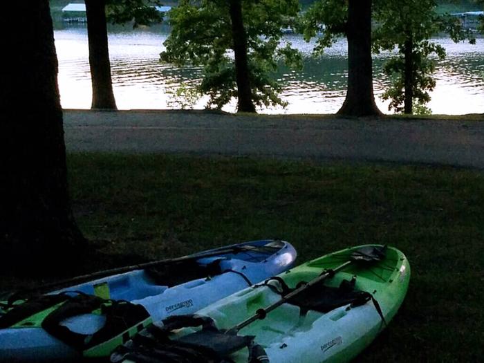
Lightfoot Landing is a smaller campground compared to neighboring park areas, making it a more quiet and peaceful location for boating and fishing on Pomme de Terre Lake, known as the ”Gem of the Ozarks.”

Recreation

The lake is well known for fishing, with one of the highest catch ratios in the country. Species include bass, catfish, walleye and crappie, but the lake is probably best known for its muskie, which is stocked each fall.

Both canoeing and power boating are popular on the lake, with a good amount of water skiing and other water activities taking place.

Facilities

Lightfoot Landing has 29 sites with electric and water hookups, including one that is accessible. Non-electric sites include RV sites, one tent-only site, and two group campsites. Both group campsites fit up to 50 guests.

Additional amenities include a shower house, boat ramp with courtesy dock, dump station, playground and picnic shelter.

Natural Features

The Pomme de Terre River and Lindley Creek are the major sources for Pomme de Terre Lake, which spans 7,790 sparkling surface acres, with 113 miles of shoreline.

Nearby Attractions

One of the best dirt tracks in the country and is located down 83 highway in Wheatland. Also nearby is the Pomme de Terre Multipurpose Trail, located in Bolivar Landing.

Reservation

More from CampingHiking.net:

MAMMOTH PICNIC SHELTERS, Kentucky Campground Images, Info & Reservations

Directions Note: Do not rely exclusively on your mobile GPS, Google Maps or similar automated navigation systems to get to the Mammoth Cave Campground. Routes can be misleading and incorrect. Directions from the North: Take Interstate 65 to Exit 53 (Cave City Exit). Turn right onto KY-70. Follow 70/255 as

MAY QUEEN, Colorado Campground Images, Info & Reservations

Directions From Leadville, Colorado, head west on County Road 4. Continue on the paved road about 9 miles to May Queen Campground on the right. Phone 719-486-0749 (FOR INFORMATION ONLY, NO RESERVATIONS Activities BOATING, HISTORIC & CULTURAL SITE, CAMPING, FISHING, HIKING, SWIMMING SITE Keywords MAYQ,TURQUISE LAKE,TURQUOISE LAKE,PIKE AND SAN ISABEL

ELWOOD CABIN, Colorado Campground Images, Info & Reservations

Directions From Del Norte, take U.S. Highway 160 west to South Fork. Continue west on U.S. Highway 160 for 8 miles to Park Creek Road. Travel 15 miles on Park Creek Road to Summitville Road. Turn right on FSR 380, the cabin is about 2 miles on the left. From

CALF CREEK CABIN, Montana Campground Images, Info & Reservations

Directions From White Sulphur Springs, head east on Highway 12 for 3 miles and turn left (north) on Highway 89. Continue about 15 miles, then head west (left) on Road 119 for 9 miles to the cabin. From Great Falls, head east on Highway 87/89 about 23 miles to the

WINDY GROUP CAMP, Oregon Campground Images, Info & Reservations

Directions Take Highway 58 approximately 8 miles east of Willamette Pass to the Crescent Lake Junction. Turn west on Forest Road 60 and continue approximately 7 miles to the campground. Phone 541-323-1746 Activities BOATING, CAMPING, FISHING, HIKING, SWIMMING SITE Keywords WING,DESCHUTES NF – FS Related Link(s) Rec Area Info &