LITTLE RIVER PARK, OK Campground Reservation, Info, Images, Map, Directions

LITTLE RIVER PARK, Oklahoma Campground Images, Info & Reservations

Directions

From Broken Bow, OK, take Highway 3 west 23 miles to the park entrance. Turn south at the sign and follow the access road.

Phone

580-876-3720

Activities

BOATING, CAMPING, FISHING, HIKING, PICNICKING, DAY USE AREA, SWIMMING SITE, WATER ACCESS

Keywords

LIRP,PINE CREEK LAKE,PINE CREEK LAKE

Related Link(s)

Rec Area Info & Images

Oklahoma State Road Conditions

Oklahoma State Tourism

Overview

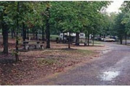
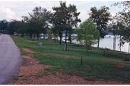
Little River Park is located on the shores of Pine Creek Lake. It boasts beautiful views of the water along with many recreational opportunities. The swimming beach and hiking trail are popular places within the site, and the lake is great for canoeing and fishing.

Recreation

Popular activities include swimming, fishing, picnicking, hiking and boating. A hiking trail is accessible from the campground.

Facilities

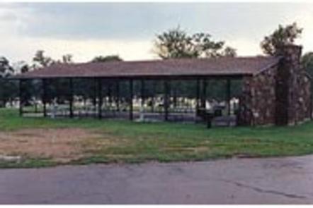
Little River Park offers numerous campsites, many of which have electric and water hookups with a few having sewer hookups. The group camping shelter comes with five electric hookups. Additional amenities include 3 showers, two dump stations, a playground and 2 boat ramps.

Natural Features

Pine Creek Lake lies in the southeast corner of Oklahoma, at the edge of the Ouachita Mountains. The lake spans 3,750 acres with 74 miles of shoreline. Hardwood/Pine forests surround the lake.

Nearby Attractions

Beavers Bend and Raymond Gary State Parks are within driving distance. Also, the historic ruins of Fort Towson, a confederate command post that was built in 1824, are interesting as well.

Reservation

More from CampingHiking.net:

UNION FLAT, California Campground Images, Info & Reservations

Directions From Downieville, take Highway 49 north about 6 miles. The campground is on the right side of the highway. Phone (530)478-6253 Activities BIKING, CAMPING, FISHING, HUNTING, SWIMMING SITE, MOUNTAIN BIKING, WATER ACTIVITIES, KAYAKING, WATER ACCESS, SCENIC DRIVE Keywords UNFL,TAHOE NF – FS Related Link(s) Rec Area Info & Images

CLEAR LAKE GROUP SITE, Washington Campground Images, Info & Reservations

Directions From Naches, Washington, follow Highway 12 west for approximately 34 miles to County Road 1200/Tieton Reservoir Road at the west end of Rimrock Lake. Turn south/left on County Road 1200 and follow for about .3 miles to Road 740. Continue for a half-mile, and the reservation site is the

Excelsior Group Camp, Washington Campground Images, Info & Reservations

Directions From Seattle, Washington, go north on I-5 to Bellingham. Take exit 255 onto Sunset Drive/Mt. Baker Highway SR 542. Turn right (east) on SR 542 and continue past the town of Glacier near mile 33. Continue past Glacier approximately 7 miles to the campground. The sign for the campground

BIG MEADOWS, Virginia Campground Images, Info & Reservations

Directions From Washington, D.C., metro area, travel west on Interstate 66 to exit 43A. Take US Highway 29 south to Warrenton, Virginia, then merge onto US Highway 211 west to Shenandoah National Park and Skyline Drive Thornton Gap Entrance. Take Skyline Drive south approximately 19 miles and turn right into