OPOSSUM CREEK, IL Campground Reservation, Info, Images, Map, Directions

OPOSSUM CREEK, Illinois Campground Images, Info & Reservations

Listen

Directions

From Shelbyville, Illinois, take State Route 128 north for 3.5 miles. Turn right onto County Road 1650 N. Continue nearly a mile to County Road 1880 E. Turn right and travel 0.5 mile to County Road 1600 N. Turn right again and drive one mile into the Opossum Creek facility.

Phone

217-774-3951

Activities

BOATING, CAMPING, FISHING, VISITOR CENTER, WILDLIFE VIEWING

Keywords

OPOS,LAKE SHELBYVILLE,LAKE SHELBYVILLE

Related Link(s)

Rec Area Info & Images

Illinois State Road Conditions

Illinois State Tourism

Overview

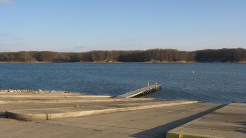
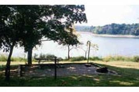
Opossum Creek Recreation Area has a quiet campground that sits on the western shore of Lake Shelbyville in the heart of central Illinois.

The lake and surrounding land offer outdoor activities for people of all ages, including fishing, swimming, picnicking and simply relaxing.

Click Here for a Virtual Tour

Recreation

Lake Shelbyville offers a multitude of fishing opportunities for catfish, crappie, largemouth bass, muskie, walleye, white bass and bluegill.

Opossum Creek provides a fishing pond for children age 12 and under with an accessible fishing dock. There are also several other ponds with farmed fish available around the lake.

Hunting areas located within a short drive offer numerous game species, including quail, rabbit, pheasant, deer, dove, turkey, waterfowl and woodcock.
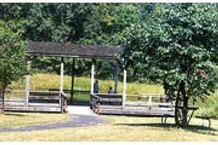
Facilities

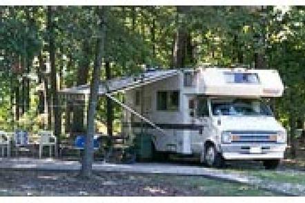
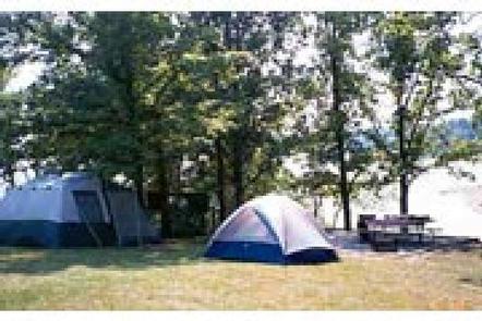
Most of the campsites have electricity and accommodate both RVs and tents, though there are several tent-only non-electric sites as well.

Flush toilets, showers, a playground and dump station help create a comfortable camping environment.

Natural Features

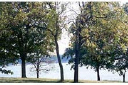
Opossum Creek overlooks the lake shore and provides plenty of shade. Oak and hickory are the lake region’s dominant tree species.

Foliage turns a variety of red, orange, purple and yellow each fall, while prairie flowers dot the landscape in spring and summer.

Numerous species of songbirds, shorebirds, waterfowl and raptors inhabit the lake area, as do mammals such as cottontail rabbit, white-tail deer, gray and fox squirrel, muskrat and mink.

Nearby Attractions

Wolf Creek State Park, Woods Lake Waterfowl Refuge and Okaw Bluff Wetlands Complex are popular locations for wildlife watching, birding and hunting near Lake Shelbyville.

Reservation

More from CampingHiking.net:

WILD MARE HORSE CAMP, Oregon Campground Images, Info & Reservations

Listen Directions From Reedsport, Oregon, take Highway 101 south for 22 miles, turn right on Transpacific Lane. Proceed 1 mile, Cross the railroad tracks and turn right on Horsfall Road. Proceed 1.9 miles down Horsfall Road to Wild Mare Campground. Campground is located on south side of road. From North

JIM CREEK GROUP CAMPGROUND, Oregon Campground Images, Info & Reservations

Listen Directions Travel north on Highway 62 for approximately 6 miles. Turn left on Forest Road 68 for approximately 2 miles. Immediately after crossing the Rogue River, turn left on Forest Road 64 for approximately 0.5 mile. Turn right on Forest Road 6470 for approximately 0.1 mile. Turn right into

MAPLE SPRINGS, Kentucky Campground Images, Info & Reservations

Listen Directions Directions from the North: Take Interstate 65 to Exit 53 (Cave City Exit). Turn right onto KY-70. Follow 70/255 as it becomes the Mammoth Cave Parkway in the park. Follow the Mammoth Cave Parkway towards the Visitor Center. Turn left on the Green River Ferry Road. Cross the

FREMONT POINT CABIN, Oregon Campground Images, Info & Reservations

Listen Directions Summer Travel: From the Paisley Ranger District Office in Paisley, Oregon: Travel north on State Route 31 for 34.2 miles, between mile posts 64 and 65, turn left (west) onto the graveled Forest Service Road (FSR) 2901. Follow FSR 2901 for 16.1 miles. Turn left (east) on FSR

TELEGRAPH PICNIC PAVILION, Virginia Campground Images, Info & Reservations

Listen Directions From Washington, D.C., and points north, take I-95 south to exit 150-B toward VA Route 619/Joplin Road. The park entrance is the second right. The Telegraph Picnic Area is located behind the visitor center, approximately 1.5 miles from the park entrance. From Fredericksburg, Virginia, and points south, take