
Directions
From the Turnpike, travel US 30 to PA 26. PA 26 to Saxton. Continue north on PA 26 for 17.5 miles to the turn-off for Hesston and Seven Points. Then 4 miles to the entrance station. If you are traveling from the north, from I-80, or PA 22, follow PA 26 south or PA 22 to PA 26 south. At Huntingdon, follow PA 26 south 6 miles to the turn-off for Hesston and Seven Points Recreation Area. Then 4 miles to the Seven Points entrance station.
Phone
RESERVATIONS 877-444-6777. OTHER QUESTIONS (814) 658-3405
Activities
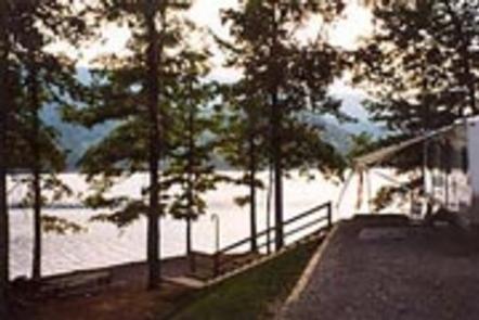
BIKING, BOATING, CAMPING, FISHING, HIKING, VISITOR CENTER, SWIMMING SITE, OTHER RECREATION CONCESSION SITE, SWIMMING, MOTOR BOAT, MOUNTAIN BIKING, WATER ACTIVITIES, BIRDING, NON-MOTORIZED BOATING, WATER SKIING, EVENING PROGRAMS, AMPHITHEATER, TUBING, ACCESSIBLE SWIMMING
Keywords
SEVP,RAYSTOWN LAKE,RAYSTOWN LAKE
Related Link(s)
Pennsylvania State Road Conditions
Overview
The Seven Points Campground, located in the central region of Raystown Lake, is perfectly situated for outdoor recreation. Within a short walk from every campsite, visitors can find everything from interpretive trails to a visitor center. Plus there’s easy access to swimming, boating, fishing hiking, and biking. For more detailed maps and information on the Seven Points Recreation area visit our website at https://www.nab.usace.army.mil/Missions/Dams-Recreation/Raystown/
Recreation
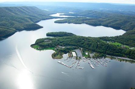
Boating is always popular at Raystown, but there’s more than just boating. Fishing for muskies, small and large mouth bass, brown trout, and many other Pennsylvania species is excellent. Every summer weekend there are education and entertainment programs at the amphitheater. The Greenside Pathway, a recycled rubber tire hiking trail, provides a safe walking route that connects the campgrounds to all of the recreational facilities within Seven Points; and world class mountain biking is available on the Allegrippis Trails and mountain biking skills park near the Visitors Center. Other nearby trails include the Lower Trail (Rails to Trails), the Terrace Mountain Trail, the Old Loggers Trail, and the Mid State Trail.
Facilities
There are six camping loops within Seven Points, with a full service marina available. Each camping loop has a restroom and a playground, and most loops have showers. Campsites are spacious where available and include a picnic table, fire grill, and lantern hanger; most sites offer electric hookups. As a convenient bonus, sites are a mile from groceries, bait, tackle, and gas.
Natural Features
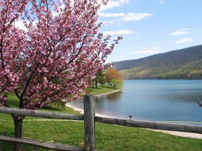
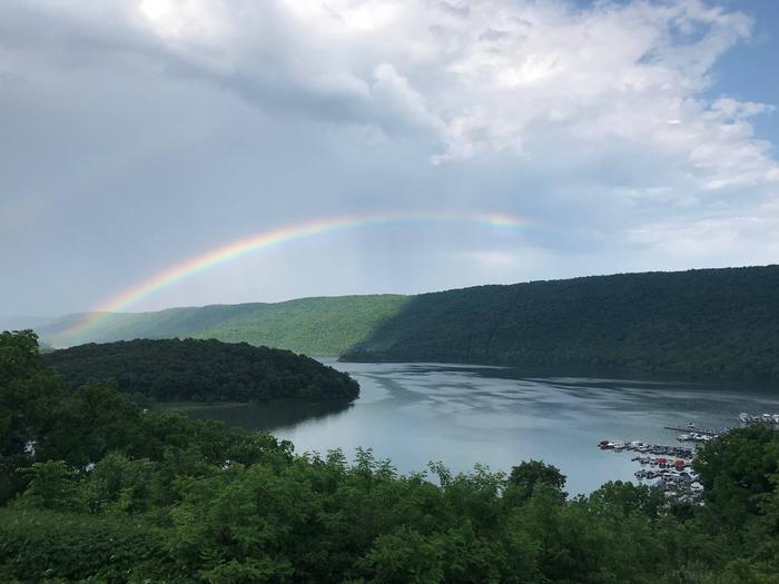
Raystown Lake is located within the ridge and valley province of Pennsylvania. The lakeshore is lined with an old oak-hickory forest giving way to mountain ridges and cliffs. The man-made lake is fed by the Raystown Branch tributary of the Juniata River and is the largest lake completely in the state of Pennsylvania.
Recreation season temperatures range from the 60s to 90s, with three to four inches of rain per month. The nights are cool and the days are pleasant through spring and fall.
Nearby Attractions
Campers can take day trips to the Lincoln Caverns, Altoona Railroaders Museum, Swigart Antique Car Museum, or other nearby attractions. Visit www.raystown.org for local attractions and activities. The nearby city of Huntingdon, 11 miles north, is a good place for restaurants, shopping, and theaters.