SPILLWAY RECREATION AREA, MO Campground Reservation, Info, Images, Map, Directions

SPILLWAY RECREATION AREA, Missouri Campground Images, Info & Reservations

Listen

Directions

From St. Louis, Missouri: Take I-55 South to US Highway 67 South to State Highway D (located just South of Greenville, Missouri). Take State Highway D south for 20 miles to State Highway T. Cross Wappapello Dam and take the first left onto a paved road and watch for signs.

From Poplar Bluff, Missouri: Take US Highway 60 East to State Highway T North. Go North on State Highway T for 22 miles and watch for signs.

Phone

573-222-8562

Activities

FISHING, DAY USE AREA, WATER ACCESS

Keywords

SPRE,WAPPAPELLO LAKE,LAKE WAPPAPELLO,SPILLWAY,WAPPAPELLO LAKE

Related Link(s)

Rec Area Info & Images

Missouri State Road Conditions

Missouri State Tourism

Overview

Wappapello Lake’s Spillway Recreation Area is nestled along the St. Francis River near the Wappapello Dam. The area provides plenty of recreation for day-use visitors, including boating, fishing or playing volleyball.

Click here to take a virtual tour of the facilities at Wappapello Lake! 

Recreation

Boating and fishing are the most popular activities with largemouth bass, crappie, bluegill, white bass and channel catfish, among other species.

Pine Ridge Natural Trail, a 3/4-mile double loop, starts at the Spillway Recreation Area and provides an excellent way to explore the beautiful woodlands.
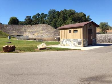
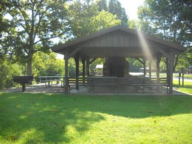
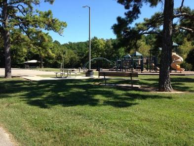
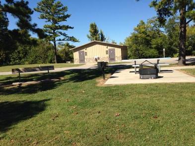
Facilities

This day use area includes two large picnic shelters, 8 picnic sites, a volleyball court, playground, horseshoe pits and bank fishing.

Natural Features

Wappapello Lake has a seemingly endless string of secluded coves hugged by a winding, wooded shoreline. The public recreation area spans 45,000 acres in the southeastern Ozark foothills.

Nearby Attractions

The extensive 33-mile Ozark Trail, starts just south of Sam A. Baker State Park and winds along the west side of the St. Francis River and Wappapello Lake.

Reservation

More from CampingHiking.net:

WHITETAIL RIDGE, Georgia Campground Images, Info & Reservations

Listen Directions From Lagrange, Georgia, travel west on State Route 109 for about 7 miles. After crossing the first bridge across the lake, travel approximately one more mile, then turn left onto Thompson Road. After a mile, bear left and watch for the sign. Phone 706-884-8972 Activities BOATING, CAMPING, FISHING,

EASTBANK, Georgia Campground Images, Info & Reservations

Listen Directions Physical Address: 153 Eastbank Road, Bainbridge, GA 39819 Take I-10 to Exit 166 (Chattahoochee) to Highway 90 West. Turn left and proceed to traffic light. Turn right on Bolivar Street. Travel 1.5 miles north. Campground sign is on the right; entrance is on the left. Phone 229-662-9273 Activities

SPARROWFOOT, Missouri Campground Images, Info & Reservations

Listen Directions From Highway 13, travel about a mile east on SE 450 Road and follow signs into the park. Phone 660-885-7546 Activities BOATING, CAMPING, FISHING Keywords SPAF,TRUMAN LAKE,HARRY S TRUMAN Related Link(s) Rec Area Info & Images Missouri State Road Conditions Missouri State Tourism Overview SPARROWFOOT CAMPGROUND WILL REMAIN

LEIGH CREEK CAMPGROUND, Wyoming Campground Images, Info & Reservations

Listen Directions From Ten Sleep, WY, drive 7.5 miles on Hwy 16 to FSR 018 (WY Hwy 436). Bear right and travel nearly 1 more mile to the campground. Phone 406-587-9054 Activities BIKING, BOATING, CLIMBING, FISHING, HIKING, WILDLIFE VIEWING, HOTEL/LODGE/RESORT PRIVATELY OWNED, OFF ROAD VEHICLE TRAILS, KAYAKING, STAR GAZING, BIRDING,