COVE CREEK, OR Campground Reservation, Info, Images, Map, Directions

COVE CREEK, Oregon Campground Images, Info & Reservations

Directions

From Detroit, Oregon, travel east on State Highway 22 for 2.7 miles to Blowout Road/Forest Service Road 10. From Idanha, Oregon, travel west on State Highway 22 for 0.7 miles to Blowout Road/Forest Service Road 10. Proceed on Blowout Road 3.6 miles to Cove Creek Campground on the right.

Phone

801-226-3564

Activities

BIKING, BOATING, FISHING, HIKING, SWIMMING

Keywords

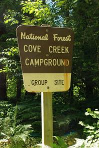
COCG,DETROIT LAKE,WILLAMETTE NF -FS

Related Link(s)

Rec Area Info & Images

Oregon State Road Conditions

Oregon State Tourism

Forest Service Concessionaire

Overview

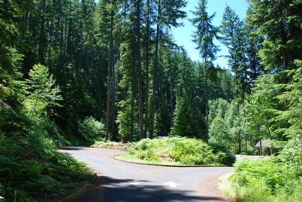
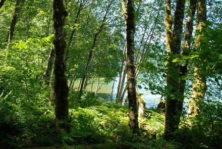
Cove Creek Campground rests on the shores of Detroit Lake at an elevation of 1,600 feet. Campsites are surrounded by towering trees, which create a secluded atmosphere. Visitors enjoy exploring the area and discovering osprey hovering above or nesting in many trees.

The campground lies in the Willamette National Forest, which stretches 110 miles along the western slopes of the Cascade Range.

Recreation

Detroit Lake is a popular destination for boating, jet skiing, swimming and fishing. Rainbow trout, Kokanee salmon and catfish are found in the lake. A boat ramp and dock are located next to the campground.

The Stahlman Point Trail is a quarter-mile from the campground entrance road. The trail meanders through younger Douglas fir forests and offers some memorable views of Detroit Lake.

Facilities

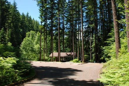
The campground offers single and double-family campsites, as well as an accessible group site for up to 70 people. Accessible flush toilets, drinking water and coin-operated showers are available at Cove Creek.

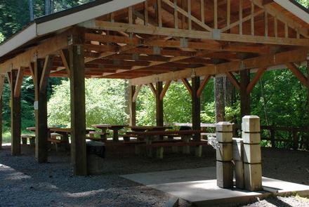
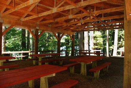
The group campground comes with a sheltered eating area.

In the day use area, there is about 1,000 ft. of shoreline. There is a dock for launching, loading and unloading only. There is no mooring allowed.

Natural Features

A mix of wooded and open sites are provided at the campground. Its location is near enough to the Detroit Reservoir to hear passing boats, but a little too far for unobstructed views of the lake. The reservoir covers 3,500 acres and is surrounded by groves of Douglas fir.

Nearby Attractions

Additional hiking trails can be found across the lake, including those that lead to Dome Rock and Needle Rock.

Reservation

More from CampingHiking.net:

FALLEN LEAF CAMPGROUND, California Campground Images, Info & Reservations

Directions From South Lake Tahoe, take Highway 89 North from the junction of State Highway 50 and 89. In 3 miles, turn left on Fallen Leaf Road. The campground is about half a mile on the right. Phone 530-544-0426 Activities BIKING, BOATING, HISTORIC & CULTURAL SITE, CAMPING, INTERPRETIVE PROGRAMS, FISHING,

WHITEBREAST POINT SHELTER (IA), Iowa Campground Images, Info & Reservations

Directions 971 Hwy S71 Knoxville, IA 50138 From Knoxville, take County Highway T-15 northeast for 8 miles. Turn north onto County Highway S-71 and continue 2 miles, following signs to the campground. From Pella, take County Highway T-15 southwest for 7 miles. Turn north onto County Highway S-71 and continue

NORTH DAVIS CREEK CAMPGROUND, Oregon Campground Images, Info & Reservations

Directions From Bend, OR: Travel 56.2 miles southwest on Cascade Lakes Hwy (46). The campground is on the east side of the highway. Phone 541-323-1746 Activities CAMPING Keywords Related Link(s) Rec Area Info & Images Oregon State Road Conditions Oregon State Tourism Overview North Davis Creek Campground is located on

DAWSON CABIN, Colorado Campground Images, Info & Reservations

Directions From Buena Vista, Colorado, go about 15 miles north on Highway 24 towards Leadville. Turn left on County Road 390 at Clear Creek Reservoir. Go about 6 miles west on County Road 390, then turn right (north) onto the cabin driveway. The cabin is about 100 yards from the

BUSHAY RECREATION AREA, California Campground Images, Info & Reservations

Directions From the South (San Francisco, Santa Rosa, Ukiah): Follow Highway 101 North towards Ukiah. Approximately 5 miles north of Ukiah, take Highway 20 East. Continue on Highway 20 East for approximately 3 miles. Just after you see Lake Mendocino on your right, you will cross a tall bridge. Take