
Directions
From Glasgow, KY: Take 31-E south for 4 mi; turn right on 252, which will cross the dam in 8 mi. The Tailwater entrance road is at the south end of the dam. Follow signs into recreation area. Approximately 19 miles from Bowling Green, KY.
Phone
270-622-7732
Activities
CAMPING, FISHING, HIKING, WILDLIFE VIEWING, DAY USE AREA
Keywords
,BARREN RIVER LAKE
Related Link(s)
Kentucky State Road Conditions
Overview
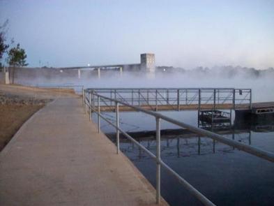
The Tailwater Campground offers 48-sites located along the Barren River, just below the dam. This lazy riverside campground is quieter than neighboring campgrounds and seems to have a slower pace since it is set below the lake, yet close enough for easy lake access.
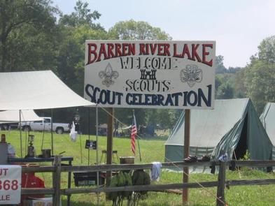
Annually, the campground is host to the Barren River Lake Scout Celebration which began in 1995. Scouts from surrounding states converge at the Tailwater Campground to celebrate, compete, and demonstrate their skills over the weekend. This event occurs every August and is something everyone can be a part of as a participant or on looker.
View a virtual tour of Barren River Lake.
Recreation
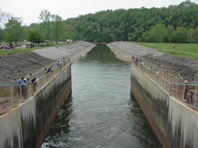
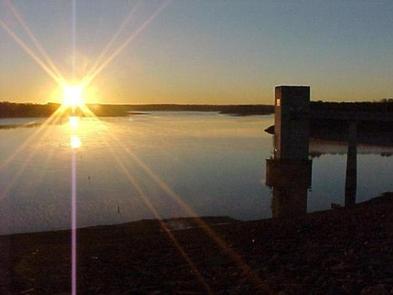
The Tailwater provides a great location when fishing for catfish or hybrid striped bass, and downstream provides an opportunity to catch several different species of bass, as well as a variety of sunfishes. Try hiking the Steen Bergen Nature Trail for a chance to spot resident great horned owls, a variety of woodpeckers, migrating songbirds, or a family of chipmunks. The river offers a chance to see belted kingfishers, green herons, or maybe even an otter dining on an afternoon snack.
Facilities
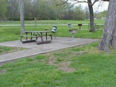
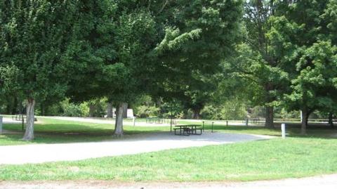
Each site has water hook ups and electric available during the months of May through September. Primitive camping is available in the off season with pit toilets offered during that time. The campground has an amphitheater, playground, beach volleyball court, horseshoe pit, and an open field for sports like softball or a fun game of tag. Other amenities just outside the campground at the stilling basin recreation area include: picnic sites, a pavilion available for reserving, playground, and basketball court.
Natural Features
Beautiful views of high cliffs and hills are on the other side of the river. Frequently you will see a bald eagle perched waiting for a fish to surface from the stilling basin’s discharge. The surrounding woods are a quiet retreat and an opportunity for wildlife viewing at the permanent wildlife blind.
Nearby Attractions
The lake’s shoreline is less than a mile away for swimming and boating activities. The premier recreation area, Port Oliver, is just across the dam and Quarry Road Recreation Area offers a reservable pavilion, fishing piers, playground, flush toilets, swimming area with beach, and a variety of picnic sites.
Stop and visit Barren River Lake State Resort Park, host of the Glasgow Highland Games. Peninsula Marina is less than five miles away. Good day trips to other local area attractions include: the National Corvette Museum, Kentucky Down Under, and Diamond Caverns. There are several other family attractions within the Glasgow, Bowling Green, and Cave City region and visitors can explore Mammoth Cave National Park, an hour north of the campground.