LANGOHR CAMPGROUND, MONTANA Campground Reservation, Info, Images, Map, Directions

LANGOHR CAMPGROUND, Montana Campground Images, Info & Reservations

Directions

From Main Street in Bozeman, travel south along 19th Avenue for 7 miles, to the paved Hyalite Canyon Road. Turn left and continue south for about 5 miles, to the campground.

Phone

(406)646-1012

Activities

BIKING, CAMPING, FISHING, HIKING, WILDLIFE VIEWING, PHOTOGRAPHY, MOUNTAIN BIKING, STAR GAZING, BIRDING, WATER ACCESS, BACKPACKING

Keywords

LANG,LANGOHR SPRING,GALLATIN NF – FS

Related Link(s)

Rec Area Info & Images

Montana State Road Conditions

Montana State Tourism

Forest Service Concessionaire

Overview

Langohr Campground is located in scenic Hyalite Canyon on the Bozeman Ranger District of the Gallatin National Forest. It is located just 12 miles south of Bozeman, Mont.

The surrounding area offers many outdoor recreational opportunities, including fishing, hiking and climbing.

Recreation

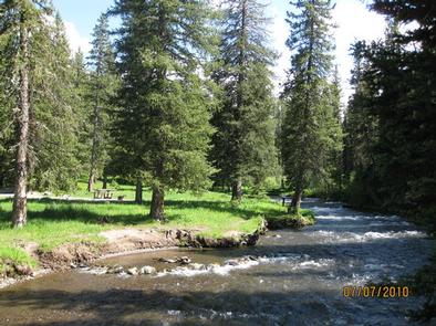
Hyalite Creek provides great fishing for Yellowstone cutthroat, Arctic grayling and brook trout. Many hiking trails can be found in Hyalite Canyon.

Facilities

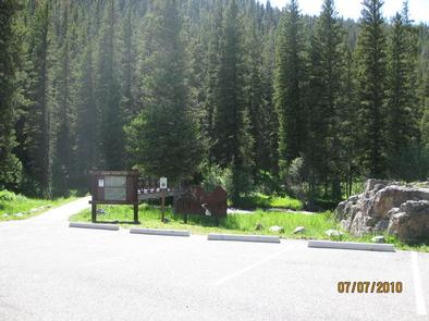
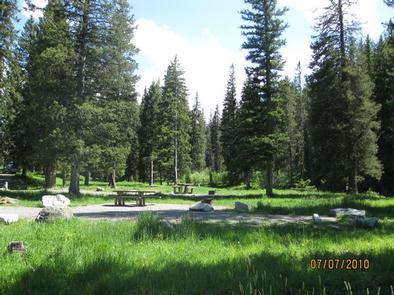
The campground offers several single-family campsites. A GROUP PICNIC AREA (SITE 20) for DAY USE ONLY is also available and can accommodate up to 50 people. Tables and campfire rings are provided, as are vault toilets, drinking water and trash collection.

Natural Features

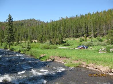
The campground sits next to Hyalite Creek, at an elevation of 6,200 feet. Most campsites are situated in open meadows along the creek. Some are located among scattered pine and fir trees.

Nearby Attractions

Hyalite Reservoir is just 3.5 miles from the campground. The scenic 206-acre lake offers many recreational activities, including boating, canoeing, fishing, hiking, climbing and picnicking.

The popular Hyalite Peak Trail begins near the reservoir. The 7.5-mile one-way trail gains 3,450 feet in elevation as is climbs past numerous waterfalls to beautiful Hyalite Lake and Peak.

Reservation

More from CampingHiking.net:

MERRISACH LAKE, Arkansas Campground Images, Info & Reservations

Directions From DeWitt, Arkansas, take US-165 south for 8.1 miles to State Route 44. Turn east for 5.3 miles and continue south onto Tichnor Blacktop Rd. After 10 miles, turn right onto Merrisach Lake Lane and continue into the park. Phone 870-548-2291 Activities BOATING, CAMPING, FISHING, HUNTING, WILDLIFE VIEWING, BIRDING

ALDER DUNE, Oregon Campground Images, Info & Reservations

Directions From Florence, Oregon, drive 6 miles north on Highway 101. The campground is located on the west side of the highway. Phone 541-997-2526 Activities CAMPING, FISHING, HIKING, WILDLIFE VIEWING, BIRDING Keywords ALDE,SIUSLAW NF – FS Related Link(s) Rec Area Info & Images Forest Service Concessionaire Oregon State Tourism Oregon

MINERS GULCH, Utah Campground Images, Info & Reservations

Directions From Duchesne, Utah: Take Highway 87 north for 15 miles to the Mountain Home turnoff. Turn left and continue 2.5 miles north to the Rock Creek Store. Turn left toward Rock Creek Canyon and proceed approximately 15 miles to the campground. You’ll see a sign for Miners Gulch and

GLACIER VIEW CAMPGROUND, Idaho Campground Images, Info & Reservations

Directions From Stanley, Idaho, take State Highway 75 south approximately 4 miles. Go west onto Forest Road 214. Turn left at Glacier View Campground entrance sign. Phone 928-537-8888 Activities BIKING, BOATING, CAMPING, FISHING, HIKING, HORSEBACK RIDING, WILDLIFE VIEWING, SWIMMING SITE Keywords GLAC,SAWTOOTH NF – FS Related Link(s) Rec Area Info