NAMEKAGON, WI Campground Reservation, Info, Images, Map, Directions

NAMEKAGON, Wisconsin Campground Images, Info & Reservations

Listen

Directions

From Cable, Wisconsin, take County Highway M east for 11 miles. Turn left on County Highway D and proceed about 6 miles to Forest Service Road 209. Turn left at the campground sign and drive less than a mile to the campground entrance.

Phone

(715) 634-4821 OR (715) 264-2511

Activities

BIKING, BOATING, CAMPING, FISHING, SWIMMING SITE

Keywords

NAME,CHEQUAMEGON-NICOLET NF – FS

Related Link(s)

Rec Area Info & Images

Overview

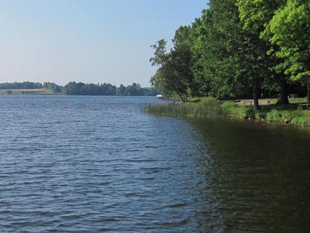
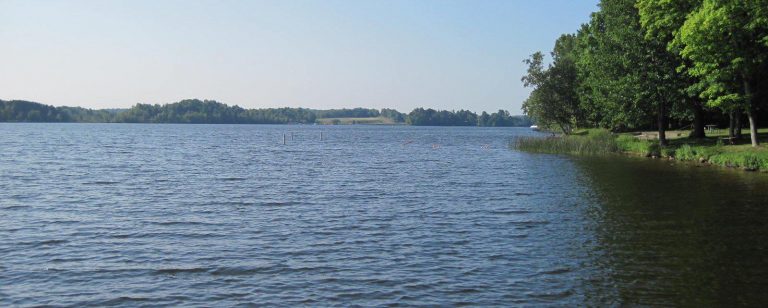
Namekagon campground is a family-friendly campground that runs alongside its namesake lake, at the headwaters of the Namekagon River. It is the perfect spot to kayak, canoe, jet ski, swim or take a boat ride to one of the many restaurants along the shoreline.

With its close proximity to mountain bike trails and the North Country hiking trail, Namekagon campground is an ideal location for making a base camp.

Recreation

Namekagon Lake offers excellent fishing, and anglers will find musky, pike, walleye and bass, among other fish varieties, available in abundance.

The campground is conveniently located near off-highway vehicle, hiking and mountain bike trails. The North Country National Scenic Trail is also nearby. The Namekagon Nature Trail is a one mile interpretive trail which traverses the immediate area and begins in the campground.

Facilities

The campground offers a couple dozen single-family campsites for tent or RV camping. Each site is equipped with tables and campfire rings with grills. Accessible vault toilets, drinking water, trash collection and recycling bins are also provided.

A day-use picnic area is equipped with multiple tables, picnic shelters, a basketball court, beach, boat ramp and fishing piers.

Natural Features

The campground is situated on the 3,227-acre Namekagon Lake that is famous for its fishing potential. It is surrounded by a hardwood and hemlock forest in northwestern Wisconsin.

Reservation

More from CampingHiking.net:

EDSON CREEK GROUP CAMPGROUND, Oregon Campground Images, Info & Reservations

Listen Directions Edson Creek campground is located off of Highway 101 between Bandon and Port Orford, Oregon. From U.S. Highway 101, turn east onto Sixes River Road. Travel approximately four miles, and turn left into the campground just before you cross the Edson Creek Bridge. Phone 541-756-0100 Activities BOATING, CAMPING,

MYSTIC LAKE CABIN, Montana Campground Images, Info & Reservations

Listen Directions There is no motorized access to this cabin. 1. Sourdough Canyon Trailhead: From Bozeman, MT. Drive south on S. 19th Ave. for 5.1 miles to Nash Rd. Turn left (east) onto Nash Rd. Drive 1.7 miles to Sourdough Canyon Road, turn right (south), and drive for 0.9 miles

WARRIOR CREEK, North Carolina Campground Images, Info & Reservations

Listen Directions From Winston-Salem, North Carolina, take Highway 421 North (approximately 55 miles) to Exit 286B, turn left onto Highway 268 and continue for approximately 8 miles. Turn right immediately after crossing the bridge and follow signs to the campground. From Charlotte, North Carolina, take I-77 North (approximately 60 miles)

PETTIT BAY, Oklahoma Campground Images, Info & Reservations

Listen Directions From Tahlequah, OK, go 8.25 miles south on Highway 82, turn right on Indian Road and go two miles south. Then turn left and go one mile southeast on the paved access road. Phone 918-487-5252 Activities BOATING, CAMPING, SWIMMING SITE Keywords PETT,TENKILLER LAKE,TENKILLER FERRY LAKE,TENKILLER FERRY Related Link(s)

BIG M, Missouri Campground Images, Info & Reservations

Listen Directions From Cassville, Missouri, travel east on State Route 76 for 9 miles. Turn onto the Highway M access road and follow signs into the campground. Phone 417-271-3190 Activities BIKING, BOATING, CAMPING, FISHING, HIKING, PICNICKING, VISITOR CENTER, WATER SPORTS, WILDLIFE VIEWING, SWIMMING SITE, PHOTOGRAPHY, SWIMMING, RANGER STATION, KAYAKING, WATER

GLEASONS LANDING, Michigan Campground Images, Info & Reservations

Listen Directions From Baldwin, take 7th street west 5 blocks to Cherry Street, then south 1.5 blocks to 52nd Street (Carr Road), go west 2 miles to Jenks Road and turn left. Drive 0.4 miles and turn right on Shortcut Road and drive 0.7 miles. Turn right at T junction