
Directions
From U.S. Highway 212, go to the south end of Red Lodge. Turn west onto West Fork Rock Creek Road (Forest Road 2071) and travel 11 miles west. The campground is on the left.
Phone
406-587-9054
Activities
BIKING, BOATING, FISHING, HIKING, WILDLIFE VIEWING, KAYAKING, CANOEING
Keywords
CASCADE,CASCADE CAMPGROUND,CASD,CUSTER NF – FS
Related Link(s)
Overview
Cascade Campground is located 11 miles west of Red Lodge, in southern Montana. It conveniently sits along Forest Road 2071, which is paved for most of the route. The area is a popular location for hiking, backpacking and fishing. The administering organization is Gallatin Canyon Campgrounds; e-mail: gccampgrounds13@gmail.com
Recreation
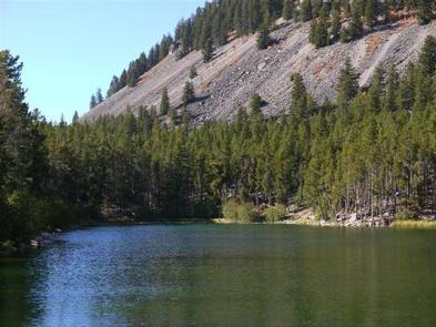
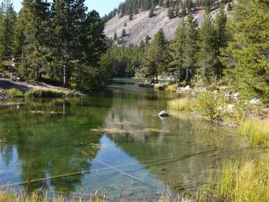
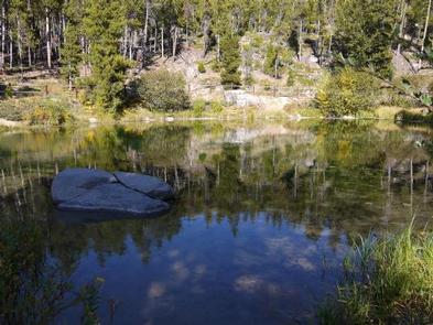
Fishing is a popular activity along the West Fork of Rock Creek and at nearby Wild Bill Lake. The small lake is open to kayaking and canoeing, and an accessible fishing dock is located on the shore.
The Basin Lakes Trailhead is three miles away, across the road from Basin Campground. Silver Run Plateau, West Fork and Timberline Lakes trails offer access to the Absaroka-Beartooth Wilderness.
Mountain bikers enjoy the Ingles Creek Trail and a variety of loop trails at Silver Run. Biking is also allowed on the Basin Lakes Trail.
Facilities
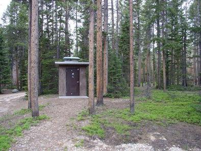
The campground offers several single-family sites, two of which are accessible. Each site is equipped with a picnic table and campfire ring with grill. Accessible vault toilets and drinking water are provided. Trash may be deposited in receptacles at nearby Basin Campground.
Sites 1 and 2 support established accessibility standards.
Natural Features
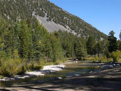
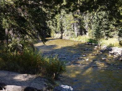
The campground is situated on the banks of the West Fork of Rock Creek. The area surrounding the campground was burned by the Cascade Fire in 2008, which left many open glades with abundant wildflowers.
Nearby Attractions
The charming town of Red Lodge, Mont., offers a variety of dining and lodging options, galleries, shops and annual summer events. The Home of Champions Rodeo is held on the Fourth of July weekend, Beartooth Bike Rally and Iron Horse Rodeo take place in mid-July, the Mountain Man Rendezvous is in late July and the Festival of Nations happens in early August.
The Beartooth Highway was deemed “the most beautiful drive in America,” by the late Charles Kuralt. It snakes across the rugged Beartooth Mountains from Red Lodge to Cooke City. It is the highest elevation highway in the Northern Rockies. Along the way, visitors are treated to sweeping views and plentiful opportunities for outdoor recreation.
Charges & Cancellations
Refunds: Refund requests made through www.recreation.gov will be charged a $10 processing fee. This cancellation processing fee is retained by the reservation service contractor along with the non-refundable reservation fee. All requests for the return of the non-refundable reservation fee and the cancellation processing fee will be declined by the campground concessionaire as they did not receive these fees (these are the fees retained by the reservation contractor, a different entity).