DIMOND O, CA Campground Reservation, Info, Images, Map, Directions

DIMOND O, California Campground Images, Info & Reservations

Directions

From the Groveland District Office, head east 15 miles on Highway 120, then turn left on Evergreen Road and travel 4 miles. The campground is located on the left.

Phone

209-379-2258

Activities

BIKING, BOATING, CLIMBING, CAMPING, FISHING, HIKING, CANOEING, ROCK CLIMBING

Keywords

DIMO,DIAMOND O,DIMOND O,STANISLAUS NF -FS,Diamond (CA)

Related Link(s)

Rec Area Info & Images

California State Tourism

California State Road Conditions

Forest Service Concessionaire

Overview

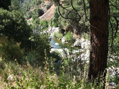
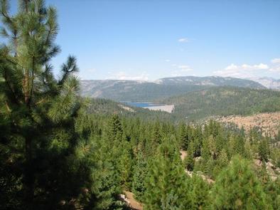
Dimond O is ideally located closest to Yosemite National Park’s Big Oak Flat entrance and Hetch Hetchy. It’s nestled near the banks of the scenic Middle Fork Toulumne River, where warm summer days can be spent wading and fly fishing in the refreshing waters.

Recreation

Nearby trails include the Carlon Falls Trail near the Carlon Day Use Area, and Yosemite National Park trails accessible from Hetch Hetchy.

The Middle Fork Toulumne River is a popular spot for swimming, wading and rainbow trout fishing.

Facilities

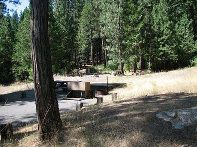
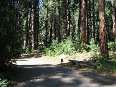
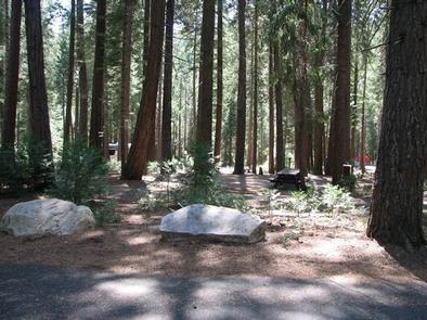
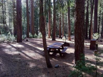
The campground offers single and double-family sites, many of which are accessible. Picnic tables and campfire rings are provided, as are accessible vault toilets and drinking water. Roads and parking spurs are paved. Firewood is available for a fee.

Natural Features

Some sites overlook the river and others are tucked among cedar and ponderosa pine trees. The Tuolumne River runs for about 150 miles from the central Sierra Nevada to the San Joaquin River.

Nearby Attractions

Take a scenic drive through Yosemite to explore its legendary landscapes.

Reservation

More from CampingHiking.net:

STONY POINT, Minnesota Campground Images, Info & Reservations

Directions From Walker, Minn., take Highway 200 east 6 miles to County Road 13. Go north 3 miles on County Road 13 to Forest Road 3793, then east 2.5 miles on FR 3793 to the campground. Phone 218-547-1044 Activities BOATING, CAMPING, FISHING, HIKING, SWIMMING SITE Keywords STOP,CHIPPEWA NF – FS

SOUTH SHORE CAMPGROUND, California Campground Images, Info & Reservations

Directions From Pioneer, CA, take State Route 88 east 21.9 miles to Bear River Lake Resort sign. Turn left at the sign and go 3.4 miles to campground on right side of the road. Phone 209-295-4360 Activities BIKING, BOATING, CAMPING, FISHING, SWIMMING SITE Keywords SOSH,BEAR RIVER RESERVOIR SO.SHORE,ELDORADO NF –

HAWE CREEK, South Carolina Campground Images, Info & Reservations

Directions From the junction of HWY 221 and HWY 378 in McCormick, SC, travel southwest on US 378, then south 4 miles on Chamberlains Ferry Road. Road ends at campground. Phone 864-443-5441 Activities BOATING, CAMPING, FISHING, HUNTING Keywords HAWE,J STROM THURMOND LAKE Related Link(s) Rec Area Info & Images South

Grandview Shelter 2, West Virginia Campground Images, Info & Reservations

Directions To reach Grandview from Beckley follow I-64 East five miles to Exit 129 B. From Lewisburg follow I-64 West forty miles to Exit 129. From either exit, turn right and follow Route 9 North six miles to Grandview. Phone 304-465-0508 Activities HIKING, PICNICKING, DAY USE AREA Keywords Grandview State

LITTLE COON CREEK PARK, Arkansas Campground Images, Info & Reservations

Directions From US-59/71 at Grannis, Arkansas, turn east onto County Rd 3/Frachiseur Rd and stay on this road for 5 miles and then follow the signs on into the park. Phone 870-385-7126 Activities BOATING, CAMPING, FISHING Keywords COON CREEK Related Link(s) Rec Area Info & Images Arkansas State Road Conditions

DOG CREEK (KY), Kentucky Campground Images, Info & Reservations

Directions From Louisville, take I-65 south to exit 76 and turn west onto Highway 224. Continue for 9 miles, then turn left onto Highway 479. After 8 miles make another left onto Highway 88 and continue for about 2 miles to Highway 1015. Turn right and follow signs to the