
Directions
From Lexington, KY, take I-75 south 83 miles to London. Take exit 41 or 38 to Daniel Boone Parkway east and continue 44 miles to Hyden Spur. Exit towards Tim Couch Pass and turn left towards Thousandsticks onto Bull Creek Road.
Go 2.5 miles to KY Highway 257, then head north about 9 miles to the Confluence bridge. Turn right and cross the bridge, then take a left on Mosley Bend Road. Continue 2 miles to Trace Branch Campground on your left.
Phone
606-672-3670
Activities
BOATING, CAMPING, FISHING, VISITOR CENTER, WATER SPORTS, SWIMMING SITE
Keywords
TRAB,TRACE,TRACE BRANCH CAMPGROUND,TRACE BRANCH RAMP,BUCKHORN LAKE
Related Link(s)
Kentucky State Road Conditions
Overview
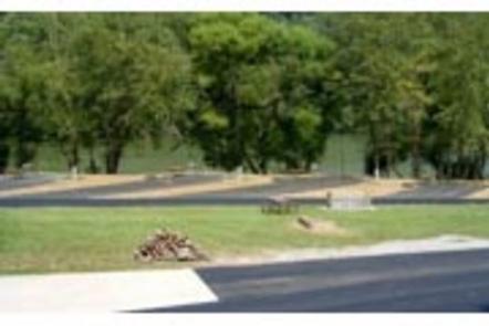
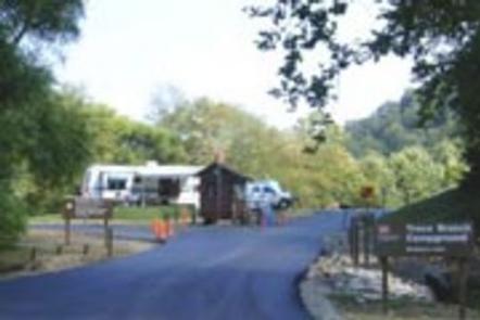
The Trace Branch Campground, located on Buckhorn Lake, is a great launchpad for outdoor activities in Kentucky’s lush Cumberland Plateau. The facility features plenty of shade and open grassy areas for spreading out and enjoying the landscape of the Appalachian Mountain Range.
Recreation
Buckhorn lake offers ideal conditions for anglers including seclusion from fishing pressure and boat traffic, producing some of the best muskie fishing in the area.
With comfortable water temperatures,swimming and water skiing are popular in summer months and hikers are encouraged to take advantage of the area’s many miles of trails.
Facilities
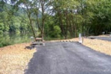
Trace Branch Campground boasts mostly waterfront campsites with electric and water hookups. Amenities include a shower house, playground, horseshoe pits, and a convenient fishing area.
A general store is about three miles from the Campground.
Natural Features
Buckhorn Lake is situated in the Cumberland Plateau of eastern Kentucky. The rugged plateau landscape is deeply traversed by a series of narrow, winding valleys separated by steep watersheds with branching streams. The Kentucky River feeds the lake, originating in the southeast of the state and flowing generally northwestward.
Nearby Attractions
Nearby destinations include the Lilley Cornett Woods, Daniel Boone National Forest, Natural Bridge State Resort Park and the Red River Gorge Geological Area.