JACKS GULCH, CO Campground Reservation, Info, Images, Map, Directions

JACKS GULCH, Colorado Campground Images, Info & Reservations

Directions

From Fort Collins, take Highway 14 northwest for 42 miles, then County Road 63 E (Pingree Park Road) south for 6 miles.

Phone

970-295-6700

Activities

BIKING, CLIMBING, CAMPING, FISHING, HIKING, HORSEBACK RIDING, WILDLIFE VIEWING, MOUNTAIN BIKING, BIRDING

Keywords

JAGU,ARAPAHO AND ROOSEVELT NF – FS

Related Link(s)

Rec Area Info & Images

Forest Service Concessionaire

Colorado State Road Conditions

Colorado State Tourism

Overview

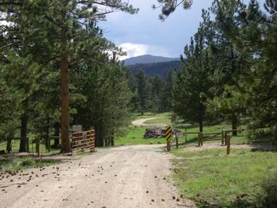
Jacks Gulch Recreation Area is located 48 miles northwest of Fort Collins, in northern Colorado. Visitors enjoy the area for its great hiking, biking and horseback riding opportunities.

Recreation

Popular activities include hiking, biking, horseback riding, birding and viewing wildlife. A nature trail circles the entire area of Jacks Gulch, with one section providing stunning views of the Mummy Range.

Facilities

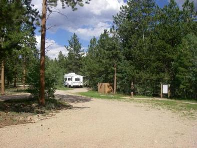
The campground offers an accessible group site with electric hookups, and five equestrian campsites without hookups. Additional single-family campsites are available on a first-come, first-served basis.

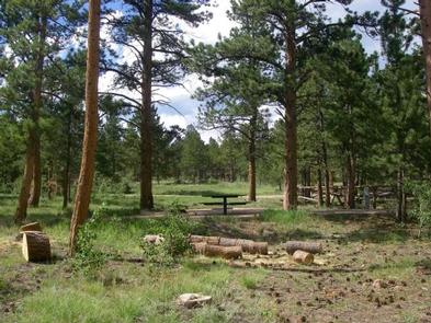
The group site accommodates up to 60 people, several cars and up to nine RVs with hookups. Ten 14-by-17 tent pads are scattered throughout the site. A picnic shelter is provided. Two central cooking and picnic areas are on-site, each with four picnic tables, a charcoal grill and campfire ring.

The two equestrian sites have four horse stalls each. Picnic tables, campfire rings and tent pads are provided. Each site can accommodate a horse trailer.

Vault toilets, drinking water and trash collection are provided. Firewood, dead and down, may be gathered in the forest or purchased from the host.

Natural Features

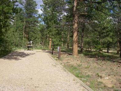
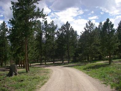
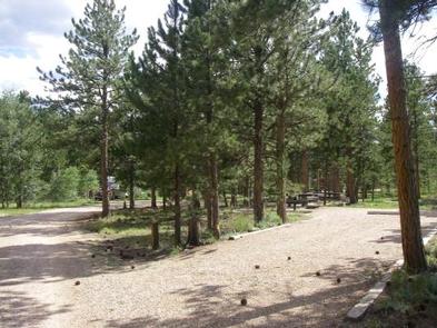
The campground is situated in a ponderosa pine forest, dotted with aspens. Grassy meadows are scattered throughout the area.

Reservation

More from CampingHiking.net:

LAKES BASIN, California Campground Images, Info & Reservations

Directions In Graeagle, CA, at the intersection of State Rt. 89 and Forest Rt. 24 (Gold Lakes directional sign), turn onto Rt. 24 and go 6.9 miles to campground sign. Turn right onto the single-lane road and proceed 0.3 miles. The campground will be on the right. Phone CAMPGROUND/CAMPSITE STATUS

TEN-X CAMPGROUND, Arizona Campground Images, Info & Reservations

Directions Ten-X Campground is located 2 miles south of Tusayan, Arizona and 47 miles north of Williams on U.S. Highway 180/State Highway 64. From Williams: Take Highway 64 north. The campground is on the right, just before the town of Tusayan. From Cameron: Take Highway 64 west to Grand Canyon

SUNSET CAMPGROUND (CA), California Campground Images, Info & Reservations

Directions Kings Canyon National Park is easily accessible from Fresno, California. Take HWY 180 East from Fresno, and proceed 55 miles to Kings Canyon National Park. Three miles east of the Big Stump Entrance Station you will find Sunset campground on your left. Phone 559-565-3341 Activities BIKING, CAMPING, INTERPRETIVE PROGRAMS,

OSAGE BLUFF, Missouri Campground Images, Info & Reservations

Directions From Highway 83, travel about a mile on Osage Bluff Road. Follow signs into park. Phone 660-438-3873 Activities BOATING, CAMPING, FISHING, FISH HATCHERY Keywords UBAG,TRUMAN LAKE,HARRY S TRUMAN Related Link(s) Rec Area Info & Images Missouri State Road Conditions Missouri State Tourism Overview Osage Bluff Park sits on the

Bear Creek Horse Camp, Tennessee Campground Images, Info & Reservations

Directions From 1-75 Northbound, take exit 141 for Oneida/Huntsville and turn left. Follow Highway 63 to the intersection of US-27 in Huntsville. Turn right and continue north on US-27 through Oneida for 18 miles. Turn onto KY-92 West and travel approximately 1.3 miles. Bear left onto Highway 1651. Travel about

EL PRADO GROUP, California Campground Images, Info & Reservations

Directions The campground is located 50 miles east of San Diego, California. Take I-8 to the Sunrise Highway (State Route S1) exit. Go approximately 15 miles north to Laguna/El Prado Campground, just beyond the 26 mile marker. Stop at the entrance station for information and site location. Phone 619-445-6235 Activities