SUMMIT VIEW CAMPGROUND, UT Campground Reservation, Info, Images, Map, Directions

SUMMIT VIEW CAMPGROUND, Utah Campground Images, Info & Reservations

Directions

From Georgetown, Idaho, turn east on County Road 102. Travel two miles, and turn left on Forest Road 095 (the sign indicates the Left Fork of Georgetown Canyon). Continue about six miles, to the campground.

Phone

541-351-1182

Activities

BIKING, CAMPING, HIKING, HUNTING, WILDLIFE VIEWING, DAY USE AREA

Keywords

SUMM,CARIBOU-TARGHEE NF – FS

Related Link(s)

Rec Area Info & Images

Idaho State Road Conditions

Idaho State Tourism

Overview

Summit View Campground is located eight miles east of U.S. Highway 30, near Georgetown, Idaho. It is in a forested setting, high in the Bear River Range. Visitors enjoy exploring area trails, including the Great Western Trail, and picking seasonal wild huckleberries.

Recreation

Summit View sits within the Great Western Trail corridor, which offers excellent hiking, biking, horseback riding and off-road vehicle riding opportunities. The Harrington Peak trail, a 3.5-mile one-way trail to the summit, begins within the campground.

Facilities

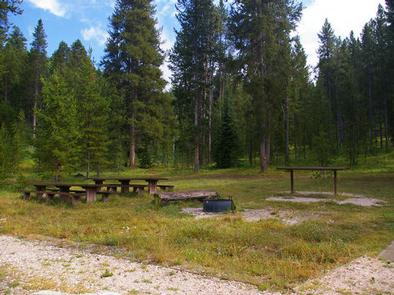
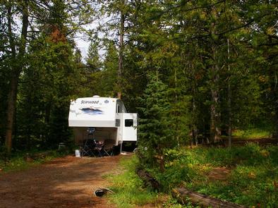
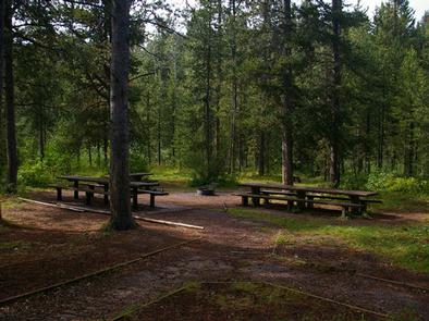
The campground contains 18 single-family campsites and three group sites. Vault toilets and drinking water are provided. An amphitheater is on-site. Roads and parking spurs within the campground are dirt.

Natural Features

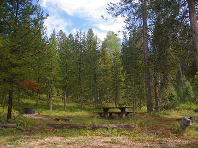
The campground is situated in a lodgepole pine forest, where summer grasses and wildflowers are plentiful. During the fall, wild huckleberries can be found in abundance throughout the campground.

Reservation

More from CampingHiking.net:

RAY BEHRENS, Missouri Campground Images, Info & Reservations

Directions From Hannibal MO, travel west on Highway 36 for 17 miles, turn south onto Route J and go 12 miles to the campground. Phone 573-735-4097 Activities BIKING, BOATING, CAMPING, DAY USE AREA Keywords RABE,BEHRENS CAMPGROUND,MARK TWAIN LAKE,MARK TWAIN LAKE Related Link(s) Rec Area Info & Images Missouri State Tourism

Beaver Creek Group Camp, Washington Campground Images, Info & Reservations

Directions From Seattle, Washington, take I-5 north to exit 194 in Everett. Take Highway 2 north at Highway 204 toward Lake Stevens. Turn north on Highway 9, then east on Highway 92 to Granite Falls. Continue about 23 miles on Highway 7 Scenic Byway. Phone 360-804-1103 Activities CAMPING Keywords BEC2,MT.

ONION VALLEY, California Campground Images, Info & Reservations

Directions The campground is 13 miles west of the town of Independence, California. Take U.S. Highway 395 to Independence. Turn west on Market Street, which turns into Onion Valley Road. Follow Onion Valley Road for 13 miles to the campground. Phone 760-937-6070 Activities CAMPING, FISHING, HIKING, HORSEBACK RIDING, WILDLIFE VIEWING