
Directions
From Seattle, take I-5 north for about 42 miles. Exit onto WA-530 East, then continue east on Highway 20 for about 40 miles. At the town of Marblemount, cross the bridge over the Skagit River and continue east approximately 16 miles to the Mineral Park Campground.
Phone
360-804-1103
Activities
CAMPING, FISHING, HIKING, PICNICKING
Keywords
MINC,MINERAL CREEK,MT. BAKER-SNOQU NF – FS
Related Link(s)
Washington State Road Conditions
Overview
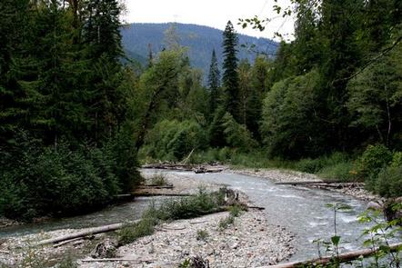
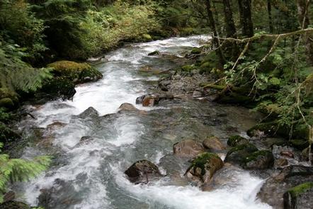
Mineral Park Campground is situated near the confluence of the North and South Forks of the scenic Cascade River in Mt. Baker-Snoqualmie National Forest.
Scattered beneath a towering canopy of diverse forest, the sites in this campground are widely spaced and within walking distance to the waterfront, making it an ideal setting for visitors wanting to camp in a more private, rustic setting. The campground is divided into two sections, Mineral Park East and Mineral Park West.
Recreation
In addition to being a prime location for hiking, fishing, picnicking, and horseback riding in summer and early fall, Mineral Park Campground offers excelent skiing and snowshoeing in the winter months.
Several trailheads for the overnight backpacker are located in the vicinity of the nearby town of Marblemount, including Hidden Lake Trail. Beginning in a forested setting, this trail climbs quickly to open meadows and grand views of the Cascade River. As it reaches higher elevations, it winds through angular slabs of granite and groupings of alpine fir. Spectacular views of high, jagged Cascade peaks can be seen from these higher meadows. Hidden Lake and the Hidden Lake Lookout can be seen from the pass, and reached by traversing down a talus slope.
Facilities
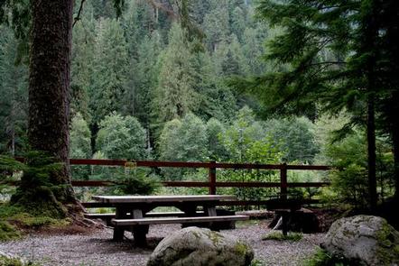
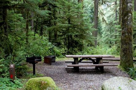
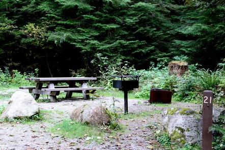
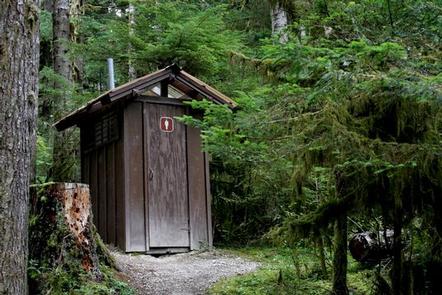
Mineral Park Campground can accommodate RV, trailer or tent-campers however water and electric hookups are not available. This is a no water facility so campers will need to bring their own supply. All sites are equipped with a picnic table and campfire ring with grill and the campground has vault toilets available.
Natural Features
Hemmed in by several designated wilderness areas, the Mt. Baker-Snoqualmie National Forest showcases rugged peaks, sparkling alpine lakes and old-growth forests.
Mt. Baker, the most prominent feature of the Mt. Baker Wilderness Area, dominates the landscape on a clear day. Rising to an elevation of 10,781 feet, the active volcano from which the forest takes its name is perpetually snow-capped and mantled with an extensive network of creeping glaciers. Mt. Baker’s summit, Grant Peak, is actually a 1,300-foot-deep mound of ice, which hides a massive volcanic crater.
Flowing adjacent to this campground is the Cascade River, designated as a National Scenic River. Possessing remarkable values related to wildlife, culture, recreation and scenery, the Cascade River is preserved in its free-flowing condition and cannot not dammed or impeded.
Wildlife in the area include mountain goats, coyotes, pine marten and a variety of migratory birds and native fish.
Nearby Attractions
Visitors enjoy the North Cascades and Mt. Rainer National Parks, where interpretive programs and exhibits offer education about the diverse landscape and history of the area.
The Pacific Crest Trail (PCT), one of the world’s premier National Scenic Trails, showcases some of North America’s most fantastic scenery, winding its way its way from Mexico to Canada through California, Oregon and Washington, and is accessible near the campground.