
Directions
Salt Springs is located 35 miles east of Ocala (I-75), 60 miles west of Daytona Beach (I-95) and 95 miles north of Orlando, Florida.
From I-75 to Ocala: Drive east on State Route 40 for about 12 miles, then turn north on County Road 314 and proceed for 18 miles. Turn north on State Highway 19 and drive for about 0.5 mile to the recreation area entrance on the right.
From I-95 east of Ormond Beach: Take SR 40 west about 40 miles to Highway 19. Turn north on Highway 19 and go about 16 miles to Salt Springs. Continue 0.5 miles to the recreation entrance on the right.
Phone
352-685-2048
Activities
BOATING, CAMPING, FISHING, HIKING, SWIMMING SITE, CANOEING
Keywords
SSRA,SALT SPRINGS CAMPGROUND,OCALA NATlONAL FOREST,LAKE GEORGE DISTRICT,SEMINOLE DISTRICT,NFs IN FLORIDA – FS
Related Link(s)
Overview
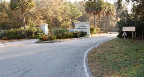
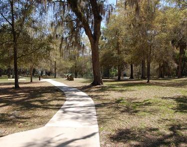
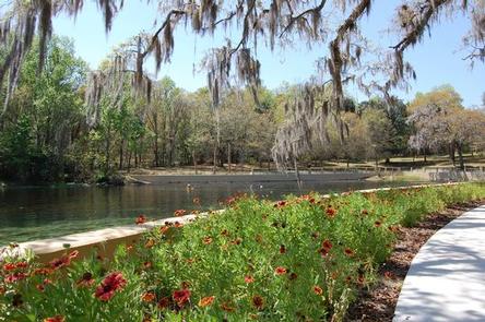
Salt Springs Recreation Area is one the recreational jewels of the Ocala National Forest, with a spectacular natural mineral spring that gives the area its name. Plenty of outdoor activities keep campers and day-use visitors busy, including swimming in the springs, fishing, snorkeling, hiking and boating. Salt Springs is located between the St. Johns and Ocklawaha Rivers, 35 miles east of Ocala, Florida.
The national forest spans four counties and 383,000 acres. It is the southernmost and oldest national forest east of the Mississippi River, and protects the world’s largest, contiguous sand pine scrub forest.
Recreation
The natural springs, nearby Lake George and many surrounding rivers and streams provide ample opportunity for water recreation. Anglers can try a good fishing spot on Salt Springs Run, downstream of the swimming area, boat ramp and marina. Boat rentals are nearby.
For those who wish to explore on land, the facility has basketball courts and a horseshoe pit. Hikers have easy access to the Bear Swamp Trail and a segment of the 1,400-mile Florida National Scenic Trail.
Facilities
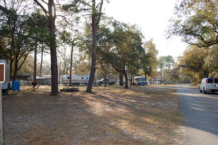
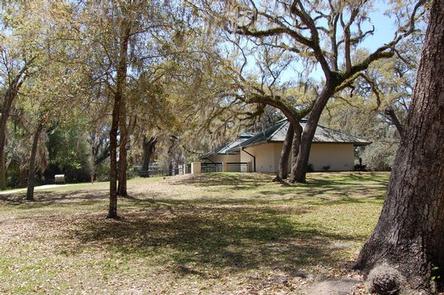
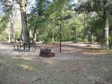
Salt Springs is the largest campground in the Ocala National Forest and the only one with full hookups for RVs. The facility offers spacious campsites for RVs and trailers, as well as a designated tent-only area, which is a short walk from the parking area. Sites are nicely shaded and well away from the busy day-use area.
The recreation area and campground are located in the community of Salt Springs, which has a gas station, grocery store, several restaurants, bait and tackle shops, a post office, laundromat and visitor center.
Natural Features
The semi-tropical region gives the campground a mixture of pines and palms, with lush greenery and warm temperatures. Within the recreation area, a natural spring rises from cracks deep within the earth. The presence of potassium, magnesium and sodium salts give the waters a slight salinity – hence the name Salt Springs.
Nearby Attractions
Salt Springs is very close to Lake George, a great fishing destination.