

Directions
From the west, take Highway 2 east through Monroe and over Stevens’ Pass. Take a right on Icicle River Road and continue approximately 10 miles to the campground, on the left.
From the east, take Highway 2 west through Leavenworth. Turn right on Icicle River Road and follow road approximately 10 miles to the campground, on the left.
Phone
509-548-3026
Activities
BIKING, CAMPING, FISHING, HIKING, VISITOR CENTER, WILDLIFE VIEWING, SWIMMING SITE
Keywords
BRCR,OKANOGAN – WENATCHEE NF -FS
Related Link(s)
Washington State Road Conditions
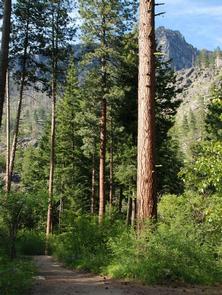
Overview
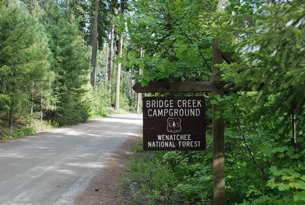
Bridge Creek Group Campground sits in Okanogan-Wenatchee National Forest in northwest Washington. Nestled in a mountainous forest near the confluence of Bridge Creek and Icicle Creek, the campground offers a delightful setting for groups and large gatherings.
Recreation
Bridge Creek Group Campground offers outdoor enthusiasts the opportunity to hike, fish, bike and enjoy a long list of outdoor recreational activities throughout the year.
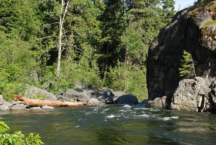
Icicle River, adjacent to the campground, offers a scenic backdrop for swimmers braving its cold, refreshing waters. Anglers may also want to cast a line into the deep pools lining the shore. Populations of rainbow and brown trout prevail in this waterway.
The nearby Fourth of July Trail offers hikers expansive ridge line views and challenging terrain. Beginning in the forest at 4,000 feet, the trail quickly climbs in elevation, out of the trees into more open, arid landscapes. The trail continues through mountain meadows with spectacular views of the Stuart Mountain Range and Icicle Valley.
At 10.6 miles, this is a solid day hike, though backpackers can hook up connecting trails to continue for multiple days though adjacent wilderness settings.
Facilities
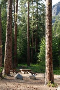
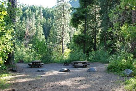
Bridge Creek Group Campground has one large site that can accommodate up to 75 people and 35 vehicles. The site is equipped with picnic tables, a group campfire ring, drinking water and vault toilets.
Natural Features
Okanogan-Wenatchee National Forest offers stunning scenic views, with high, glaciated alpine peaks, valleys of old growth forest and rugged shrub-steppe country making up the diverse landscape. Elevations range from below 1,000 feet to over 9,000 feet.
Precipitation varies greatly throughout the area, ranging from approximately 140 inches along the Cascade Crest to only 10 inches along the eastern edge. Visitors can expect many days of warm, sunny weather in the summer, and winters with clear skies and plenty of snow.
Goat Rocks Wilderness is a stunning adventure for those wanting to traverse higher elevations. Peaks within the area are remnants of an extinct volcano, taking the name "Goat Rocks" in honor of the numerous mountain goats traversing this isolated region. Gilbert Peak is the highest summit in this area at an elevation of 8,184 feet.
Nearby Attractions
Visitors enjoy the North Cascades and Mt. Rainer National Parks, where interpretive programs and exhibits offer education about the diverse landscape and history of the area.
The spectacular Pacific Crest Trail (PCT), one of the world’s premier National Scenic Trails, showcases some of North America’s most fantastic scenery, winding its way its way from Mexico to Canada through California, Oregon and Washington, and is accessible near the campground.