
Directions
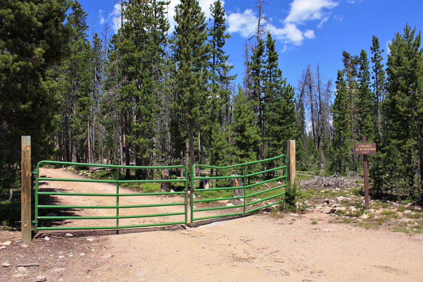
From Laramie, Wyoming, take Highway 130 west toward Centennial, Wyoming. Turn south on Highway 11 through Albany, Wyoming. Spruce Mountain Fire Lookout Tower is located 7 miles west of Albany on Forest Service Road 500, High clearance vehicles are advised for accessing the Tower.
The road (Forest Service Road 500) to this lookout may have logging operations during daylight hours during your stay. Please read and respect the signs posted at the entrance road for further instructions upon entering this site. If you have questions, call the Medicine Bow National Forest, Laramie District Office during the week at (307) 745-2300.
Phone
307-745-2300
Activities
BIKING, BOATING, CAMPING, FISHING, HIKING, HORSEBACK RIDING, HUNTING, WATER SPORTS, WILDLIFE VIEWING, WILDERNESS, FIRE LOOKOUTS/CABINS OVERNIGHT, PHOTOGRAPHY, MOUNTAIN BIKING, OFF ROAD VEHICLE TRAILS, OFF HIGHWAY VEHICLE TRAILS
Keywords
SPMT,SPRUCE MOUNTAIN FIRE TOWER,SPRUCE FIRE TOWER,SPRUCE MOUNTAIN TOWER,SPRUCE TOWER,SPRUCE MOUNTAIN FIRE LOOKOUT,SPRUCE FIRE LOOKOUT,SPRUCE MOUNTAIN LOOKOUT,SPRUCE LOOKOUT,SPRUCE MOUNTAIN RANGER STATION,SPRUCE MOUNTAIN GUARD STATION,MEDICINE BOW-ROUTT NF
Related Link(s)
Overview
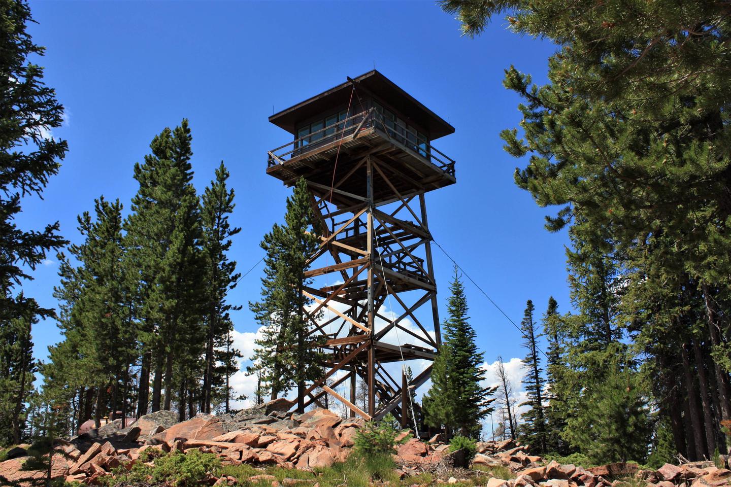
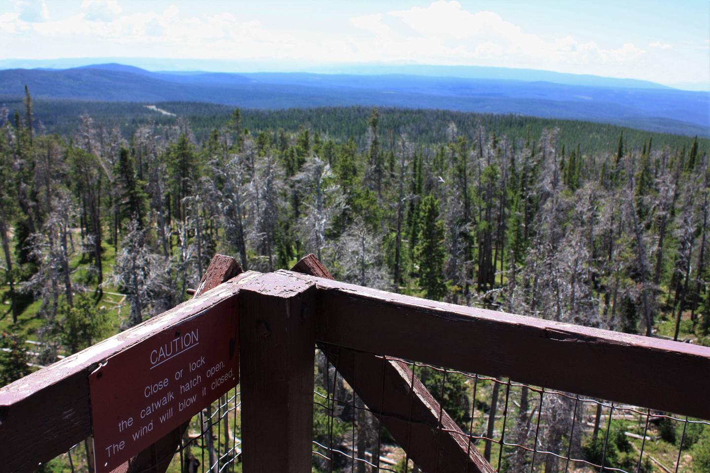
Perched atop a forested mountain, Spruce Mountain Fire Lookout Tower offers visitors a unique lodging experience in Medicine Bow National Forest in southcentral Wyoming. Historically occupied as a fire lookout, the 55-foot tall structure was renovated and opened to the public for overnight rental in 1977.
The lookout is typically open from June through September. Guests can drive directly to the lookout. Several amenities are provided, but guests should be prepared to pack in some of their own supplies and gear for a comfortable stay.
Recreation
The area around the lookout offers opportunities for hiking, mountain biking, horseback riding and hunting. The lookout is also ideal for guests who simply want to relax and enjoy picnics, campfires and stargazing at night. Rob Roy Reservoir is a six mile drive from the lookout, offering opportunities for fishing, boating and water skiing. Gold panning is a popular activity in Douglas Creek, which is connected to the reservoir.
Facilities
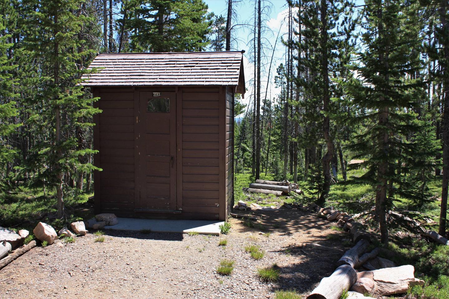
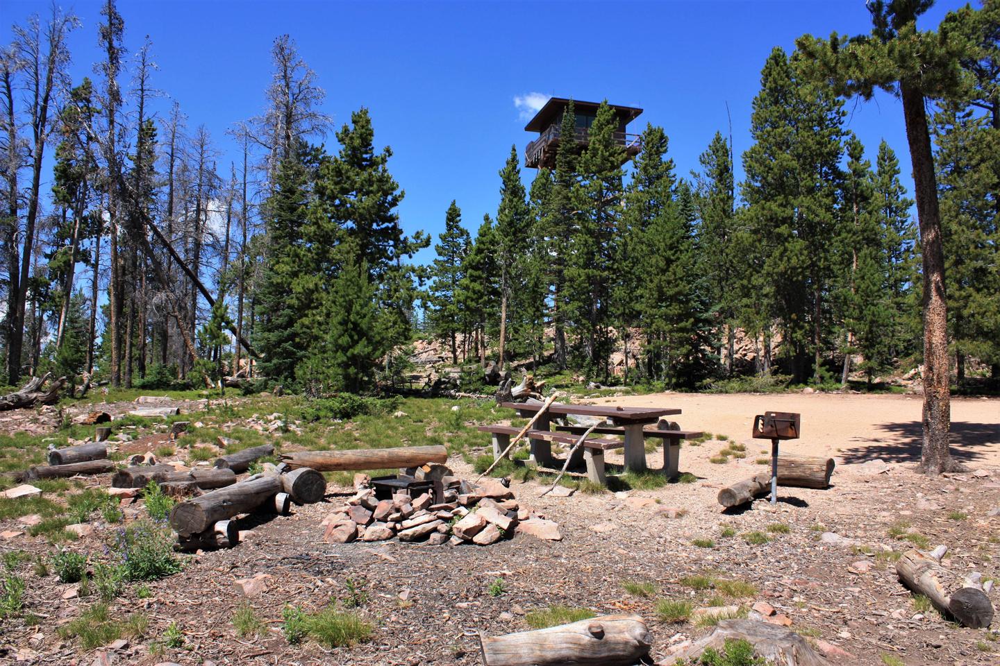
The lookout cabin is furnished with two single beds with mattresses and can accommodate up to two guests. Inside amenities include a table with chairs, cookware, dishes, utensils, cleaning supplies, a propane heater, propane cook stove and oven and propane lights. An outhouse with pit toilet is provided, and a campfire ring is located at the base of the lookout. Firewood is provided. Additional camping is allowed on-site, though the area is rocky. A hoist (pulley and rope) is available to transport gear to the tower cabin. There is no water or electricity available at the site. Guests must bring enough water for drinking, cooking and washing. Other items to bring include sleeping bags, flashlights or lanterns, towels, dish soap, matches, toilet paper, a first aid kit and garbage bags. All food and trash must be packed out, and guests are expected to clean the cabin before leaving.
Natural Features
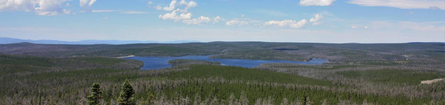
The lookout offers panoramic views that include Medicine Bow Peak, Rob Roy Reservoir, Jelm Mountain and the southern end of the Snowy Range. Snowdrifts melt in June, welcoming the arrival of wildflowers that splash color on the rocky, timbered hillsides. Wildlife species such as elk, deer, black bears, cougars, squirrels, foxes and bats are supported by the area’s diverse forest habitats. At an elevation of 10,003 feet, guests should be prepared for high altitude conditions. Summertime temperatures average 70 degrees fahrenheit, but can drop as low as 30 degrees at night or during thunderstorms.
Charges & Cancellations
Refunds for cancellations may be processed on a case-by-case basis. There are no refunds for reservation processing fees. Please be aware of changes in weather and road conditions prior to arrival and plan accordingly.