


Directions
From Naches, take Highway 410 approximately 38 miles northwest to milepost 83.4.
Phone
541-338-7869
Activities
CAMPING, FISHING, HIKING, WATER SPORTS, SWIMMING SITE
Keywords
HECR,OKANOGAN – WENATCHEE NF -FS,HELLS CROSSING,HELLS CROSSING CAMPGROUND
Related Link(s)
Washington State Road Conditions
Overview
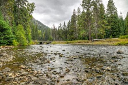
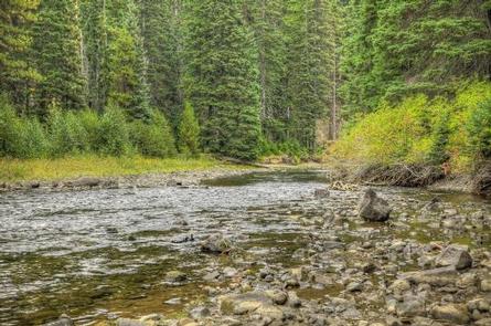
Hells Crossing Campground is located along the American River in the Okanogan-Wenatchee National Forest in Washington’s Cascade Range. Warm summer days and easy access to an abundance of recreational activities make the campground a perfect setting for individual and group camping excursions.
Recreation
Hells Crossing Campground offers outdoor enthusiasts the opportunity to hike, fish, ski, raft and enjoy a multitude of recreational activities throughout the year.
The American River, which can be accessed from within the campground, offers a scenic backdrop for swimmers braving its cold, refreshing waters. Whitewater enthusiasts may enjoy a rafting trip on the American or on one of many scenic rivers in the area.
Facilities
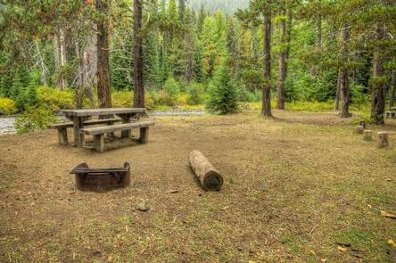
Hells Crossing Campground offers standard and tent-only sites. Picnic tables, vault toilets and drinking water are available; however, there are no electrical hookups.
There are two sections in the campground, each with its own entrance; sites 1-10 are in the eastern section (just over the American River), while sites 11-18 are in the western section.
Natural Features
The Okanogan-Wenatchee is a unique National Forest, where high, glaciated alpine peaks tower along the Cascade Crest. Lush valleys of old-growth forest define its western boundary, and at its eastern edge, rugged shrub-steppe country comprises a more arid region. Elevations range from below 1,000 feet to over 9,000 feet.
Precipitation varies greatly thoughout the area, ranging from approximately 140 inches along the Cascade Crest to only 10 inches along the eastern edge. Visitors to the area can expect many days of warm, sunny weather in the summer and plenty of snow in the winter.
Nearby Attractions
Boulder Cave National Recreation Trail is one of the most popular places in the Naches District. Visitors can walk the accessible trail along the river or explore Boulder Cave. Interpretive signs along the trail explain the geology, plants, animals and fire history of the area.
Hikers may want to traverse a portion of the spectacular Pacific Crest Trail (PCT), one of the world’s premier National Scenic Trails. This trail showcases some of North America’s most fantastic scenery as it winds its way from Mexico to Canada through California, Oregon and Washington.