


Directions
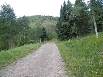
From La Veta, Colorado, take State Route 12 south for 25.3 miles to Purgatoire campground sign. Turn right onto gravel Route 34. Go 0.2 miles to "T" intersection. Turn right and drive 4 miles on rough gravel road to campground.
Phone
FOR RESERVATIONS CALL (877) 444-6777, FOR OTHER NON REAL TIME INFORMATION CALL THE SAN CARLOS RANGER DISTRICT AT (719) 269-8500.
Activities
CAMPING, FISHING, HIKING
Keywords
PURG,POTATO PATCH CAMPGROUND,PIKE AND SAN ISABEL NF- FS
Related Link(s)
Colorado State Road Conditions
Overview
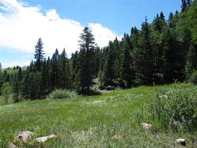
Purgatoire Campground is nestled near the headwaters of the Purgatoire River in the beautiful Culebra Range of the Sangre de Cristo Mountains. The primitive campground is laid out on two loops. One is a large grassy meadow with sites that accommodate equestrian campers and one that is wooded with aspen and spruce. The access road is very rough and is not suitable for low-clearance trailers.
Constructed by the Youth Conservation Corp in 1976, Purgatoire was originally named Potato Patch Campground. The river provides nice fishing and a trailhead attracts hikers and horseback riders.
Recreation
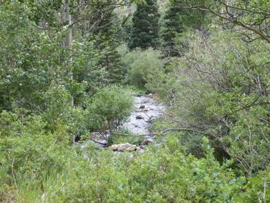
The North Fork Trail # 1309 is located on the north end of the campground and offers non-motorized access to hikers, cyclists, and horseback riders. The 5-mile trail delights with mountain vistas and shade from forested terrain. The river, which is creek-sized at these upper reaches, provides opportunities for anglers to cast for trout.
Facilities
Campsites come with campfire rings, picnic tables and vault toilets. Equestrian sites can fit large horse trailers. Drinking water is from a hand pump and parking aprons are grass and gravel. Trash service is provided.
Natural Features
The campground is in an aspen and conifer forest near the North Fork River at an elevation of 9,800 feet. The river, also known as the Purgatoire River, flows 196 miles to the confluence of the Arkansas River.
Pike-San Isabel National Forest includes over a million acres of wilderness and over half of Colorado’s mountain peaks that reach above 14,000 feet.
Nearby Attractions
The nearby towns of Stonewall and Cuchara offer shopping and restaurants.