
Directions
From Santa Barbara, take Highway 154 approximately 9 miles to Paradise Road. Turn right and follow the road to the campground.
Phone
805-434-1996
Activities
BIKING, BOATING, CAMPING, FISHING, HORSEBACK RIDING, SWIMMING SITE
Keywords
FRCA,Fremont Park,Fremont Recreation Area,LOS PADRES NF -FS
Related Link(s)
California State Road Conditions
Overview
Fremont Campground is a family-friendly facility located just off California’s western coast. It provides access to a variety of hiking, biking and horseback riding trails, as well as some off-road vehicle trails, in a scenic area.
Recreation
The Santa Ynez River is popular for a variety of water-related recreation. It can be accessed at nearby White Rock Day Use Area. Cachuma Lake Recreation Area, a no-body-contact reservoir, is also nearby. It offers boating, kayaking and fishing opportunities.
Visitors enjoy access to a variety of hiking, biking and horseback riding trails. The Aliso National Recreation Trail is a popular, 2.5-mile loop available close to the campground. Also nearby is the 18-mile Santa Cruz Trail, which provides access to a variety of other trails in the area. The Camuesa OHV Route and its connectors are within 10 miles.
Facilities
The campground offers more than a dozen sites for tent or RV camping. Some sites are available on a first-come, first-served basis. Large accessible sites are also available.
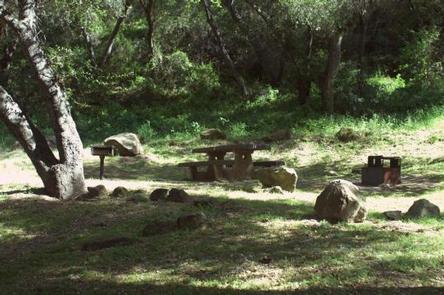
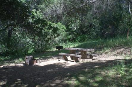
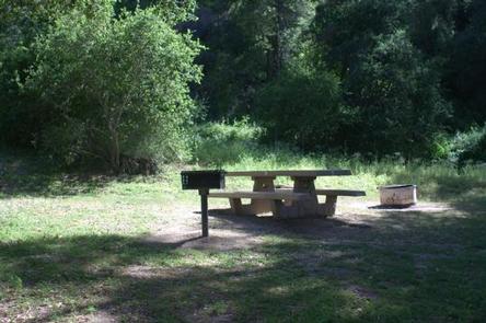
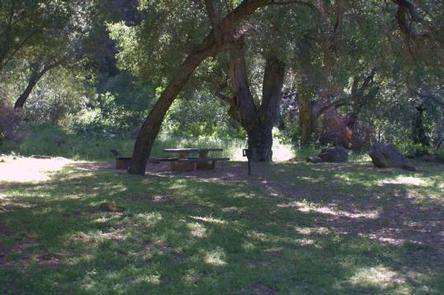
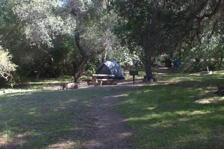
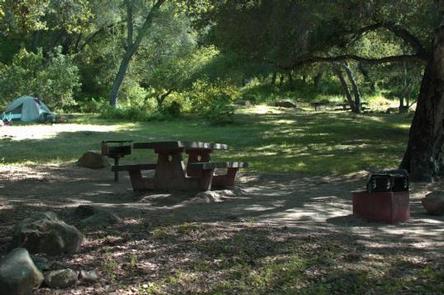
Each site is equipped with a table, campfire ring with grill and a pedestal grill. Accessible flush toilets and drinking water are provided. Firewood is available for purchase from the host.
Natural Features
The campground is located in the Lower Santa Ynez Recreation Area of the Santa Barbara Ranger District. It is situated in an forest of mostly oak trees in hilly terrain at an elevation of about 1,000 feet. The campground is full of lush greenery and is shady.
Nearby Attractions
The large city of Santa Barbara is located about 18 miles from the campground. The coast is not far beyond that.