EDGEWATER CAMPGROUND, WA Campground Reservation, Info, Images, Map, Directions

EDGEWATER CAMPGROUND, Washington Campground Images, Info & Reservations

Directions

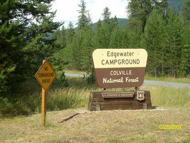
The campground is located approximately 90 miles north of Spokane, WA. After crossing the Ione Bridge eastbound over the Pend Oreille River, look for the Edgewater Campground sign and immediately turn left. The campground is located 2 miles north of the bridge on Box Canyon Road.

Phone

509-446-7500

Activities

BIKING, BOATING, CAMPING, FISHING, WATER SPORTS, WILDLIFE VIEWING

Keywords

EDGW,COLVILLE NF – FS

Related Link(s)

Rec Area Info & Images

Washington State Tourism

Washington State Road Conditions

Overview

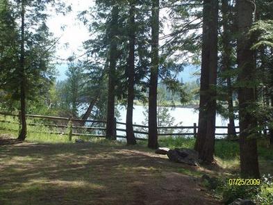
Edgewater Campground is perched along the banks of the Pend Oreille River in the Colville National Forest. The quiet, family-friendly campground attracts visitors who come for boating, hiking and fishing. The picturesque area, surrounded by cedar, hemlock and Douglas fir, boasts views of the Selkirk Mountains.

Recreation

Trout and bass fishing is great for avid anglers. A boat ramp is located on-site.

Hikers enjoy exploring nearby Terry Trail and Box Canyon. Wildlife watching for moose, white-tailed deer and the endangered woodland caribou is another popular activity.

Facilities

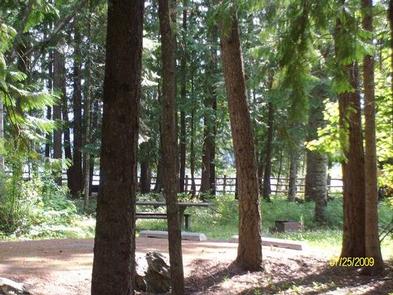
Parking spurs are gravel and grass and can accommodate any size RV. A campground host is on-site, and firewood is available for sale. Amenities inc lude vault toilets, drinking water and trash collection.

Natural Features

The campground sits on a bluff on the east bank of the river at an elevation of 2,000 feet. Many campsites offer a scenic view of the river. The forest floor is covered with thimbleberry, wild rose and other shrubs.

The 1.1 million acre Colville National Forest lies in the northeast corner of Washington. The forest’s great salmon runs first attracted native Americans to the area, then miners, homesteaders and fur trappers followed. The variety of resources and natural beauty in the region continues to attract visitors.

Three mountain ranges, the Okanogan, Kettle River and Selkirk, run through the Colville Forest.

Nearby Attractions

Sweet Creek Falls is located just north of the city of Ione.

Reservation

More from CampingHiking.net:

SOUTH FORK (WYOMING), Wyoming Campground Images, Info & Reservations

Directions From Buffalo, Wyoming, take U.S. Highway 16 west for 15 miles to Forest Service Road 337. Follow Forest Service Road 337 east for .25 miles to the campground. Phone 406-587-9054 Activities BIKING, BOATING, CAMPING, FISHING, HIKING, HORSEBACK RIDING, HOTEL/LODGE/RESORT PRIVATELY OWNED, OFF ROAD VEHICLE TRAILS Keywords SOU1,SOUTH FORK WYOMING,BIGHORN

FIDDLE CREEK, California Campground Images, Info & Reservations

Directions From Downieville, travel south on Highway 49 for about 12 miles. The campground is on the left side of the highway. Phone (530)478-6253 Activities BOATING, CAMPING, FISHING, HIKING, HUNTING, WATER SPORTS Keywords FIDD,TAHOE NF – FS Related Link(s) Rec Area Info & Images California State Tourism California State Road

PLEASANT VALLEY CAMPGROUND, Washington Campground Images, Info & Reservations

Directions From Naches, take Highway 410 northwest approximately 42 miles to milepost 80.2. Phone 541-338-7869 Activities BIKING, CAMPING, FISHING, HIKING, WATER SPORTS, SWIMMING SITE Keywords PLVA,OKANOGAN – WENATCHEE NF -FS,PLEASANT VALLEY,PLEASANT VALLEY CAMPGROUND Related Link(s) Rec Area Info & Images Washington State Road Conditions Washington State Tourism Forest Service Concessionaire

UNION CREEK CAMPGROUND, Oregon Campground Images, Info & Reservations

Directions From Baker City, Oregon, travel south on Highway 7 for about 18 miles. The campground and day-use entrance is on the left side of the road. Follow the signs in the Union Creek Recreation Area down to the various campground loops and areas. Phone 541-894-2332 Activities BIKING, BOATING, CAMPING,

FISHHOOK PARK, Washington Campground Images, Info & Reservations

Directions From Pasco, Washington, take Highway 12 east. After crossing the Snake River Bridge, take the first exit and head east on State Route 124. Continue for 19 miles, then turn left, heading north on Fishhook Park Road. Follow for 4 miles to the park entrance; the campground is on